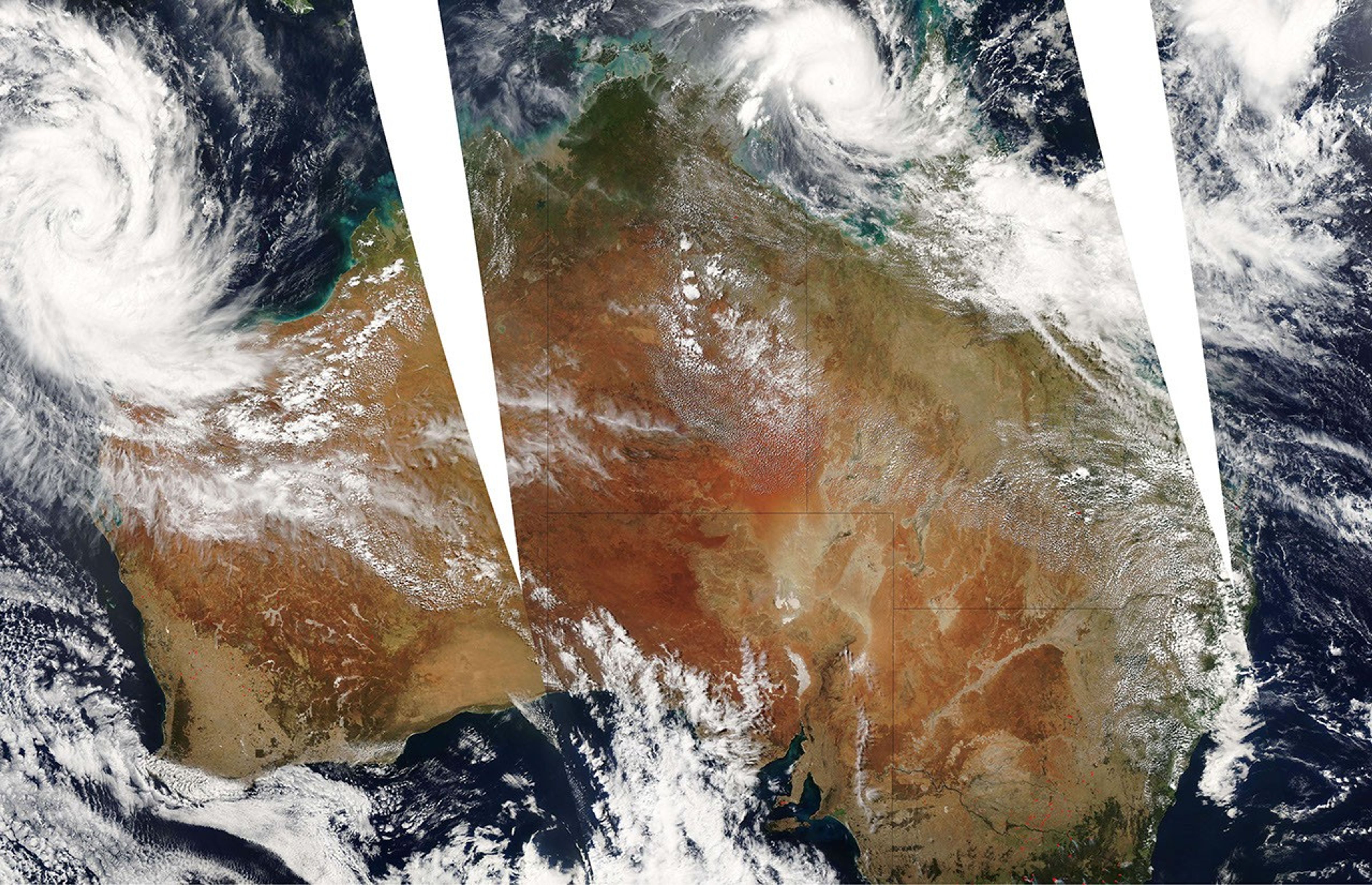


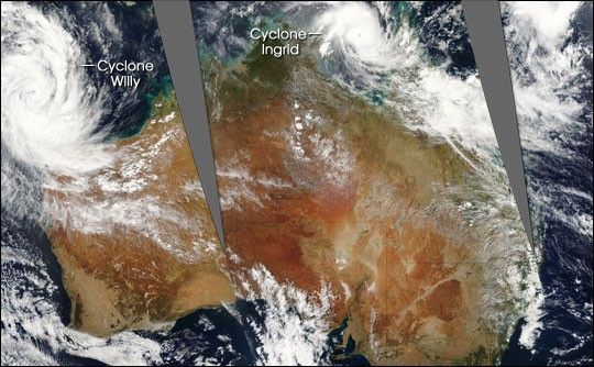
Two tropical cyclones were hovering near Australia’s coastline on March 10, 2005, when the Moderate Resolution Imaging Spectroradiometer (MODIS) on NASA’s Aqua satellite captured this image. The larger storm, at left, is Cyclone Willy, which the Australian Bureau of Meteorology reported on March 11 to be strengthening but unlikely to come ashore. At top center, Cyclone Ingrid was re-strengthening in the Gulf of Carpentaria after losing some momentum and power as it passed over the Cape York Peninsula on previous days. The storm was continuing to track westward toward the Gove Peninsula.
The image shows observations from MODIS from three consecutive orbits of the Aqua satellite, each about 90 minutes apart. The progression is from the right side of the image to the left; that is, the satellite pass at left came first, then the center pass, and finally the right-hand pass. The large version of the image provided here has a spatial resolution of 1 kilometer per pixel. The MODIS Rapid Response Team provides this image at additional resolutions.
References & Resources
Image courtesy the MODIS Rapid Response Team, NASA-Goddard Space Flight Center