


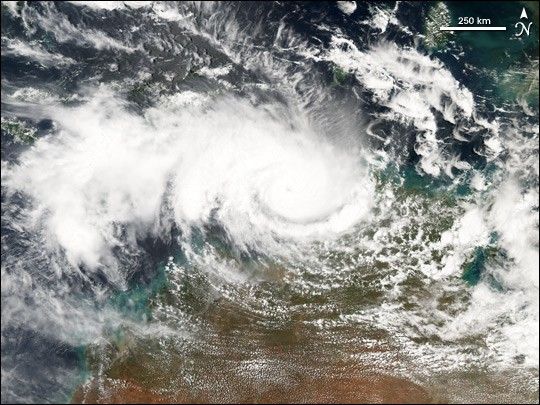
Cyclone Ingrid continues to build steam as it skims the coast of Australia’s Northern Territory. The storm formed on March 6, 2005, in the Coral Sea, east of Australia. On March 9 and 10, it crossed the Cape York Peninsula, all but disintegrating over land. But when Ingrid reached the Gulf of Carpentaria, it re-formed into a Category 4 cyclone. The storm is now in the Timor Sea, and is expected to maintain its current intensity until it comes ashore over Kimberley, Australia. According to the Joint Typhoon Warning Center, the storm had winds of 213 kilometers per hour (132 mph) with gusts to 260 kph (160 mph) about the time this image was acquired on March 14, 2005. The Moderate Resolution Imaging Spectroradiometer (MODIS) on NASA’s Aqua satellite captured this true-color image of the storm.
References & Resources
NASA image created by Jesse Allen, Earth Observatory, using data provided courtesy of the MODIS Rapid Response team.


