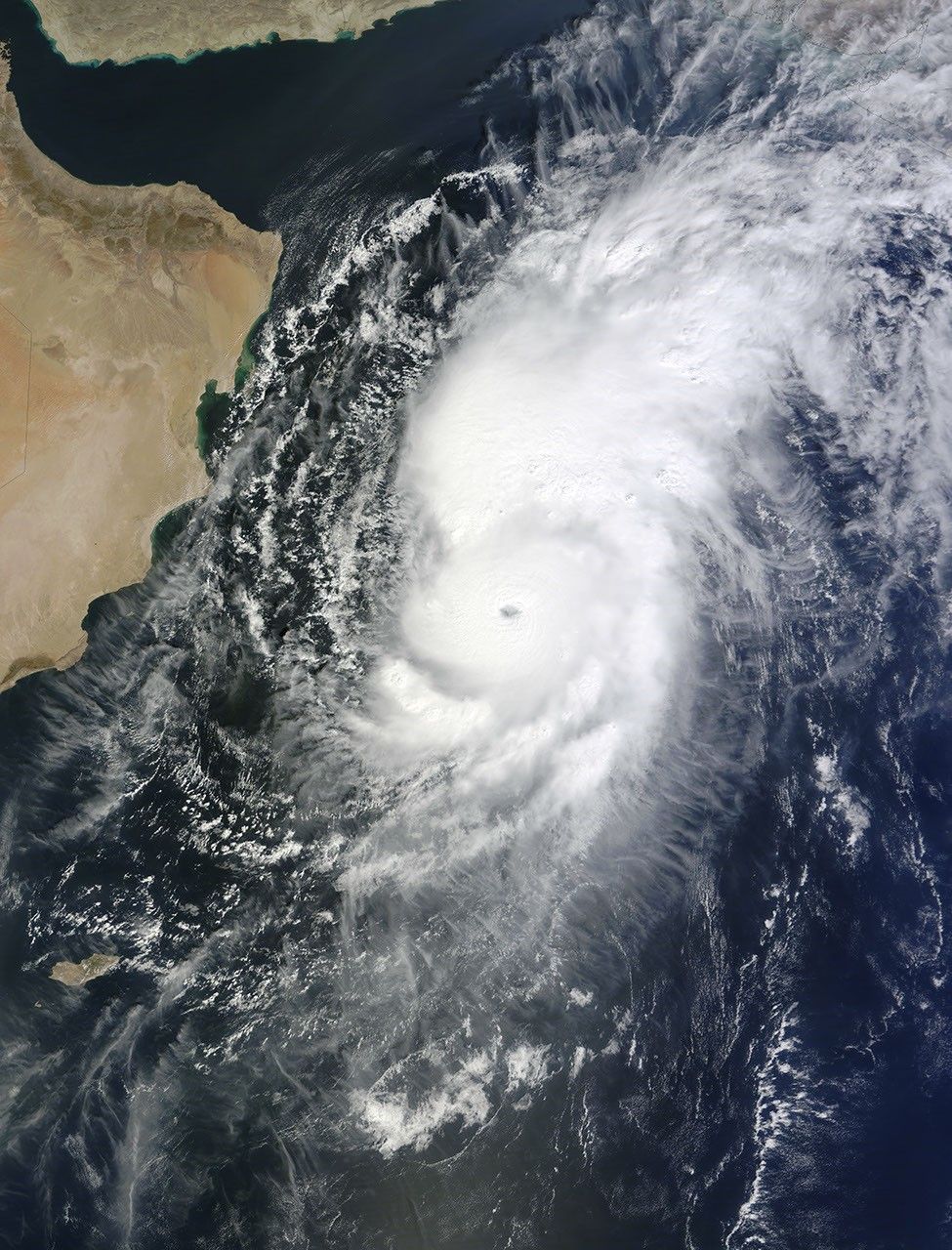

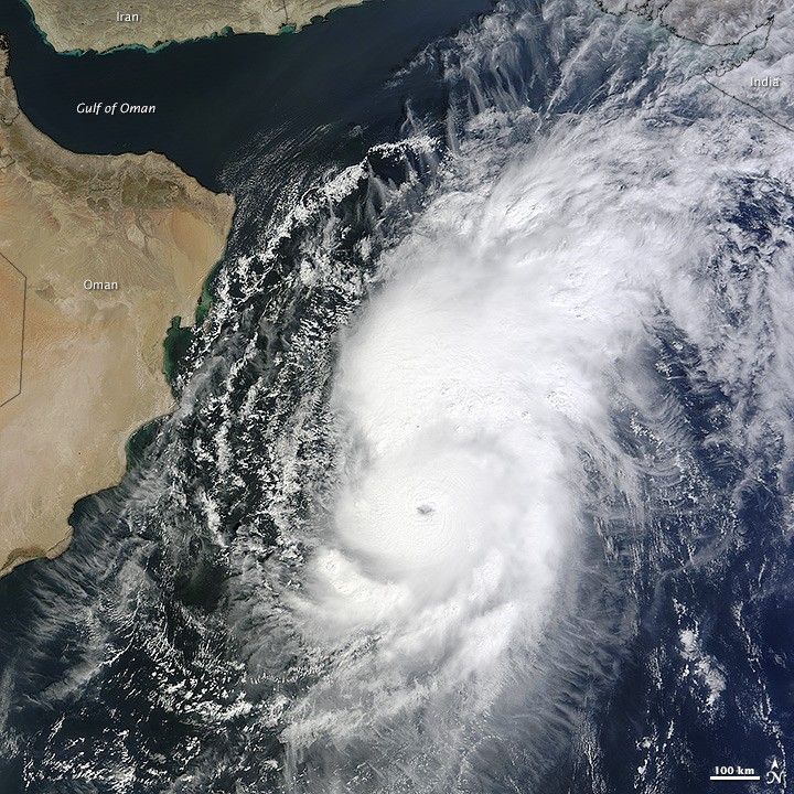
Cyclones are relatively infrequent in the Arabian Sea—just one or two per year—and severe cyclones are even rarer. For this reason, meteorologists and government officials in India, Pakistan, and Oman were anxiously watching Cyclone Nilofar in the last week of October 2014. The cyclone reached category 4 strength on the Saffir-Simpson scale, but by the time of landfall in India on October 31, it was barely a tropical depression.
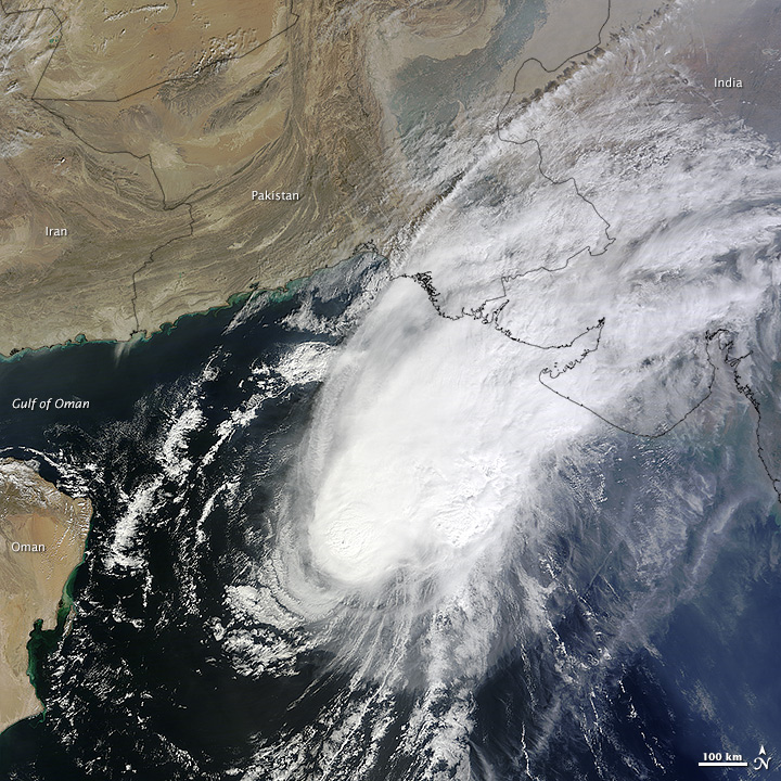
The images above and below were acquired by the Moderate Resolution Imaging Spectroradiometer (MODIS) on NASA’s Terra satellite on October 28 (top), when the storm was approaching peak intensity, and on October 30 (below), when it had decayed to tropical storm force. A few hours after the first image was taken, Nilofar’s winds reached 115 knots (130 miles or 210 kilometers per hour). It was the third strongest cyclone on record for the Arabian Sea. By the time the second image was acquired, wind speeds had dropped to 50 knots (55 mph or 90 kmph).
Local authorities in the Indian state of Gujarat had started to evacuate residents from low-lying areas in advance of the storm. But as Nilofar moved north and east in the Arabian Sea, it was broken up by strong wind shear and further weakened by dry desert air blowing offshore. By October 31, the storm had faded to a low-pressure system that was expected to bring moderate to heavy rainfall, rough surf, and windy weather to Gujarat.
References & Resources
- Amato T. Evan and Suzana J. Camargo (2011) A Climatology of Arabian Sea Cyclonic Storms. Journal of Climate, 24, 140–158.
- Jeff Masters WunderBlog (2014, October) Tropical Cyclone Nilofar the 3rd strongest Arabian Sea storm on record. Accessed October 31, 2014.
- NASA (2014) Nilofar (Arabian Sea) Accessed October 31, 2014.
- Times of India (2014, October 31) Gujarat heaves sigh of relief as cyclone Nilofar fizzles out. Accessed October 31, 2014.
- Unisys Weather (2014) Nilofar. Accessed October 31, 2014.
NASA images by Jeff Schmaltz, LANCE/EOSDIS Rapid Response. Caption by Michael Carlowicz.