


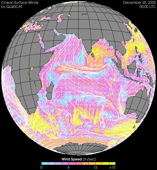
In late December 2000, a cyclone hit Sri Lanka and India. With winds up to150 km per hour (90 mph), the storm killed eight people in Sri Lanka andforced thousands of people to evacuate their homes in India.
The image above shows data from the SeaWinds instrument aboard theQuikSCAT satellite at 5:30 AM Sri Lankatime. At that time the storm was approaching Sri Lanka from the east.SeaWinds measures ocean winds by measuring the scattering ofmicrowaves (generated by the instrument) off the sea surface. In additionto providing data about cyclones and other tropical storms, scientists useSeaWinds data to study ocean circulation, El Niño, and global climate.
References & Resources
Image courtesy Seaflux and the JPL Scatterometry team
None


