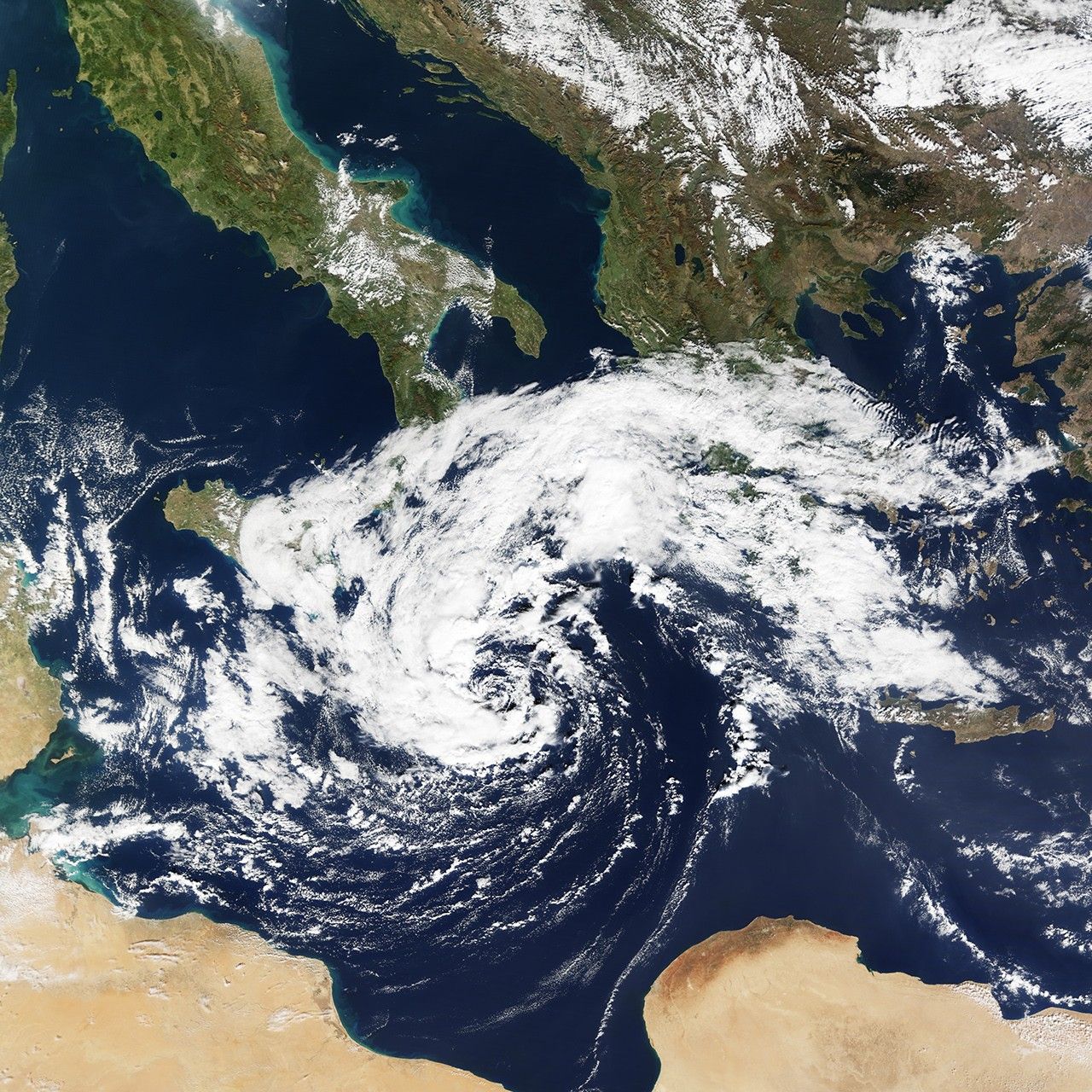


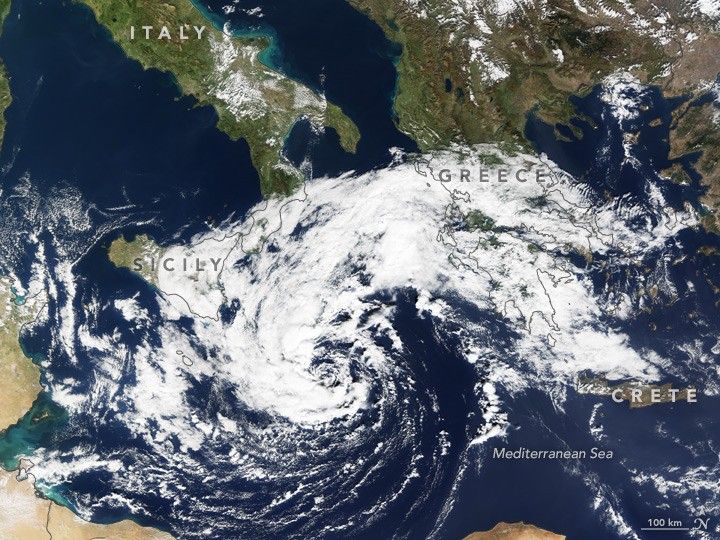
The shape of this storm resembles something you would more often see spinning over the Pacific or Atlantic oceans. This one, however, developed over the Mediterranean Sea.
At 10:30 a.m. Central European Time (09:30 Universal Time) on October 30, 2016, the Moderate Resolution Imaging Spectroradiometer (MODIS) on NASA’s Terra satellite captured this natural-color image of a storm system dubbed 90M.
Soon after this image was acquired, NOAA reported that the system appeared to be a T-number 1.0 storm on the Dvorak Current Intensity Chart. It was generating sustained winds of 47 kilometers (29 miles) per hour, equivalent to a tropical depression on the Saffir-Simpson wind scale. (For comparison, category-1 storms on the Saffir-Simpson scale have sustained winds between 119–153 kilometers per hour.) The storm was strong enough to generate large waves that affected some areas of land. News reports noted that that crews removed 177 tons of debris that washed up on the east coast of Malta.
Cloud patterns in satellite imagery usually show cyclonic circulation before a storm reaches tropical storm intensity. Some of these storms over the Mediterranean have had characteristics similar to hurricanes, earning them the name “Medicanes,” a mash-up of the words “Mediterranean” and “hurricane.”.
References & Resources
- Times of Malta (2016, October 31), 177 tonnes of debris washed ashore in weekend’s storm. Accessed November 1, 2016.
- University of the Balearic Islands, MEDICANES: Mediterranean tropical-like storms. Accessed November 1, 2016.
- The Weather Channel (2016, October 31), Halloween Surprise: Rare Tropical Storm Forms in Mediterranean Sea. Accessed November 1, 2016.
NASA Earth Observatory image by Jesse Allen, using data from the Land Atmosphere Near real-time Capability for EOS (LANCE). Caption by Kathryn Hansen.