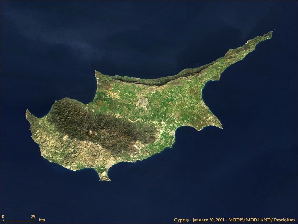

The island of Cyprus is located south of Turkey and northwest ofLebanon in the Mediterranean Sea. The island is 225 km from east towest, and has an area of about 9,250 square kilometers. This image,acquired by NASA’s Moderate-resolution Imaging Spectroradiometer(MODIS) on January 30, 2001, shows the three distinct geologic regionsof the island. In the central and western part of the island is theTroödos Massif, a mountain range whose surface layer is mostlybasaltic lava rock, and whose maximum elevation is 1953m. Running in athin arc along the northeast margin of the island is Cyprus’ secondmountain range, a limestone formation called the Kyrenia Range. A flatarea of low relief occupies the space between these ranges, and is hometo Lefkosia, the capital city of the Republic of Cyprus. The city isvisible as a grayish-brown patch near the image’s center. Lefkosialies along a UN-patrolled cease fire line that begins in roughly thecenter of the W-shaped northwestern coastline and meanderseast/southeast across the island. The line was established in 1974, andit divides the Turkish-occupied North from the Republic of Cyprus to thesouth.
References & Resources
Image courtesy Jacques Descloitres, MODIS Land Team