















Suggested Searches

1 min read

Deadly Flooding in Namibia

Instruments:
2009-04-19 00:00:00
April 19, 2009

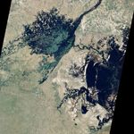
Heavy seasonal rains swelled the Zambezi River in southern Africa in March and April 2008. This image shows how the floods spilled down the Bukalo Channel to swell Lake Liambezi. The Advanced Land Imager on the EO-1 satellite acquired the image on April 19, 2009. While the river system floods seasonally, the floods of 2009 were more extensive than normal, causing thousands of evacuations.

References & Resources

NASA image created by Jesse Allen, using EO-1 ALI data provided courtesy of the NASA EO-1 Team. Caption by Holli Riebeek.

You may also be interested in:

Stay up-to-date with the latest content from NASA as we explore the universe and discover more about our home planet.

Ice Moves Out of Aniak
3 min read

Spring melt along Alaska’s Kuskokwim River caused ice jams and flooding.

Article
Farming in Ancient Lake Agassiz
3 min read

The glacial lake left a layer of silt and clay in southeastern Manitoba, creating fertile farmland that was divided during…

Article
Low Water at San Carlos Reservoir
4 min read

Drought and water releases drained the Arizona reservoir to levels that have led to widespread fish deaths.

Article