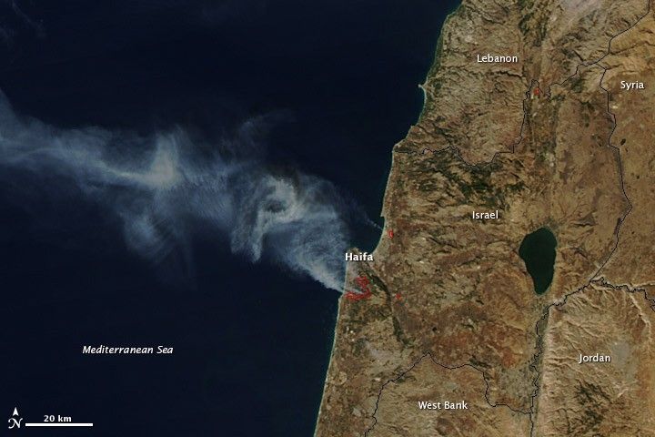
The largest forest fire in Israel’s history burned outside of Haifa on December 3, 2010. Having started the previous day, the fire quickly grew out of control as strong winds blew through the drought-dried forest. The Moderate Resolution Imaging Spectroradiometer (MODIS) on NASA’s Aqua satellite captured this image of the fire on December 3 at 12:50 p.m. local time.
Red boxes outline the actively burning areas. It is evident that winds were still strong, since the thick plumes of smoke are blowing west over the Mediterranean Ocean.
By December 3, the fire had burned more than 7,000 acres, destroyed homes, forced 17,000 evacuations, and killed at least 42 people, reported Reuters. At least 16 countries sent resources to help control the large fire.
The large image provided on the Earth Observatory is the highest resolution version of the image. The image is available in additional resolutions from the MODIS Rapid Response Team, who also produces twice-daily images of Israel.
References & Resources
- Amichal, R., and Hayoun, D. (2010, December 3). International crews help Israel fight forest fire. Reuters. Accessed December 3, 2010.
NASA image courtesy Jeff Schmaltz, MODIS Rapid Response Team at NASA GSFC. Caption by Holli Riebeek.