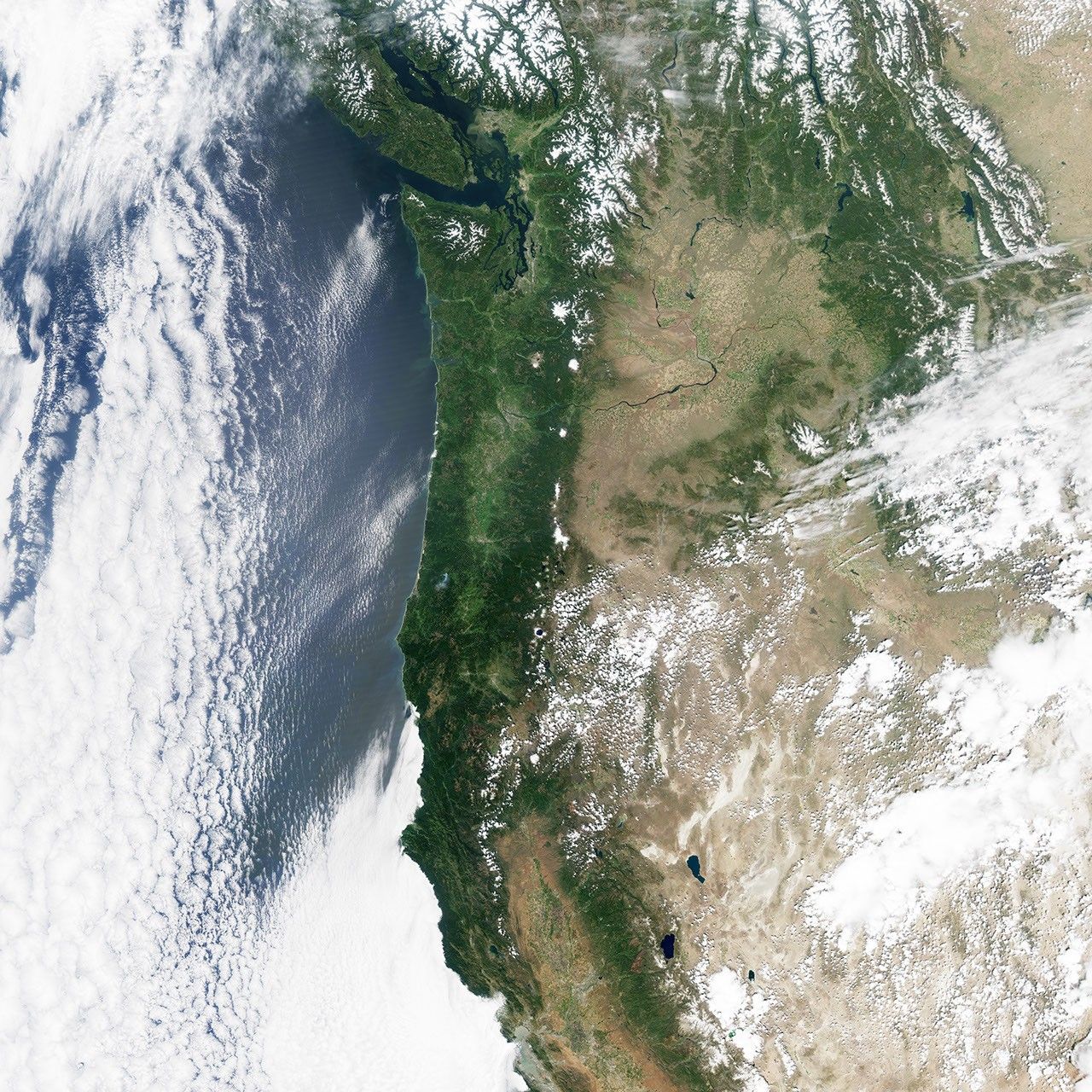


Despite several months with average or just-below average precipitation, concerns about drought are growing in the states of Oregon and Washington. That’s because winter and early spring snows instead fell as rain. Like many parts of the western United States and Canada, the region depends on mountaintop snow as a sort of frozen reservoir that melts and fills streams and rivers through warmer, drier summer months. Warmer than usual temperatures on land and offshore in the North Pacific led to rainfall events even at high elevations.
The Moderate Resolution Imaging Spectroradiometer (MODIS) on NASA’s Aqua satellite acquired these natural-color images of Oregon, Washington, and the Cascade and Olympic Mountains. The left image shows the region on May 13, 2014, while the right was acquired on May 3, 2015. Last year was not necessarily good for snowpack, but it was substantially better than 2015.
According to state officials, snowpack in Washington was 16 percent of normal as of May 15, and yearly runoff is predicted to be at its lowest in 64 years. Of 98 locations that are regularly monitored for snowpack, 66 were snow free by mid-May. The state’s water managers noted that 48 of 62 watersheds were at or below 75 percent of water capacity, and record-low water levels have been recorded on the Stillaguamish, Snohomish, Skykomish, and Snoqualmie rivers, among others. The data prompted Governor Jay Inslee to declare a statewide drought emergency.
In neighboring Oregon, average snow pack stood at 11 percent, its lowest level since 1992. The peak of mountain snow cover in 2015 came anywhere from three to thirteen weeks before the normal peak in April. Snow cover in May ranged from zero in the Klamath Basin to 16 percent in northeastern Oregon. Conservation managers noted that three quarters of the state’s snow monitoring stations reached their lowest April measurements on record.
References & Resources
- Oregon Water Resources Department (2015) Drought Watch. Accessed May 15, 2015.
- Washington State Department of Ecology (2015) Washington Drought 2015. Accessed May 15, 2015.
- Associated Press, via Journal Gazette and Times-Courier (2015, May 14) Oregon snowpack at 11 percent, tough for farmers, fish. Accessed May 15, 2015.
- King5 News (2015, May 11) More bad news for Washington’s drought. Accessed May 15, 2015.
- Northwest Public Radio (2015, May 12) More Northwest Mountains Are Snow-Free Already As Drought Deepens. Accessed May 15, 2015.
- NASA Earth Observatory (2015, April 18) Warm Water and Strange Weather May Be Connected.
- NASA Earth Observatory (2015, March 10) Going Hot and Cold in February.
NASA Earth Observatory images by Jesse Allen, using data from the Level 1 and Atmospheres Active Distribution System (LAADS). Caption by Mike Carlowicz.