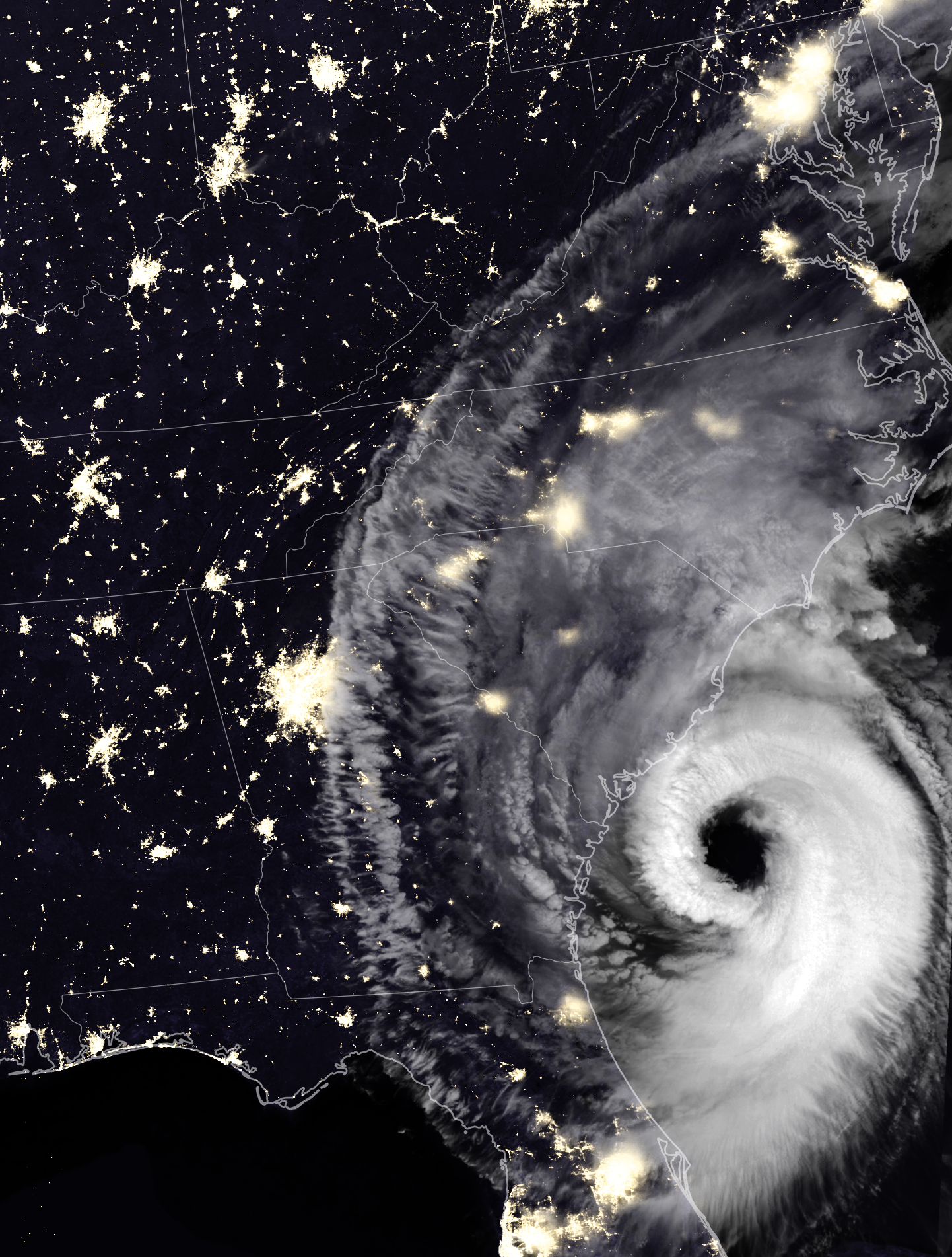
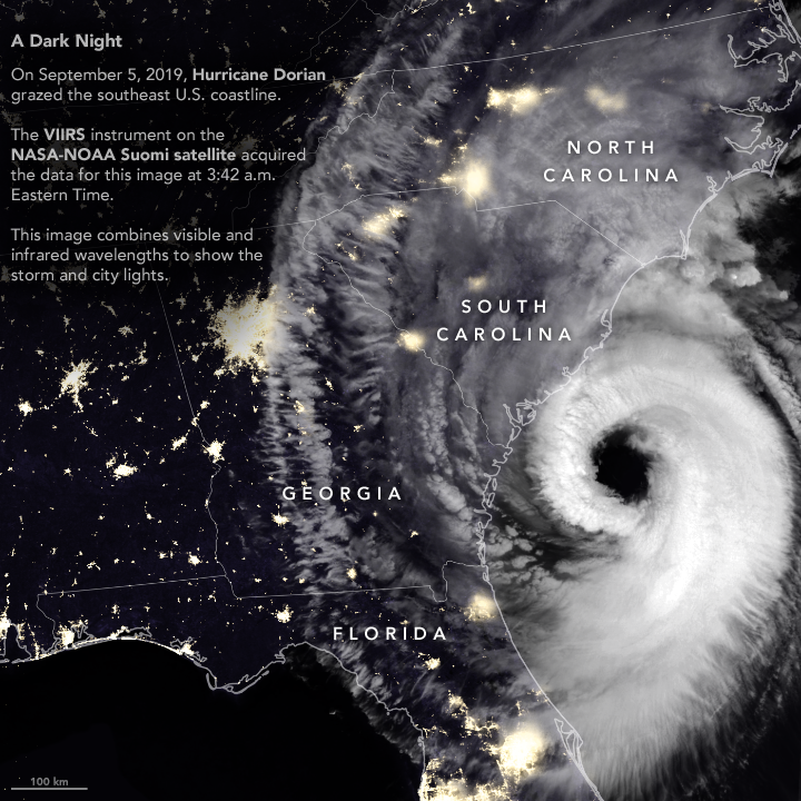
After devastating the Bahamas and grazing Florida and Georgia, Hurricane Dorian rebounded and raked the coast of South Carolina with strong winds, heavy rains, and a storm surge. Wind, falling trees, and flooding damaged power infrastructure in coastal areas of the southeast U.S.
The Visible Infrared Imaging Radiometer Suite (VIIRS) on the Suomi NPP satellite captured this nighttime composite image as the storm approached the coast at 3:42 a.m. Eastern Time (07:42 UTC) on September 5, 2019. At the time, Dorian packed maximum sustained winds of 115 miles (185 kilometers) per hour and was moving north at 8 miles per hour.
The VIIRS sensor observed thick cloud bands circulating around Dorian’s large eye, the part of the storm with mostly calm weather and the lowest atmospheric pressure. Hurricane eyes average about 20 miles (32 kilometers); the National Hurricane Center reported Dorian’s eye had a diameter of 50 miles (80 kilometers) around the time this image was acquired. Thinner clouds—part of the storm’s higher-level outflow—extended well inland across Georgia, South Carolina, and North Carolina.
The VIIRS image was captured by the sensor’s
, which detects light in a range of wavelengths from green to near-infrared and uses filtering techniques to observe signals such as gas flares, city lights, and reflected moonlight. Infrared observations from VIIRS were used to enhance the visibility of clouds. Optical MODIS satellite data was layered into the image to make it easier to distinguish between ocean and land surfaces.
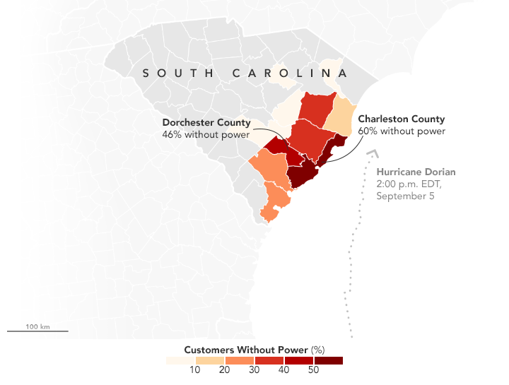
It is not possible to identify the locations of power outages based on the VIIRS night light image alone. However, as of 2 p.m. on September 5, several utility companies and Poweroutages.us were reporting more than 240,000 outages in South Carolina. The hardest hit area was Charleston County, where companies were reporting more than 130,000 outages.
In the coming days, forecasters expect Dorian to move near or over the coast of North Carolina and then toward New England and Nova Scotia.
References & Resources
- Dominion Energy (2019, September 5) Outage Map. Accessed September 5, 2019.
- Berkley Electric (2019, September 5) External Outage Map. Accessed September 5, 2019.
- National Hurricane Center (2019, September 5) Hurricane Dorian. Accessed September 5, 2019.
- NASA Hurricane and Typhoon Updates (2019, September 5) DorianâAtlantic Ocean. Accessed September 5, 2019.
- NASA Disasters Program (2019, September 5) Hurricane Dorian 2019. Accessed September 5, 2019.
- Poweroutages.us (2019, September 5) South Carolina. Accessed September 5, 2019.
- The Post and Courier (2019, September 4) More than 220,000 power outages reported across SC as Dorian travels up coast. Accessed September 5, 2019.
NASA Earth Observatory images by Joshua Stevens, using VIIRS data from the Suomi National Polar-orbiting Partnership, and power outage data courtesy of PowerOutage.us. Story by Adam Voiland.