


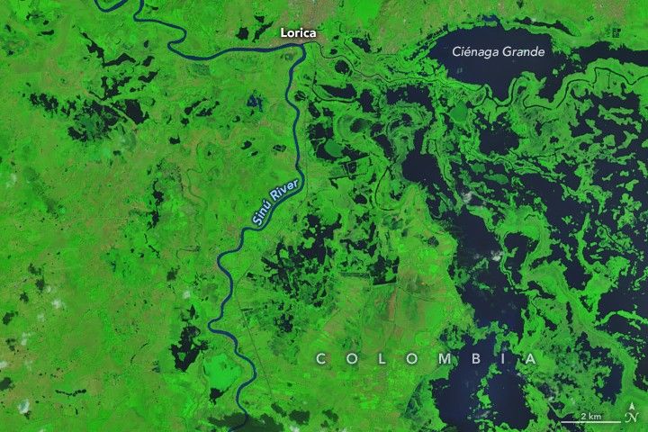
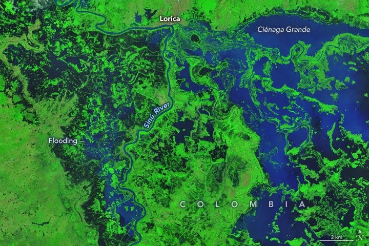
February is one of the driest months of the year in northern Colombia’s Córdoba department, a major farming and cattle region. It’s the time of year when farmers normally prepare fields for planting and ranchers move livestock to graze in drying floodplains. In 2026, however, unusually heavy rains in early February upended seasonal rhythms and submerged much of the department under floodwaters.
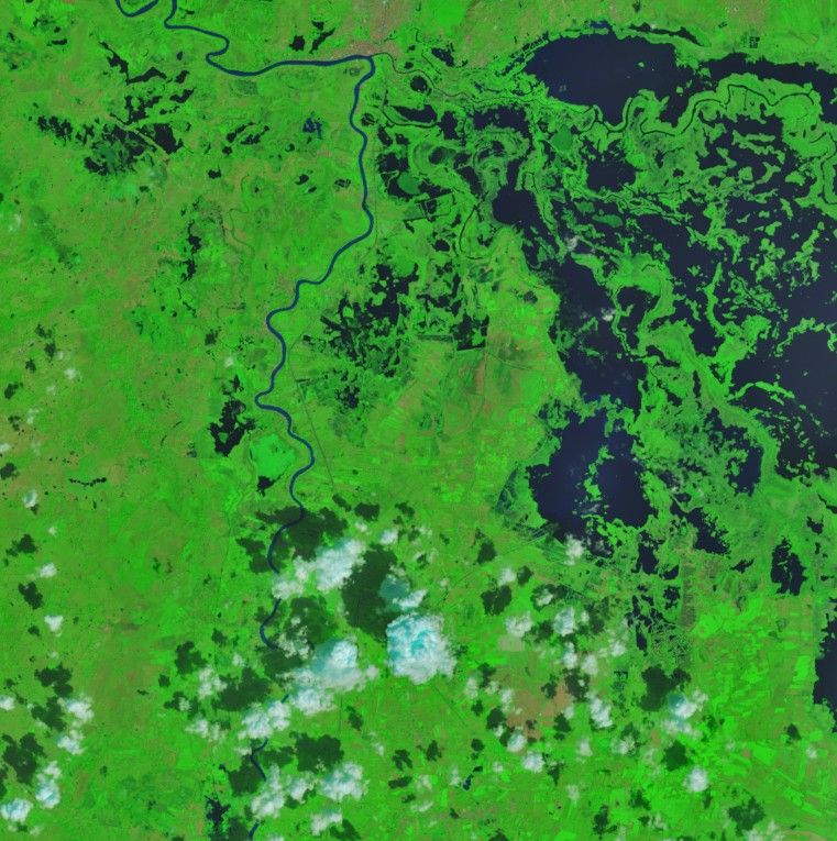
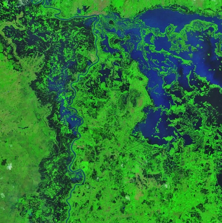
The OLI (Operational Land Imager) on Landsat 9 captured this false-color image (bands 7-5-4) of flooding along the Sinú River on February 9, 2026 (right). Dark floodwaters cover farmland, pastureland, and several communities, particularly to the west of the river. To the east, water levels at a complex of wetlands are unseasonably high. Lorica, a city of roughly 90,000 people, is visible in the upper part of the image. The OLI image on the left shows the same area on January 23, before floodwaters arrived.
After an already wet January, rainfall intensified in early February when an unusual cold front in the Caribbean pushed south on February 1 and 2, forcing moisture-laden air into northern Colombia and over the Andes. This led to several days of intense downpours in Córdoba, with some areas receiving more than 4 to 7 centimeters (2 to 3 inches) of rain per day, according to one analysis of the event.
NASA's IMERG (Integrated Multi-satellite Retrievals for Global Precipitation Measurement) estimated rain rates of 1.7 centimeters per hour near Lorica on February 1, the day of the heaviest rains. In the following weeks, storms continued to drench the region. On February 25, imagery from NASA's Terra satellite indicated that flooding remained widespread.
The floods have been far-reaching and destructive. More than 80 percent of Córdoba flooded, according to the UN Office for the Coordination of Humanitarian Affairs. Preliminary estimates cited by news and government sources suggest that thousands of homes were destroyed, more than 11,000 families displaced, and more than 150,000 hectares of farmland inundated.
NASA Earth Observatory images by Michala Garrison, using Landsat data from the U.S. Geological Survey. Story by Adam Voiland.
References & Resources
- The City Paper Bogotá (2026, February 10) Extreme flooding in northern Colombia triggers humanitarian crisis. Accessed February 25, 2026.
- ClimaMeter (2026, February) February 2026 floods in northern Colombia. Accessed February 25, 2026.
- Colombia Reports (2026, February 12) Colombia declares emergency in response to widespread floods. Accessed February 25, 2026.
- El País (2026, February 10) Carlos Carrillo: “La inundación en Córdoba es mucho más grave de lo previsto en los escenarios más pesimistas.” Accessed February 25, 2026.
- IDEAM (2026) News. Accessed February 25, 2026.
- IDEAM (2026, February 3) Boletín de condiciones hidrometeorológicas y alertas No. 100. Accessed February 25, 2026.
- International Charter Space & Major Disasters (2026) Flood in Colombia. Accessed February 25, 2026.
- ReliefWeb (2026, February 25) Colombia: Floods. Accessed February 25, 2026.
- Unidad Nacional para la Gestión del Riesgo de Desastres (2026, February 15) Con tecnología satelital, UNGRD identifica mancha de inundación en Córdoba. Accessed February 25, 2026.


