


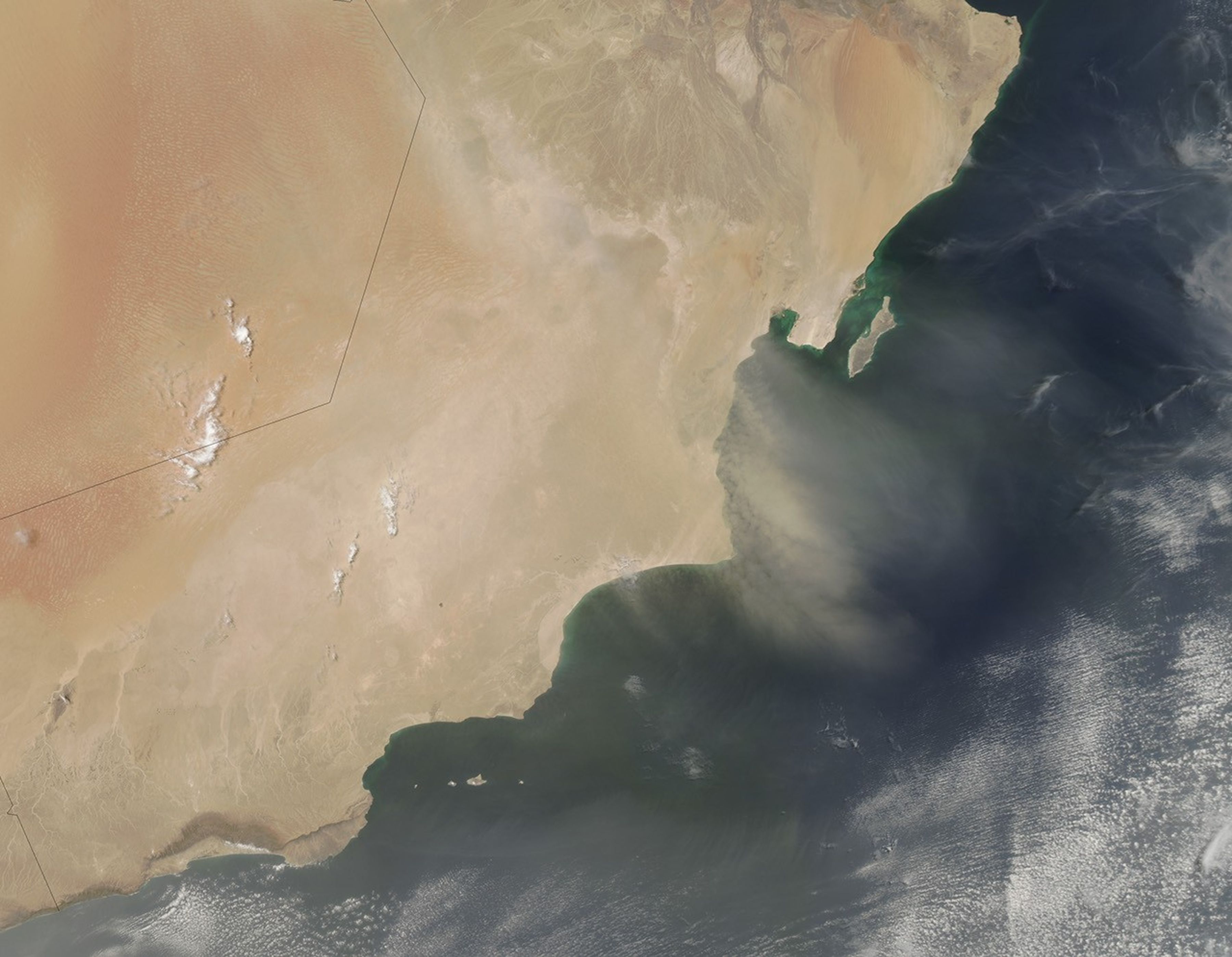
June 15, 2014, was destined to be a bad weather day for the people of Oman. For days, forecasters had been watching Tropical Cyclone Nanauk track northwest toward the country’s shores. It was expected to make landfall on June 15, but the advancing Southwest Monsoon intervened with winds that carried very dry Middle Eastern air into the core of Tropical Cyclone Nanauk. The storm fell apart.
Instead, strong northwesterly winds prevailed, so on June 15, many in Oman saw dust instead of rain and floods. The Moderate Resolution Imaging Spectroradiometer (MODIS) on NASA’s Aqua satellite acquired this image of the dust storm at 1:45 p.m. local time. The dust blurs land features and extends out over the Arabian Sea.
The winds and resulting dust reduced visibility, leading to warnings throughout the region. The winds also caused high waves in the Persian Gulf and Gulf of Oman.
References & Resources
- The Gulf Today (2014, June 15) Unstable weather garners yellow warning: Met Office. Accessed June 16, 2014.
- Khaleej Times (2014, June 15) NCMS warns of low visibility due to dust, sand. Accessed June 16, 2014.
- Masters, Jeff (2014, June 12) Little change to Arabian Sea Tropical Cyclone Nanauk. Published on Weather Underground. Accessed June 16, 2014.
- Oman Tribune (2014) Storm Nanauk weakens, won’t have a direct impact on Oman. Accessed June 16, 2014.
NASA image courtesy Jeff Schmaltz, LANCE/EOSDIS MODIS Rapid Response Team at NASA GSFC. Caption by Holli Riebeek.


