

























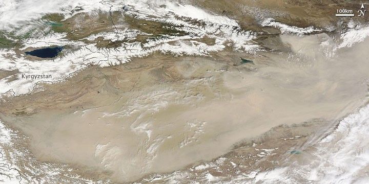
Dust stirred in the Taklimakan Desert in mid-April 2009. The Moderate Resolution Imaging Spectroradiometer (MODIS) on NASA’s Terra satellite captured this image on April 17, 2009. In this image, opaque dust plumes completely obscure the desert floor. To the north, brilliant white snow caps mountain ranges.
The Taklimakan Desert rests the Tarim Basin, which sits between the mountain ranges of the Tien Shan (or Tian Shan) in the north and the Kunlun Shan in the south. This desert qualifies as China’s biggest, hottest, and driest. It also qualifies as one of the world’s largest shifting sand deserts, with dunes reaching a height of as much as 200 meters (656 feet).
References & Resources
- World Wildlife Fund, McGinley, M. (2007). Taklimakan Desert. Encyclopedia of Earth. Accessed April 17, 2009.
NASA image courtesy MODIS Rapid Response Team, Goddard Space Flight Center. Caption by Michon Scott.







