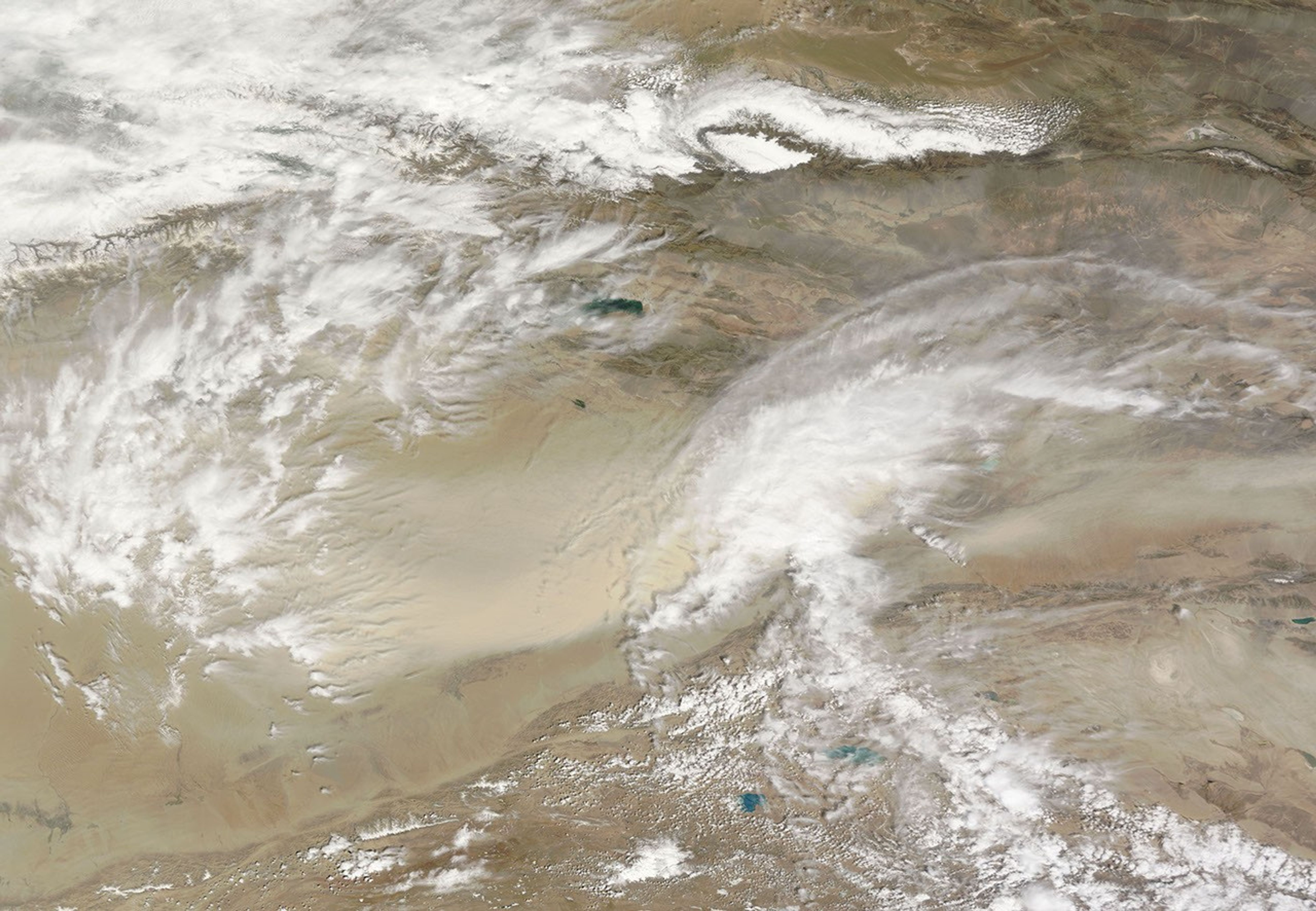
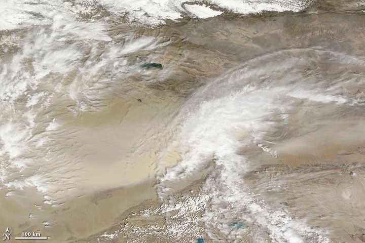
Another dust storm blew eastward out of China’s Taklimakan Desert on May 5, 2009, continuing a pattern of intermittent dust-storm activity in the region. The Moderate Resolution Imaging Spectroradiometer (MODIS) on NASA’s Terra satellite captured this image the same day. In this true-color image, the camel-colored dust cloud hides the eastern half of the desert floor. Dust passes under a bank of clouds at the desert’s margin and continues eastward.
Sitting in the Tarim Basin between the mountain ranges of the Tien Shan (or Tian Shan) in the north and the Kunlun Shan in the south, the Taklimakan Desert is one of the world’s largest shifting-sand deserts. Each spring, dust storms regularly blow out of this desert, often bringing yellow dust to eastern China.
References & Resources
- World Wildlife Fund, McGinley, M. (2007). Taklimakan Desert. Encyclopedia of Earth. Accessed May 5, 2009.
NASA image courtesy MODIS Rapid Response Team, Goddard Space Flight Center. Caption by Michon Scott.