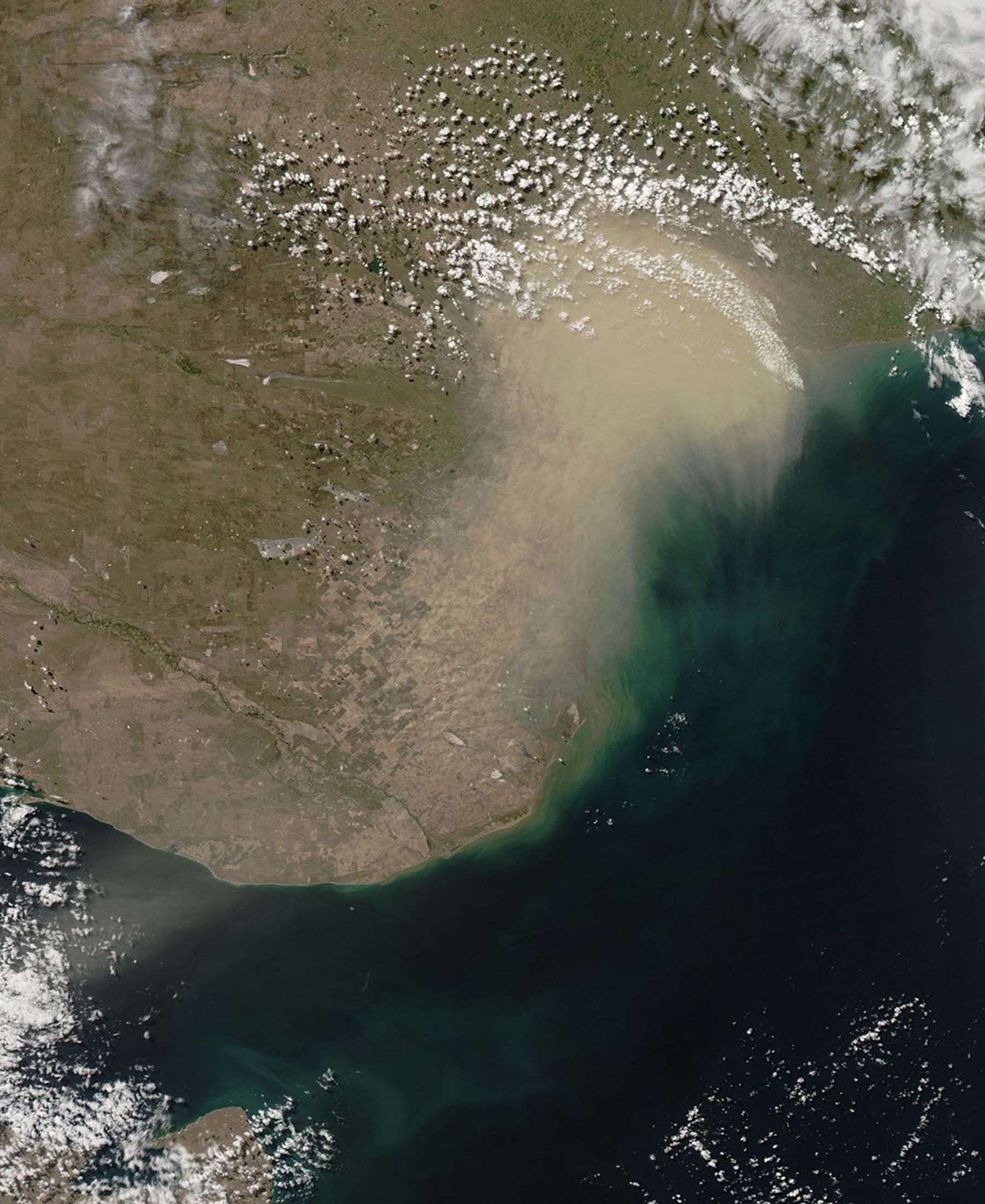
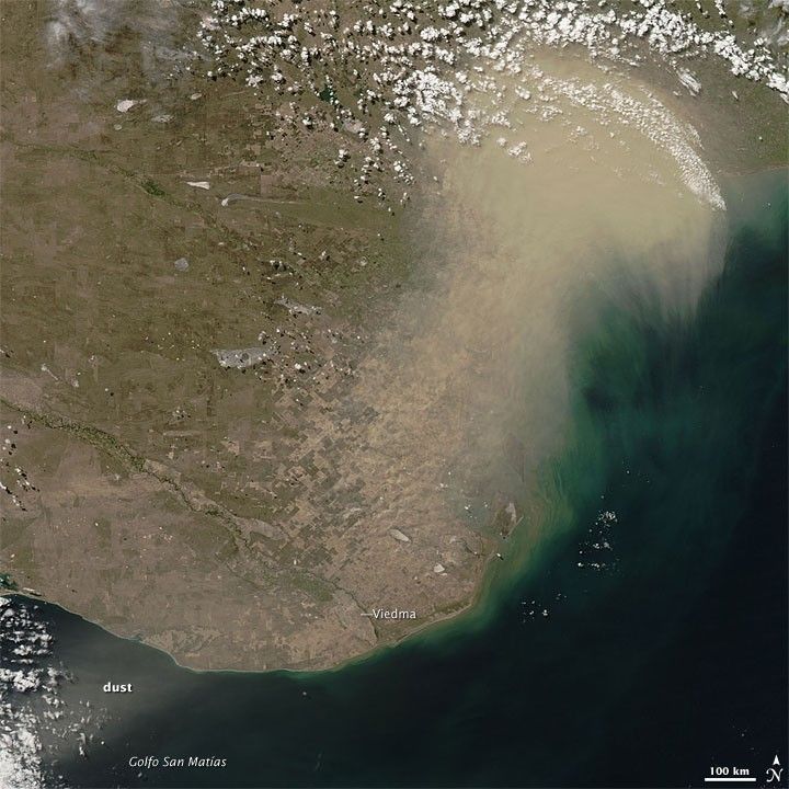
The dust plumes that blew inland from the coast earlier in the day had traveled northward by the time the Moderate Resolution Imaging Spectroradiometer (MODIS) on NASA’s Aqua satellite passed overhead. This image shows the progress of the dust storm along the coast of Argentina on the afternoon of March 16, 2009.
Compared to the Terra image acquired about four hours earlier, skies over the city of Viedma were relatively clear in this shot. To the northeast, however, an opaque dust plume hovered over the coastline, with tendrils reaching seaward. In addition, a thinner plume of dust appeared southwest of Viedma. As the plumes that arose earlier in the day were headed inland, these plumes blowing toward the sea indicate that wind directions changed, or the dust plumes encountered winds blowing different directions at different altitudes.
References & Resources
NASA images by Jeff Schmaltz, MODIS Rapid Response Team. Caption by Michon Scott.