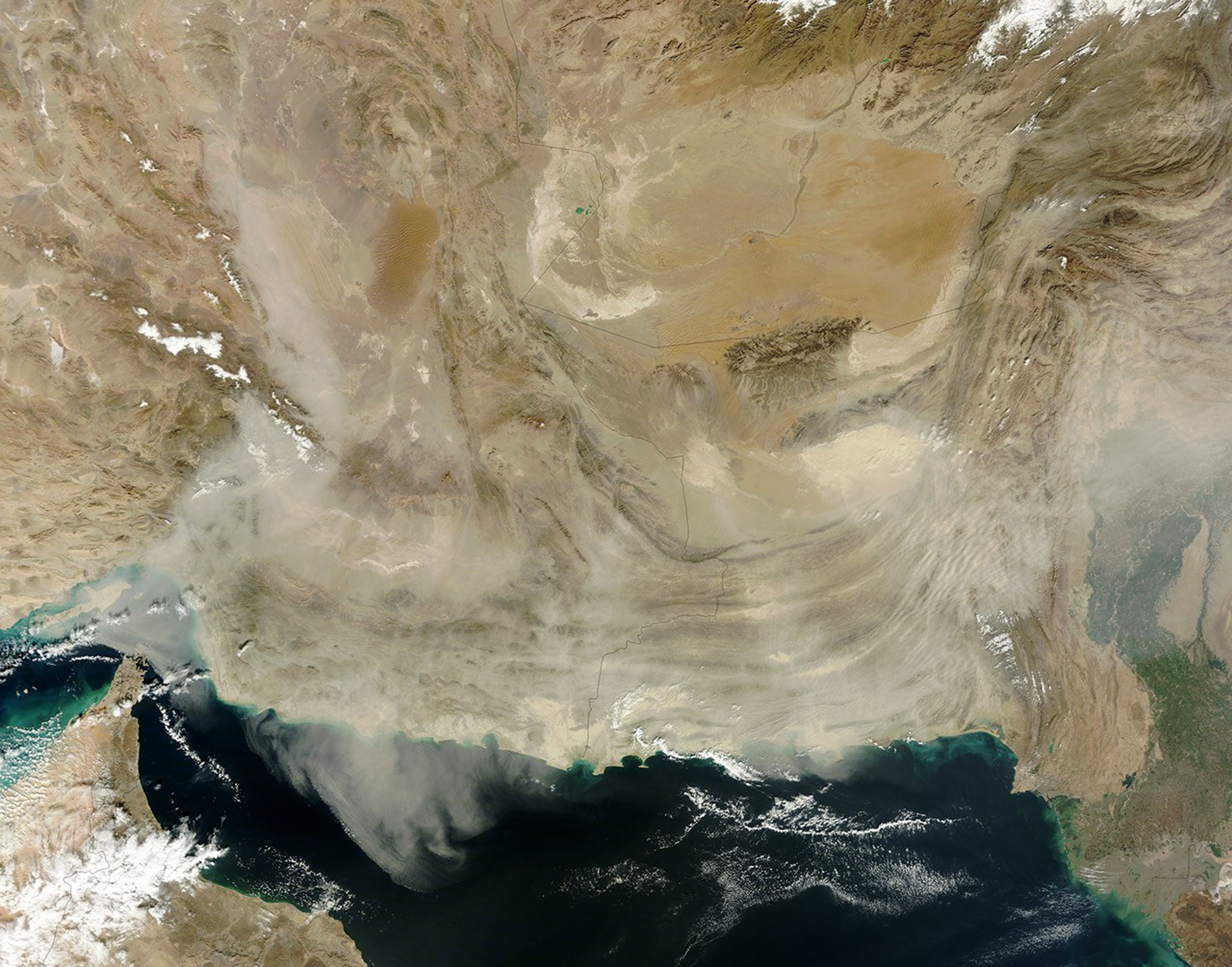
A dust storm that arose on January 11 spread toward the south and east the next day. The Moderate Resolution Imaging Spectroradiometer (MODIS) on NASA’s Terra satellite acquired this natural-color image on January 12, 2013.
By the time MODIS captured this scene, the dust stretched from the coast of Pakistan to the Strait of Hormuz. Thick enough to hide the ground below, a river of dust flowed southward past the Dasht-e Lut (Desert of Emptiness) in southeastern Iran. West and south of that desert, mountain ridges poked above the low-lying dust.
Dust storms rank among the leading natural hazards in Iran. Other than the subtropical climate of the Caspian Sea coast, Iran is mostly arid or semiarid. Less than 10 percent of the country’s land is arable.
References & Resources
- CIA World Factbook. (2013, January 2) Iran. Accessed January 14, 2013.
NASA image courtesy Jeff Schmaltz, LANCE MODIS Rapid Response. Caption by Michon Scott.