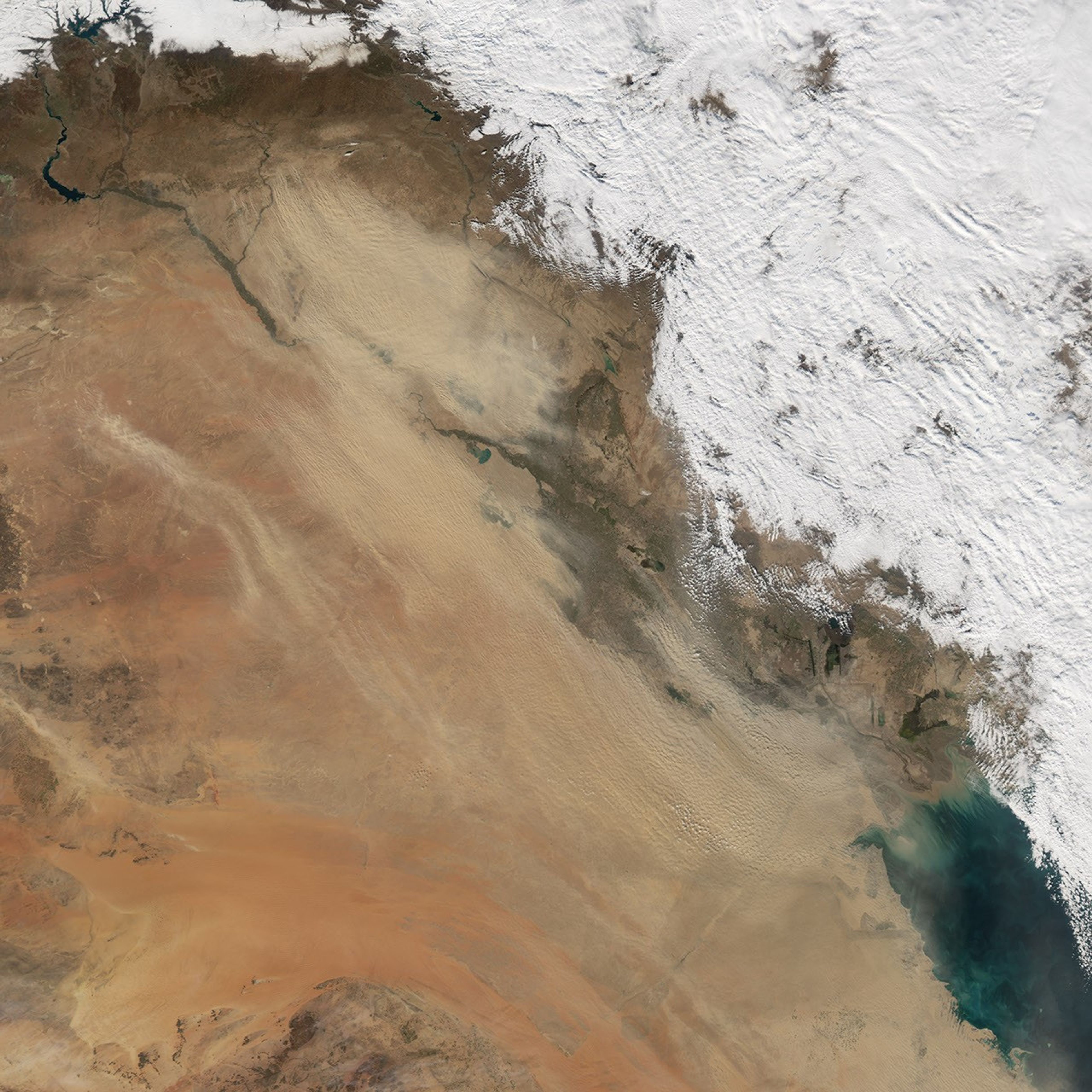

On January 21, 2006, a dust storm crossed Iraq toward the Persian Gulf. Moving in a southeasterly direction, the storm moved over the city of Baghdad and the network of rivers, lakes, and wetlands to the southeast of the city. The Moderate Resolution Imaging Spectroradiometer (MODIS) flying onboard the Aqua satellite captured this image the same day. In this image, the dust appears as tendrils of pale beige, partially obscuring the underlying land areas. Immediately to the north and east of the dust storm is heavy cloud cover. Winds associated with weather systems can stir up dust storms in arid regions, so the dust storm and heavy cloud cover may be related.
According to the University Corporation for Atmospheric Research’s Forecasting Dust Storms Website, the source regions for these storms, including source regions in Iraq, can be surprisingly small. Like billowing smokestacks, these areas can produce dust plumes that spread out to cover wide areas.
References & Resources
NASA image created by Jesse Allen, Earth Observatory, using data obtained from the Goddard Earth Sciences DAAC .