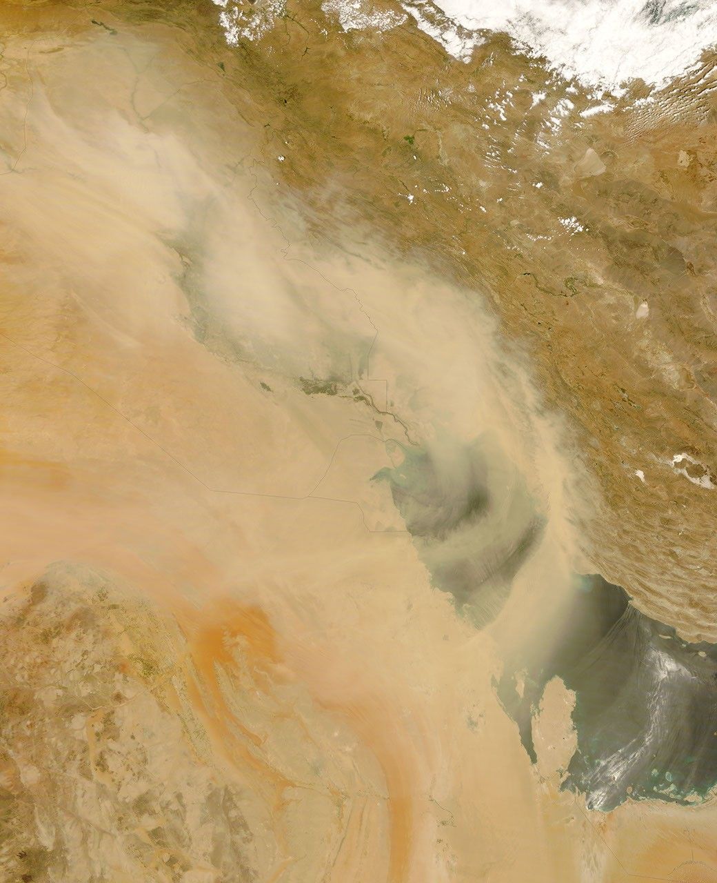


























A dust storm blew through Iraq and over the Persian Gulf on July 1, 2008. The Moderate Resolution Imaging Spectroradiometer (MODIS) on NASA’s Terra satellite captured this image the same day.
In this image, the dust plumes are thick enough to almost completely hide the land and water below. The dust blows in a counter-clockwise direction, forming arcs over the Gulf and blowing over Saudi Arabia. The thickest part of the dust appears to skirt Bahrain, missing Qatar and the United Arab Emirates (UAE), although a thin veil of dust likely hangs over the entire region. In the southeast, the pale arcs crossing the Persian Gulf probably result partly from thin dust plumes. The arcs with more distinct outlines, especially northeast of Qatar, however, may result from sunglint—reflection of sunlight on the ocean’s surface.
These thick plumes result from a shamal—a northwesterly wind that often blows over the floodplain of the Tigris and Euphrates Rivers in Iraq. This floodplain’s fine sediments provide ample material for dust storms in the region.
References & Resources
NASA image courtesy of Jeff Schmaltz, MODIS Rapid Response Team , NASA-Goddard Space Flight Center. Caption by Michon Scott.