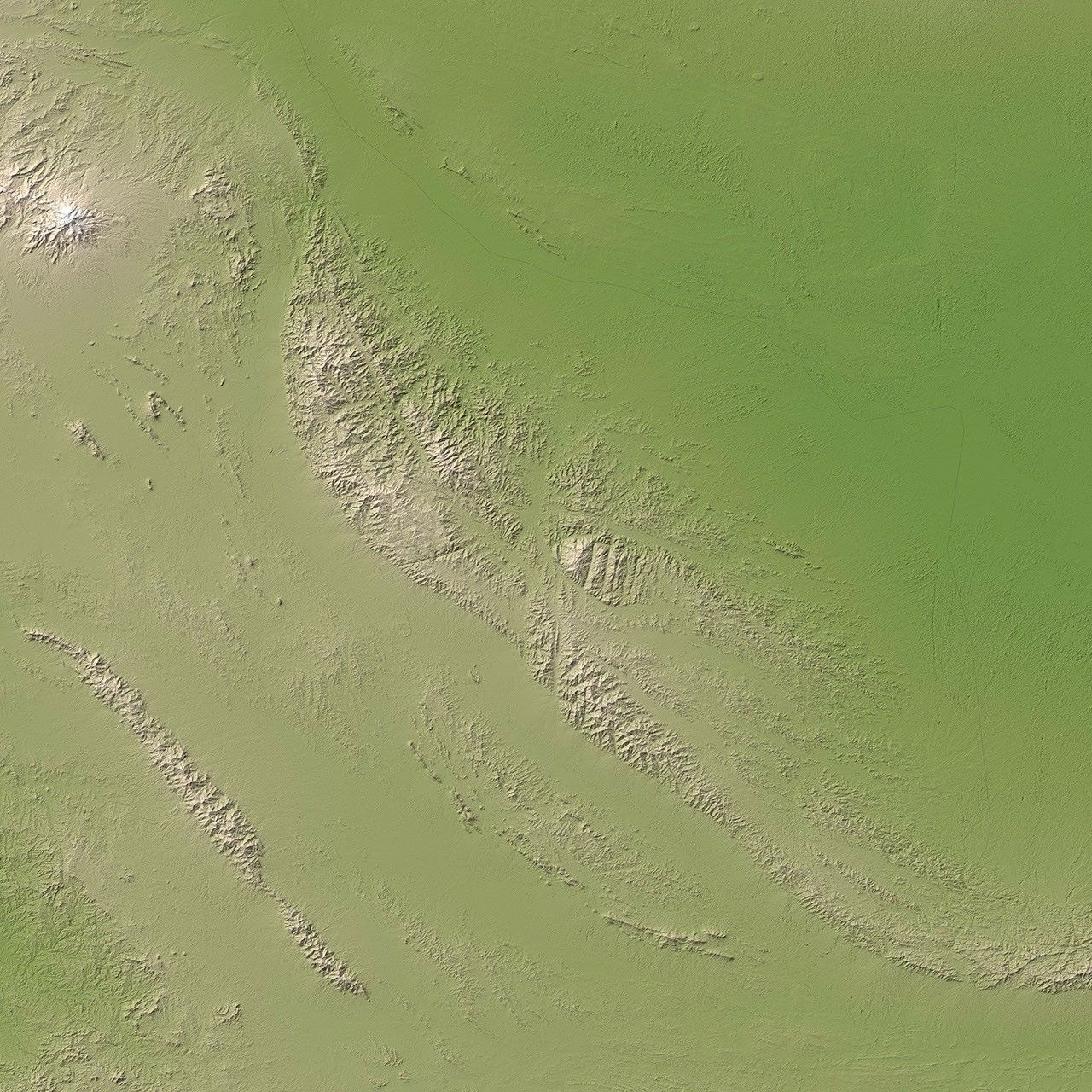
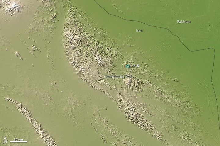
The ongoing collision of two enormous slabs of the Earth’s lithosphere—the Arabian and Eurasian plates—caused a magnitude 7.8 earthquake in southeastern Iran on April 16, 2013. The quake was the largest to hit Iran in more than 50 years. Its epicenter was about 83 kilometers (52 miles) east of Khash, a city with a population of more than 70,000.
Earth’s lithosphere is broken into giant plates that cover the surface of the planet like pieces of a puzzle. Individual plates constantly collide and grind against one another as they slide on top of a somewhat fluid layer of the Earth’s interior known as the asthenosphere, causing earthquakes in the process.
The Arabian plate is sliding north-northeast at a speed of about 37 millimeters (1.5 inches) per year relative to the larger Eurasian plate. Where the two plates collide in an area known as the Makran subduction zone, the Arabian plate plunges beneath the larger Eurasian plate. As it descends into the mantle where it will eventually melt, earthquakes occur deep beneath the surface, along the boundary between the two plates.
According to the U.S. Geological Survey, the earthquake was the result of faulting at an intermediate depth in the Arabian plate lithosphere, approximately 80 kilometers (50 miles) beneath Earth’s surface. The descending Arabian plate has caused quakes as deep as 160 kilometers (100 miles) beneath the surface in this area in the past, though most have been at much shallower depths.
This image, based on elevation data acquired by the Advanced Spaceborne Thermal Emission and Reflection Radiometer (ASTER) on NASA’s Terra satellite, shows the area where the earthquake occurred. Land is shown with shades of green and beige. Higher elevations are lighter in color.
Further Reading
- Al Jazeera (2013, April 16) Quake Rocks Iran and Pakistan. Accessed April 16, 2013.
- Live Science (2013, April 16) Iran’s Massive Earthquake Explained. Accessed April 16, 2013.
- New York Times (2013, April 16) Powerful Earthquake Strikes in Iran. Accessed April 16, 2013.
References & Resources
- NASA Johnson Spaceflight Center Arabian Plate: Makran Region. Accessed April 16, 2013.
- U.S. Geological Survey (2013, April 16) Magnitude 7.8 – 83 KM East of Khash, Iran. Accessed April 16, 2013.
- U.S. Geological Survey (2013, April 16) Magnitude 7.8 Earthquake in Iran. Accessed April 16, 2013.
- U.S. Geological Survey Plates of the Earth (Map). Accessed April 16, 2013.
NASA Earth Observatory image by Jesse Allen, using data from NASA/GSFC/METI/ERSDAC/JAROS, and U.S./Japan ASTER Science Team. Caption by Adam Voiland