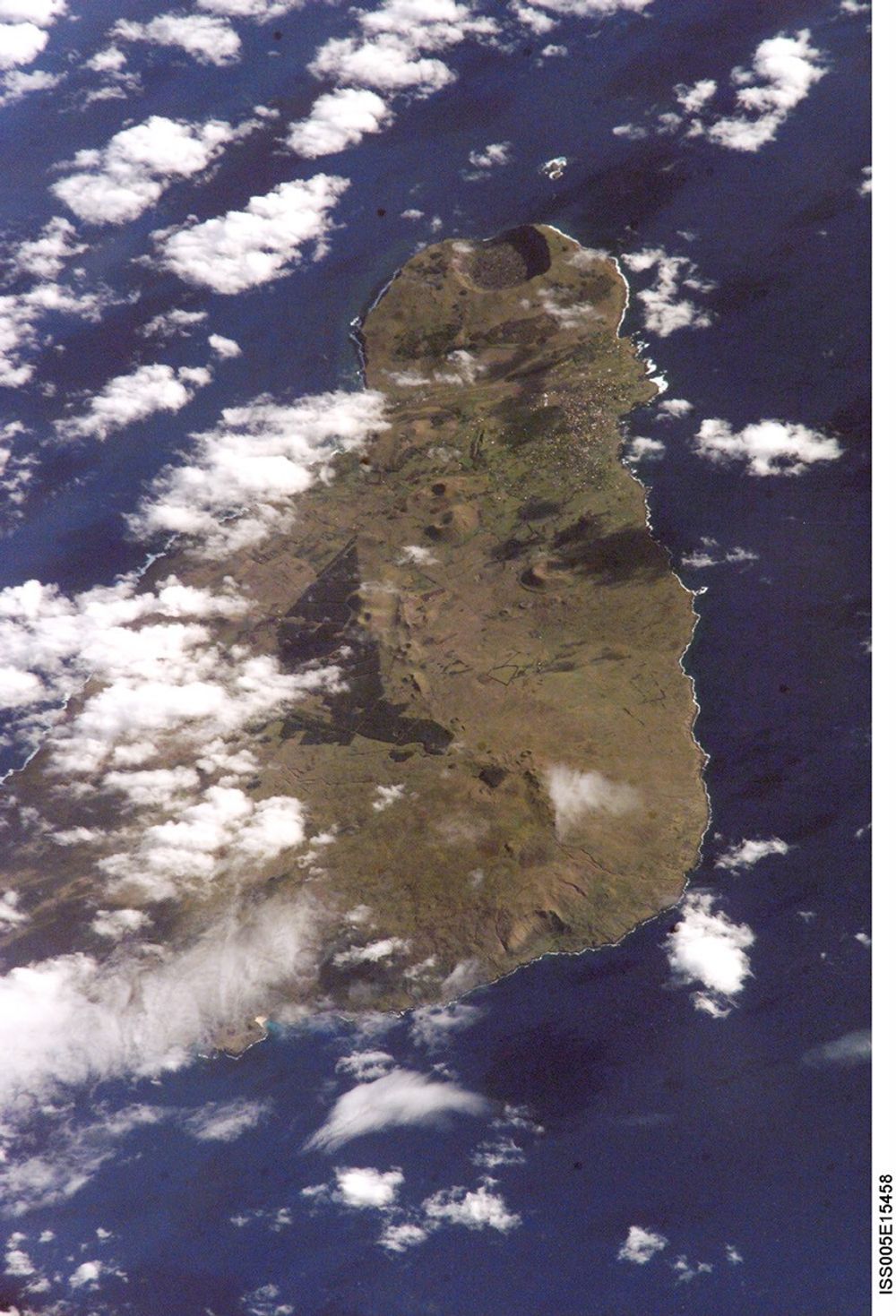
On September 25, 2002, astronauts aboard the International Space Stationviewed Easter Island, one of the most remote locations on Earth. Easter Islandis more than 2000 miles from the closest populations on Tahiti and Chile—evenmore remote than astronauts orbiting at 210 n.mi. above the Earth. The islandis less than 15 miles long and, until now, has been a photographic challengefor astronauts on space missions.
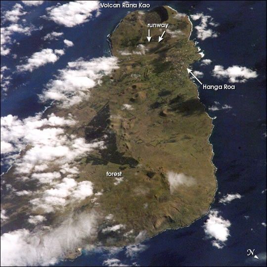
Although not visible here, Easter Island is perhaps most famous for the giantstone monoliths, known as Moai, that have been placed along the coastline.Archaeologists believe the island was discovered and colonized by Polynesians atabout 400 AD. Subsequently, a unique culture developed. The human populationgrew to levels that could not be sustained by the island. A civil war resulted,and the island’s deforestation and ecosystem collapse was nearly complete.Today, a new forest (primarily eucalyptus) has been established in the center ofthe island (dark green).
The geography of the island is dominated by volcanic landforms, including thelarge crater Rana Kao at the southwest end of the island and a line of cindercones that stretch north from the central mountain. A final feature (difficultto see) is the very long runway (Chile’s longest) near Rana Kao. The airportserves as an emergency landing site for the Space Shuttle.
For additional information visit the Easter Island Home Page.
References & Resources
Astronaut photograph ISS005-E-15458 was provided by the Earth Sciences and Image Analysis Laboratory at Johnson Space Center. Additional images taken by astronauts and cosmonauts can be viewed at the NASA-JSC Gateway to Astronaut Photography of Earth.