


April 4, 2010
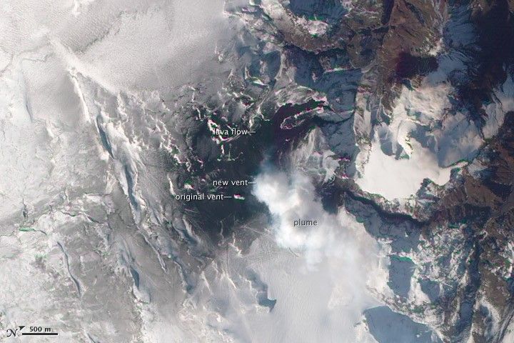
Lava continued to pour out of two fissures near Eyjafjallajökull as the eruption near the Fimmvörduháls Pass entered its third week. This satellite image shows the eruption on April 4, 2010. The original fissure—originally about 1,000 meters (3,000 feet) long and composed of several distinct vents—has coalesced into a single vent.
The new fissure is hidden under a volcanic plume, likely composed primarily of steam. Black lava flows reach several kilometers north from the vents, eventually spilling into Hvannárgil and Hrunagil Canyons. This image was acquired by the Advanced Land Imager (ALI) aboard NASA’s Earth Observing-1 (EO-1) satellite.
References & Resources
- Eruptions. (2010, April 5). Eyjafjallajokull-Fimmvörduháls eruption. Accessed April 5, 2010.
- The Volcanism Blog. (2010, April 1). Eyjafjallajökull. Accessed April 5, 2010.
NASA image by Robert Simmon, using ALI data from the EO-1 team. Caption by Robert Simmon.


