June 11, 2011
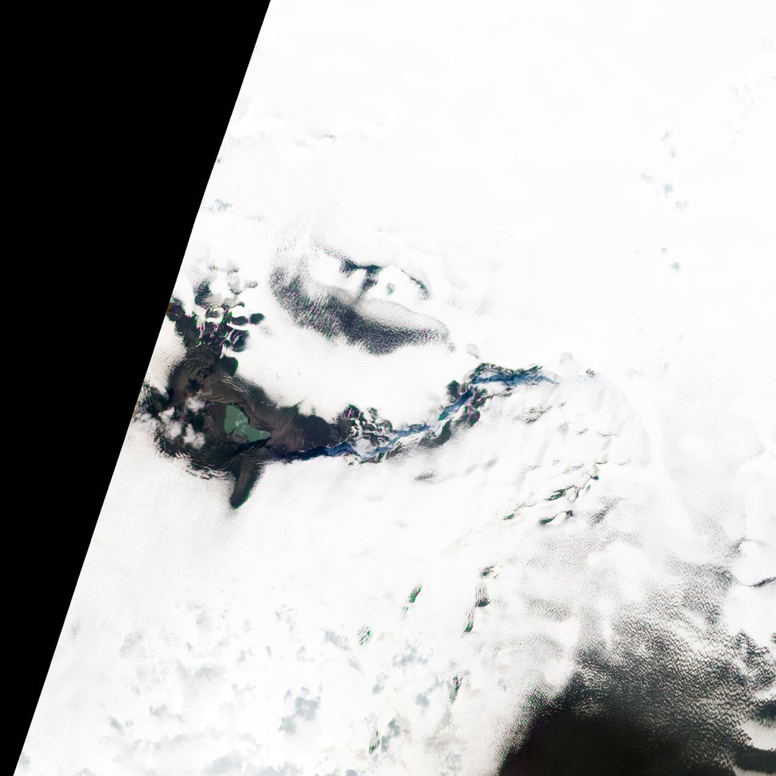
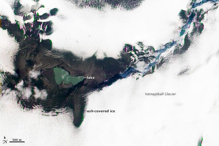
After covering a large portion of Iceland with ash in late May 2011, Grímsvötn Volcano left behind a small lake filled with melt water and a hole in the Vatnajökull Glacier. This natural-color satellite image was acquired by the Advanced Land Imager (ALI) aboard Earth Observing-1 (EO-1) on June 11, 2011. The lake covers much of the site of the eruption, with the possible exception of the crescent-shaped feature along the southern shore of the lake. This may be a tephra cone left behind by the eruption. Gray ash covers the ice of Vatnajökull Glacier near the vent. Further away, the ash layer itself is obscured by snow.
References & Resources
- Institute of Earth Sciences. (2011). Eruption in Grímsvötn 2011. Accessed June 22, 2011.
NASA Earth Observatory image by Jesse Allen and Robert Simmon, using EO-1 ALI data. Caption by Robert Simmon.