Although deforestation in the Amazon Rainforest slowed in the late 1990s, the rate is increasing again in the 21st century. From July 2001 through June 2002 25,500 square kilometers of Brazil’s Amazon Rainforest were cut down or burned. The average for the 1990s was about 18,000 km2 of forest destroyed per year, with a peak of 29,000 km2 destroyed in 1995. The Brazilian National Space Research Institute (INPE) used data from NASA’s Landsat satellites to measure the rate of forest loss.
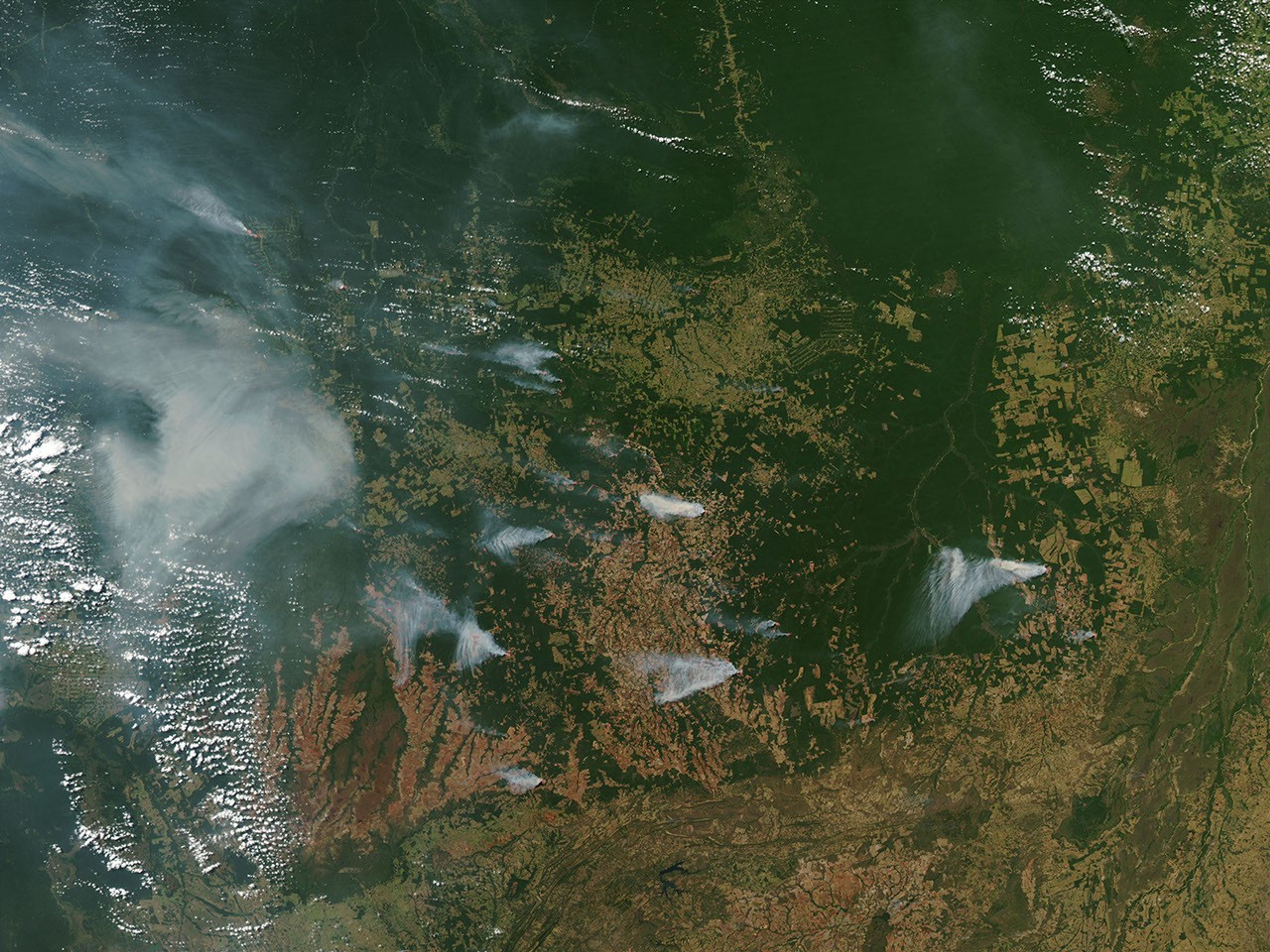
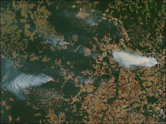
The large numbers of fires and smoke plumes in the image above suggest that rapid destruction of the Amazon continues. Acquired by the Moderate Resolution Imaging Spectroradiometer (MODIS) on June 30, 2003, this image shows a portion of the Brazilian state of Mato Grosso. Intact forest is dark green, while cleared land is tan or reddish-brown. Mato Grosso is located on the southern edge of the Amazon, east of Bolivia.
For more information, read:
Brazilian Government Disputes Bleak Amazon Deforestation Outlook
Urgent measures needed to stop shocking deforestation rate in the Amazon
References & Resources
Image courtesy Jacques Descloitres, MODIS Land Rapid Response Team at NASA GSFC