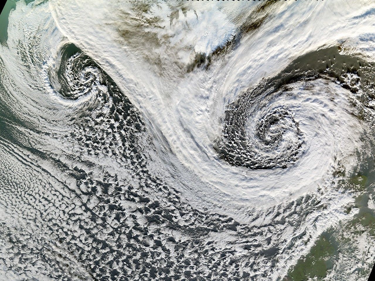
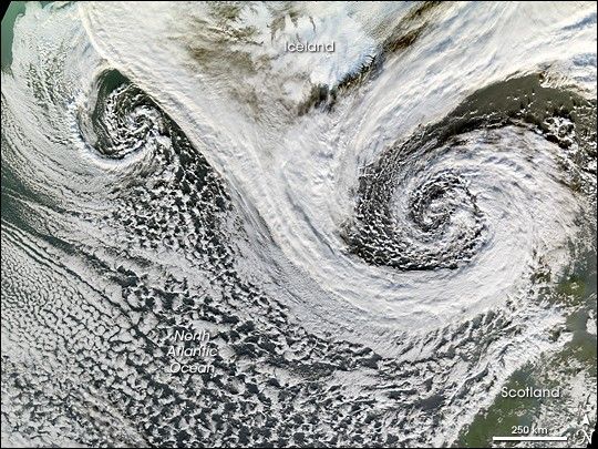
A cyclone is a low-pressure area of winds that spiral inwards. Although tropical storms most often come to mind, these spiraling storms can also form at mid- and high latitudes. Two such cyclones formed in tandem in November 2006. The Moderate Resolution Imaging Spectroradiometer (MODIS) flying onboard NASA’s Terra satellite took this picture on November 20. This image shows the cyclones south of Iceland. Scotland appears in the lower right. The larger and perhaps stronger cyclone appears in the east, close to Scotland.
Cyclones at high and mid-latitudes are actually fairly common, and they drive much of the Earth’s weather. In the Northern Hemisphere, cyclones move in a counter-clockwise direction, and both of the spiraling storms in this image curl upwards toward the northeast then the west. The eastern storm is fed by thick clouds from the north that swoop down toward the storm in a giant “V” shape on either side of Iceland. Skies over Iceland are relatively clear, allowing some of the island to show through. South of the storms, more diffuse cloud cover swirls toward the southeast.
References & Resources
NASA image by Jesse Allen, Earth Observatory. Image interpretation provided by Dave Santek and Jeff Key, University of Wisconsin-Madison.