![Request for Information – Potential [Placeholder for Prize]](https://assets.science.nasa.gov/dynamicimage/assets/science/missions/a-step/FFR_Earth_Background_20251120%20.png?w=1024)


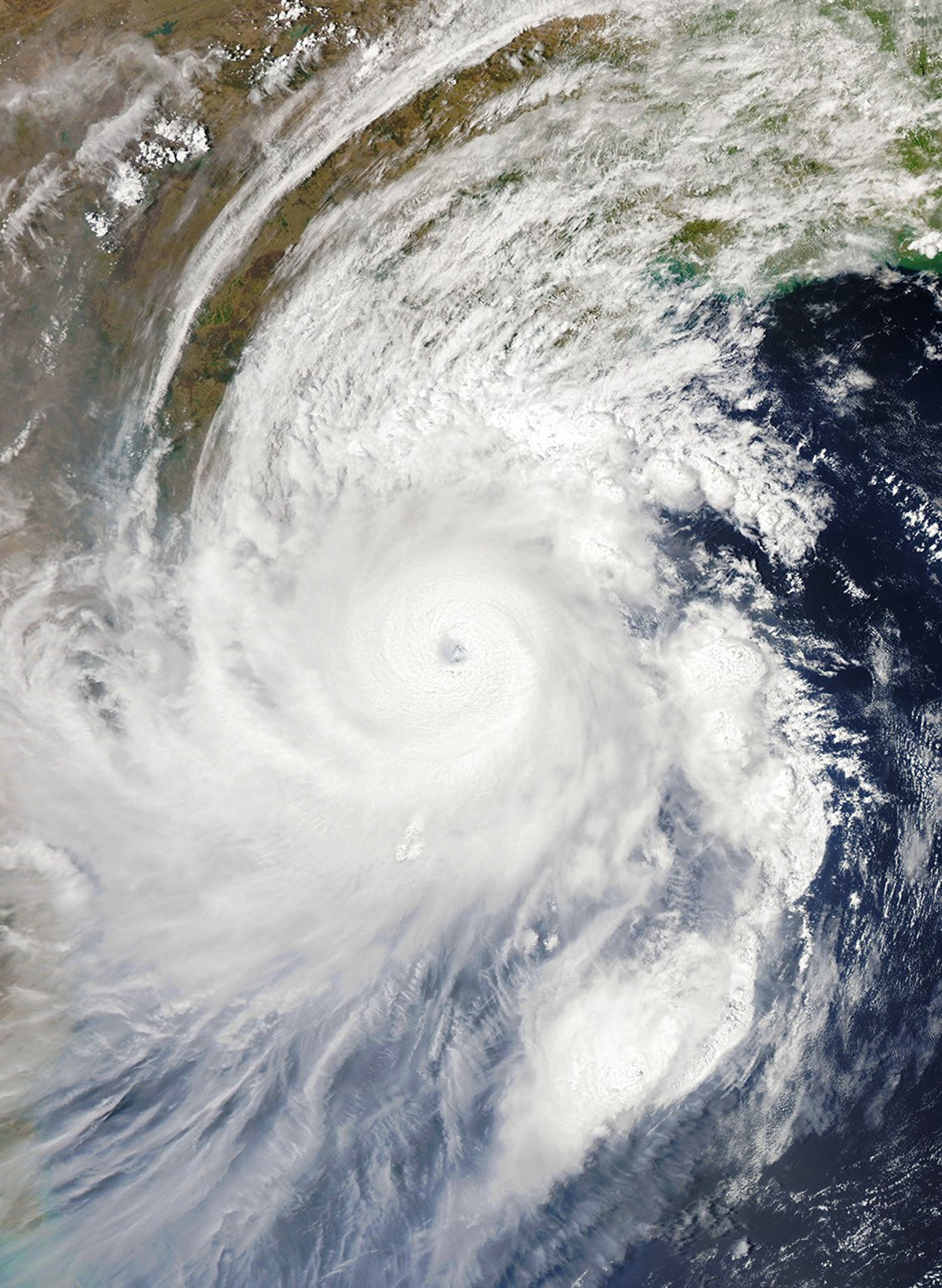
As Tropical Cyclone Fani bore down on the eastern coast of India, the storm gained significant strength over the past 24 hours.
The Moderate Resolution Imaging Spectroradiometer (MODIS) on NASA’s Auqa satellite acquired this natural-color image at 1:02 p.m. India Standard Time (07:32 Universal Time) on May 2, 2019. Around that time, the storm had sustained winds of 135 knots (155 miles/250 kilometers per hour). That’s the equivalent of a category 4 storm on the Saffir-Simpson wind scale.
Over the latter half of May 2, sustained wind speeds decreased just slightly, measuring between 210-220 kilometers per hour, according to the India Meteorological Department (IMD). That’s still a category 4, or “extremely severe” storm as classified by the IMD.
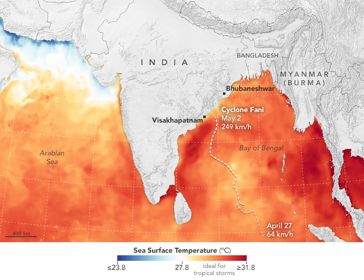
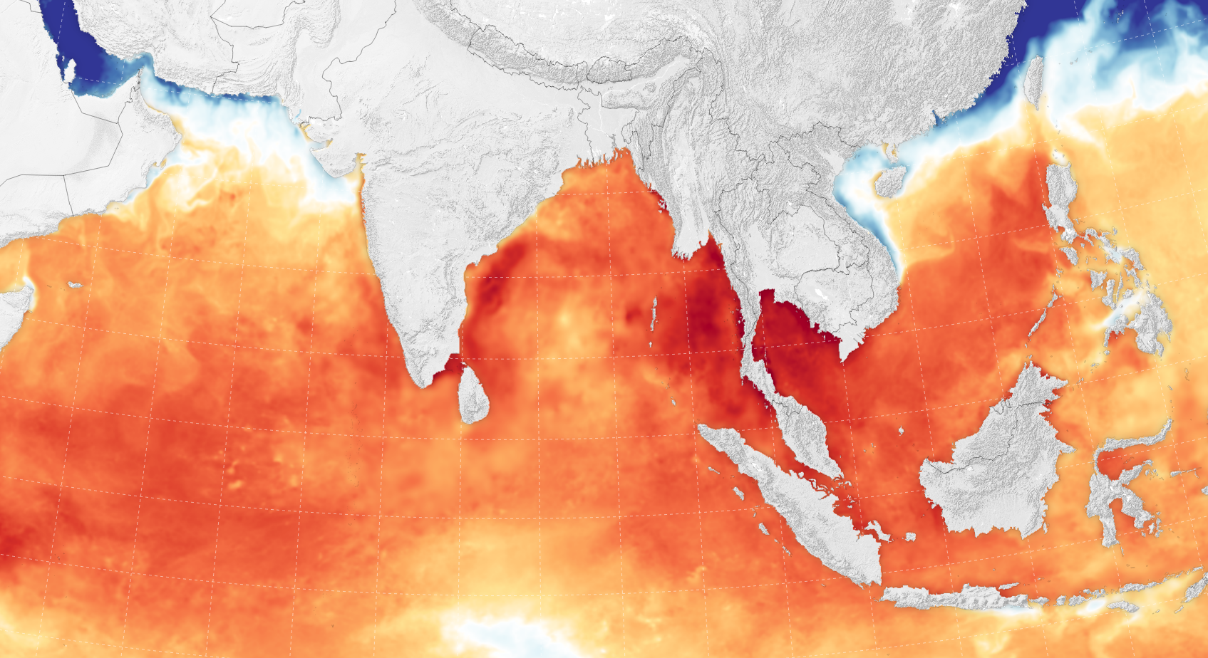
According to the U.S. Joint Typhoon Warning Center, the intensification happened as Fani became more organized and developed a 30-kilometer-wide (18-mile) symmetrical eye. Warm sea surface temperatures (between 30-31 degrees Celsius) along with warm, humid air provided fuel for the storm. (The map above shows sea surface temperatures on May 1, 2019.) Meanwhile, the difference in lower level and upper level wind speeds (or sheer)—which can sometimes rip storms apart—was small enough to allow this storm to build.
Hundreds of thousands of people have been ordered to evacuate ahead of Fani’s landfall. Forecasts call for the storm to move ashore between the towns of Gopalpur and Chandbali in the morning on May 3, 2019. Its path is then likely to move north-northeast toward Bangladesh, with wind intensity weakening as the storm passes over land.
References & Resources
- India Meteorological Department (2019, May 2) Bulletin No. :50. Accessed May 2, 2019.
- New York Times (2019, May 2) Tropical Cyclone 01B (Fani) Warning Nr 019. Accessed May 1, 2019.
- The Washington Post (2019, April 30) Strengthening Cyclone Fani could hit eastern India as âextremely severeâ storm. Accessed May 1, 2019.
- Weather Underground (2019, May 1) Tropical Cyclone Fani. Accessed May 1, 2019.
NASA Earth Observatory images by Joshua Stevens, using MODIS data from NASA EOSDIS/LANCE and GIBS/Worldview, sea surface temperature data from Coral Reef Watch, and storm track information from Weather Underground. Story by Kathryn Hansen.