


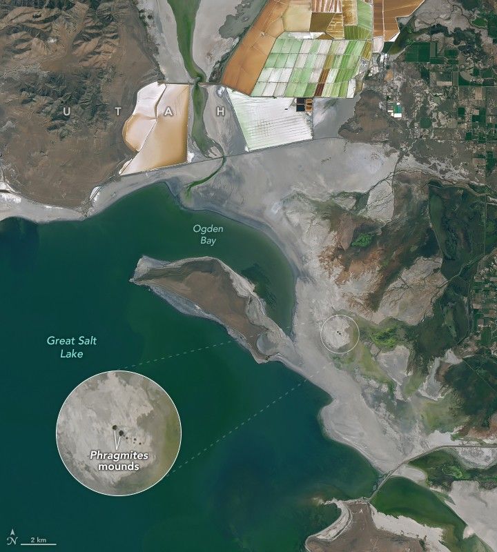

Declining water levels in the Great Salt Lake have revealed something odd in satellite images: dozens of small, circular features along the eastern edge of the drying lakebed in parts of Farmington Bay, Ogden Bay, and Bear River Bay.
University of Utah researchers gained an early clue about these features while traveling by airboat through the lake’s shallow bays years ago. They noticed circular patterns roiling the water surface in certain areas but were not sure why. When water levels dropped and exposed portions of the lakebed, researchers began to find circular features in imagery from Landsat and other satellites and now think they must be related.
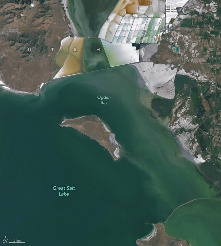
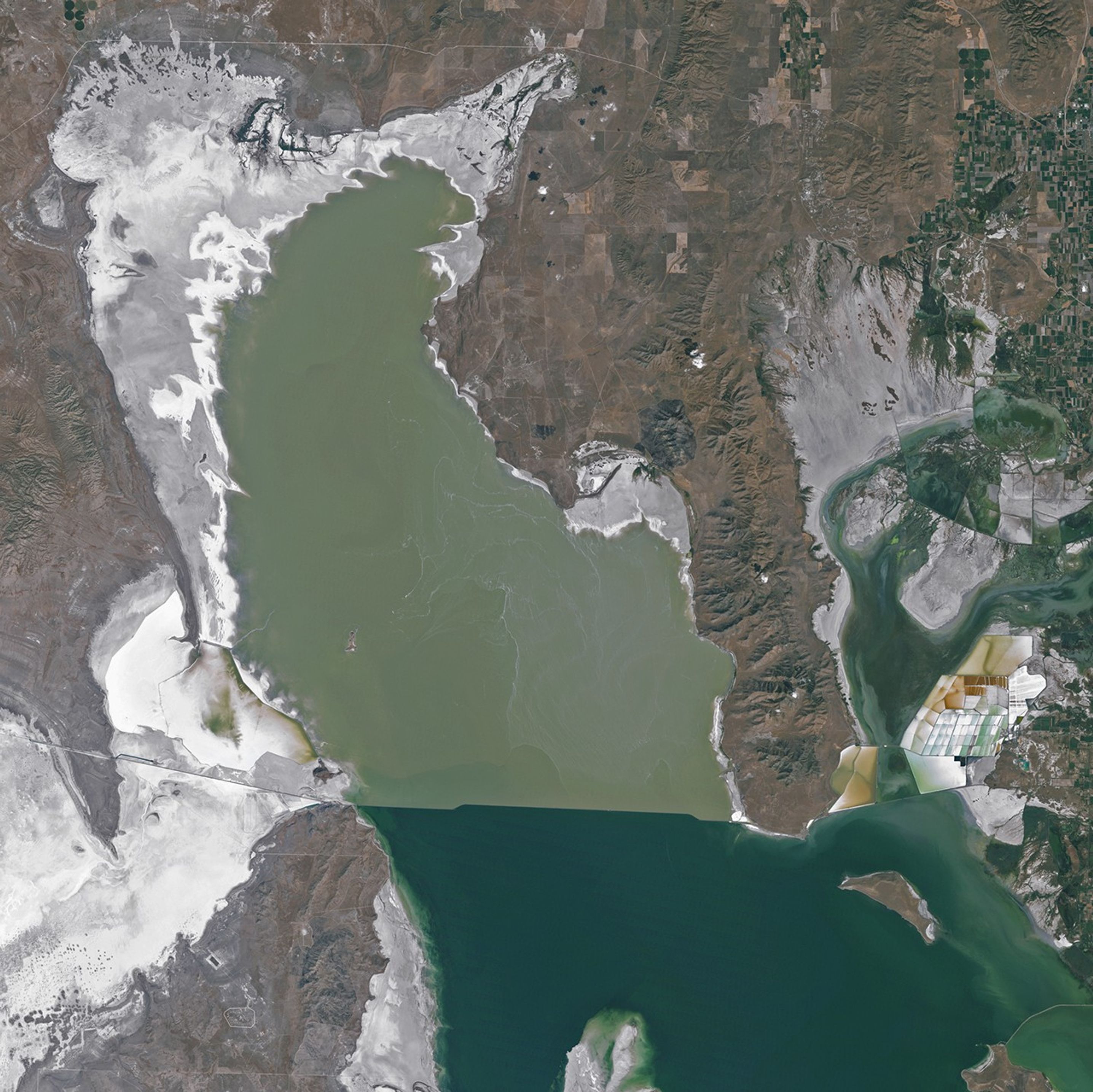
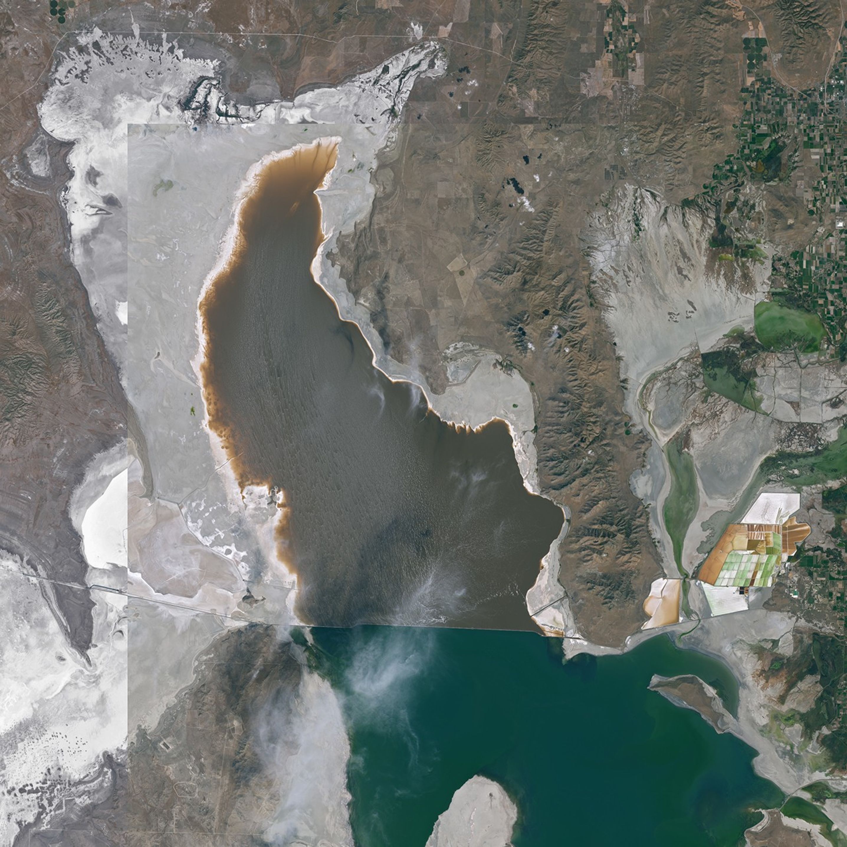
The image above (right) shows a cluster of at least seven of the features in Ogden Bay. The OLI (Operational Land Imager) on Landsat 9 acquired the image on September 13, 2025. The image on the left, from the TM (Thematic Mapper) on Landsat 5, shows the same area on September 15, 2011, when water levels were significantly higher. Higher-resolution sensors have imaged dozens of smaller, similar examples to the southwest and south of this cluster.
Their curiosity piqued, the researchers organized field expeditions to explore several of the features from the ground over the past year. "It took some work to reach certain sites since we wanted to avoid using vehicles or other modern equipment that might damage the playa," said William Johnson, a geologist at the University of Utah.
Instead, they used snow bikes and garden tools to fight through thick patches of reeds to reach the center of the "islands" of vegetation. Once there, they set up piezometers and other monitoring equipment at various depths and distances from the centers of the features to measure the pressure and salinity of the underlying water.
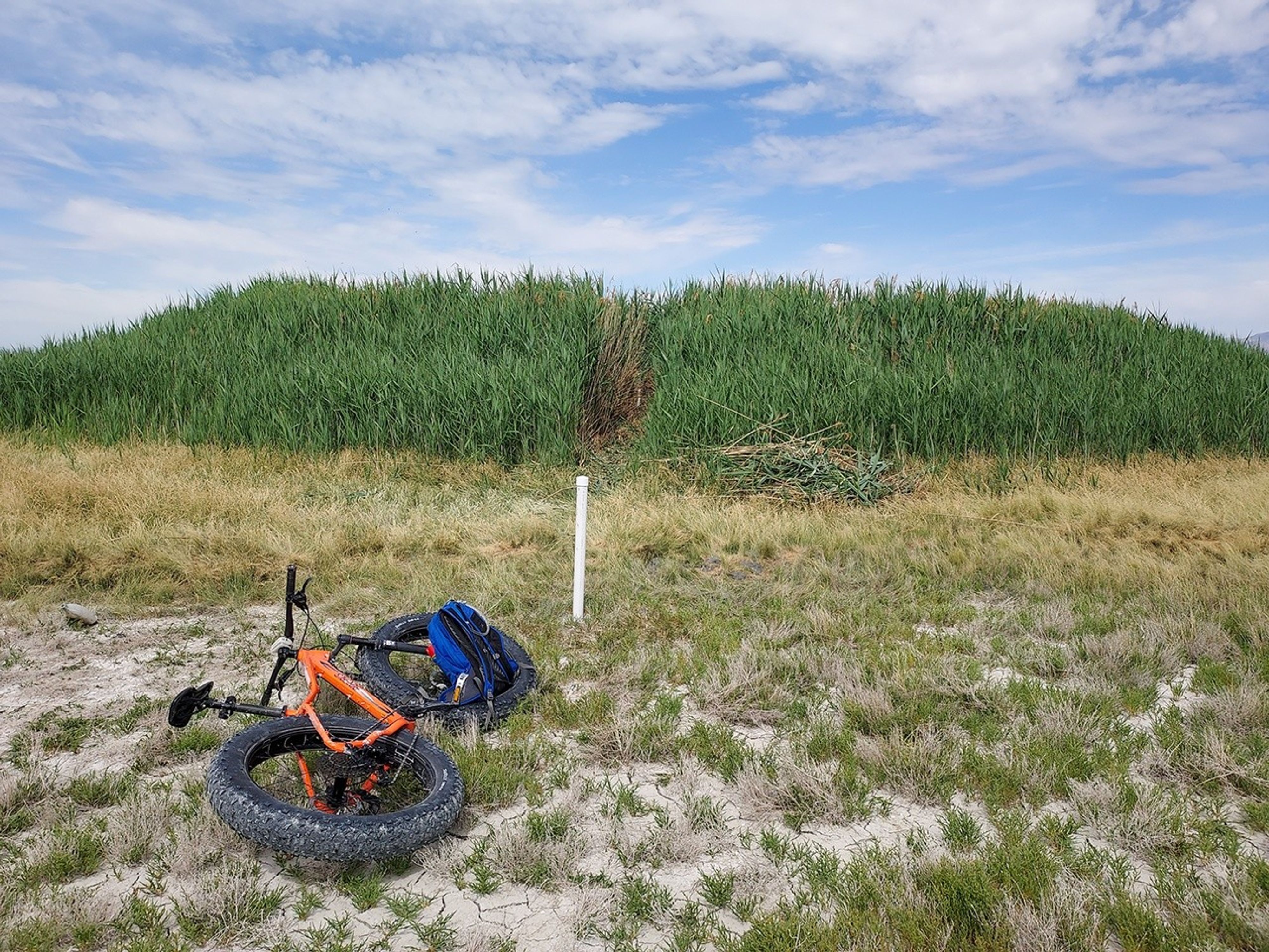
Groundwater proved salty toward the edges but fresher near the centers, encouraging the growth of circular mounds of phragmites. It's these reeds that cause the features to stand out from the surrounding bright playa in satellite images. The photograph above shows an example of one of the mounds in Ogden Bay just southeast of the Landsat image that the researchers call "Round Spot 8.”
After conducting a round of aerial electromagnetic surveys, the researchers think there are probably hundreds of these groundwater-fed oases spread across newly exposed parts of Great Salt Lake’s playa. Johnson described the features as "windows" into an extensive underlying freshwater reservoir that scientists had not realized existed before. Their analysis suggests that discharge from the freshwater springs may account for as much as 12 percent of the lake’s total water budget, much more than the roughly 3 percent that hydrologists assumed prior to the discovery.
The direct inflow of so much freshwater into one of the world’s largest salt lakes came as somewhat of a surprise. But Johnson thinks the freshwater could prove helpful. "This isn't some huge new freshwater resource that we should tap on a large scale, but it might be useful for mitigating dust generation," he said. Dried lakebeds are often major sources of dust because they’re usually rich with fine-grained sediments and have little vegetation to hold it in place. Water on the surface makes it harder for winds to lift dust and fuel dust storms.
Great Salt Lake water levels hit a record low in 2022. The declining water levels have raised concerns about increased exposure to toxic dust particles. However, the trends in dust exposure and health impacts of Great Salt Lake’s dust remain unclear and under study, according to Johnson. Researchers with the Great Salt Lake Strike Team attribute the decline to rising temperatures and consecutive dry years.
NASA Earth Observatory image by Michala Garrison, using Landsat data from the U.S. Geological Survey. Photo courtesy of William Johnson (University of Utah). Story by Adam Voiland.
References & Resources
- Adomako-Mensah, E., et al. (2026) Significance of ancient artesian fresh groundwater below the playa of a hypersaline terminal lake of hemispheric significance. Journal of Hydrology, 668, 134813.
- Great Salt Lake Strike Team (2024, January 10) Great Salt Lake Data and Insights Summary. Accessed January 23, 2026.
- NASA Earth Observatory (2022, August 12) The Great Shrinking Lake. Accessed January 23, 2026.
- Solomon, D. (2025) Evaluating groundwater inflow to Great Salt Lake, USA. Accessed January 23, 2026.
- The University of Utah (2025, July 10) Great Salt Lake’s mystery islands. Accessed January 23, 2026.
- The University of Utah (2022, September 21) Toxic Dust Hot Spots. Accessed January 23, 2026.
- The Wilkes Center (2025, June 30) Modeling Great Salt Lake Dust Exposure. Accessed January 23, 2026.


