


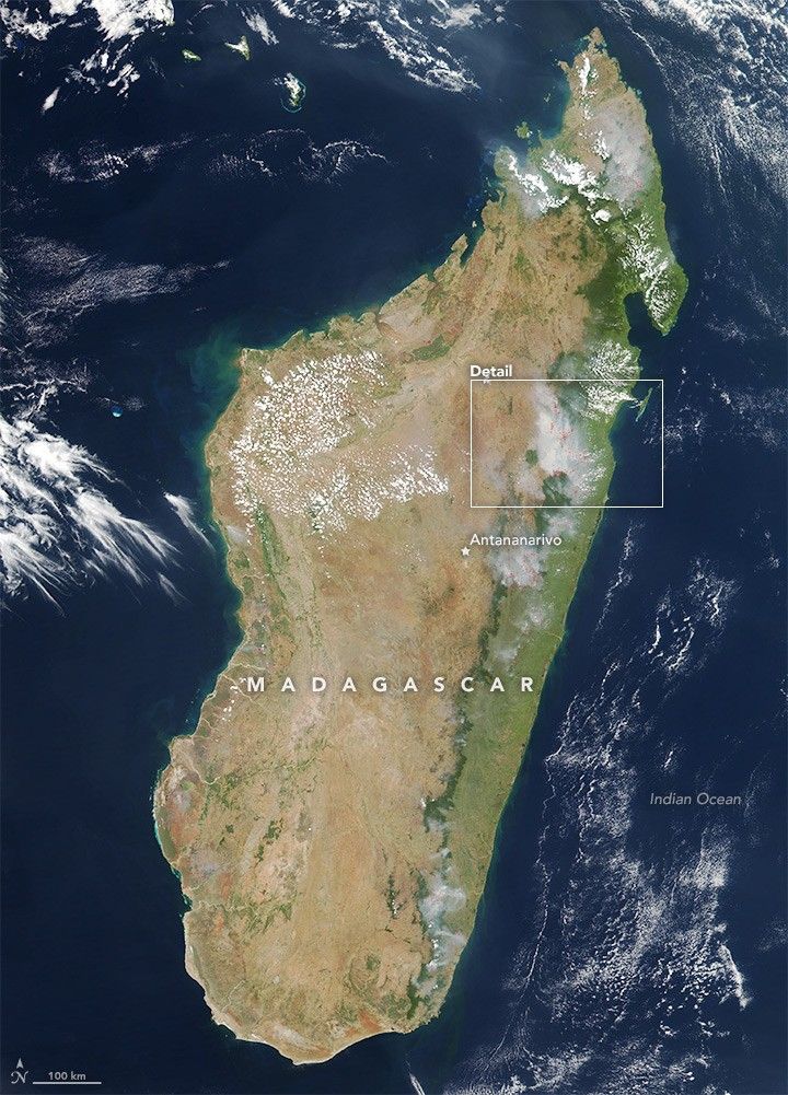

On November 11, 2015, dozens of small fires burned across Madagascar. The Visible Infrared Imaging Radiometer Suite (VIIRS) on Suomi NPP captured a natural-color image of the island at 2:00 p.m. local time (11:00 Universal Time) that day. Red boxes indicate locations where the sensor detected active fires. The lower image shows a more detailed view near Tanambe.
The broad image shows the dramatic change in Madagascar’s landscape from the coast to the highland interior. Light green areas along the coastal plain are a mixture of forest and agricultural land. Dense forests appear deep green. The grassland and savanna ecosystems of the interior high plateau appear in shades of dull green, tan, and reddish-brown.
Most of the fires are scattered across the coastal plain to the east, though there are also numerous fires along the west coast. Several of the smokiest blazes appear at the edges of densely forested areas. Some may be naturally occurring forest fires, but they are more likely intentional land-clearing or accidental human-caused fires.
In a country with nearly 10 million cattle, pasture management is one of the primary uses of fire. Burning grasslands prevents the encroachment of woody plants that are unpalatable to cattle. According to one estimate, about one quarter to one half of the island’s grasslands are burned each year. Fire is also widely used to clear brush or forest for farm fields.
Although agricultural fires are not immediately hazardous, they can have a significant impact on climate, air quality, and plants and animals, particularly when they grow out of control.
References & Resources
- Kull, C. (2012) Fire and people in tropical island grassland landscapes: Fiji and Madagascar. The Journal of Pacific Studies, (32), 121-129.
- NASA Earth Observatory (2008, October 19) Fires in Madagascar.
NASA image courtesy Jeff Schmaltz, LANCE MODIS Rapid Response Team at NASA GSFC, using VIIRS data from the Suomi National Polar-orbiting Partnership (Suomi NPP). Suomi NPP is the result of a partnership between NASA, the National Oceanic and Atmospheric Administration, and the Department of Defense. Caption by Rebecca Lindsey and Adam Voiland.


