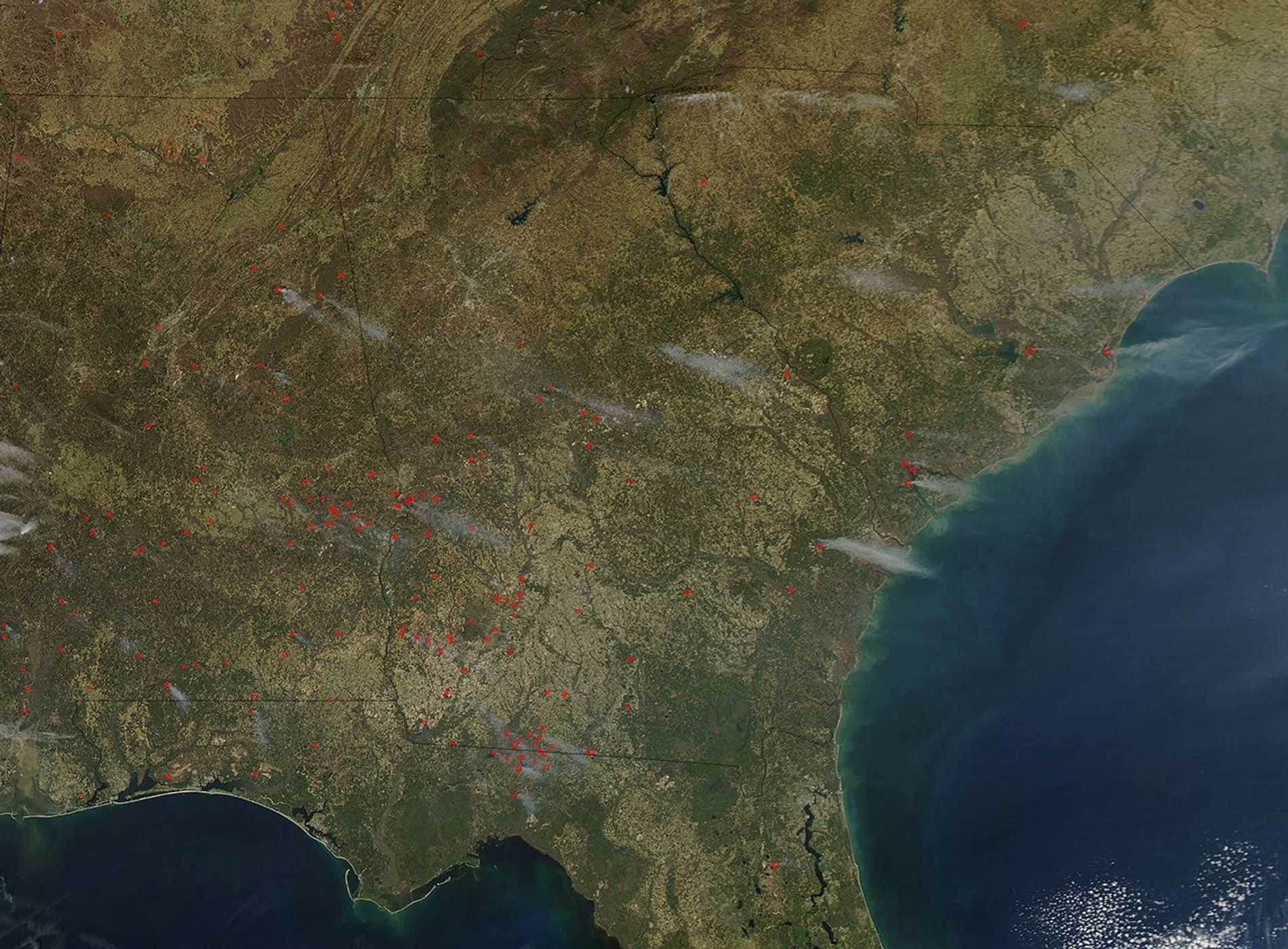
On March 12, 2004, the Moderate Resolution Imaging Spectroradiometer (MODIS) on the Aqua satellite captured this image of dozens of fires burning across the Southeast. Fires, marked with red, are present in every state pictured: (top row to bottom row, left to right) Tennessee, North Carolina, Alabama, Georgia, South Carolina, and Florida.
Most of us don’t think of late winter as fire season in the United States, but according to the Southern Coordination Center for the National Interagency Fire Center, just over 993,000 acres had been affected by fire in the Southern region as of March 23, 2004: 11,936 human-caused fires affected 130,385acres; 18 lightning-caused fire affected 225 acres; and 1,084 prescribed fires (those set by land management agencies for natural resource management purposes) affected 862,772 acres.
The high-resolution image provided above is 500 meters per pixel. The MODIS Rapid Response System provides this image at additional resolutions.
References & Resources
Image courtesy Jeff Schmaltz, MODIS Rapid Response Team, NASA-GSFC