![Request for Information – Potential [Placeholder for Prize]](https://assets.science.nasa.gov/dynamicimage/assets/science/psd/solar/2023/09/s/solarsystem_0.jpg?w=1024)


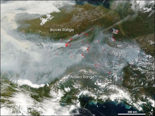
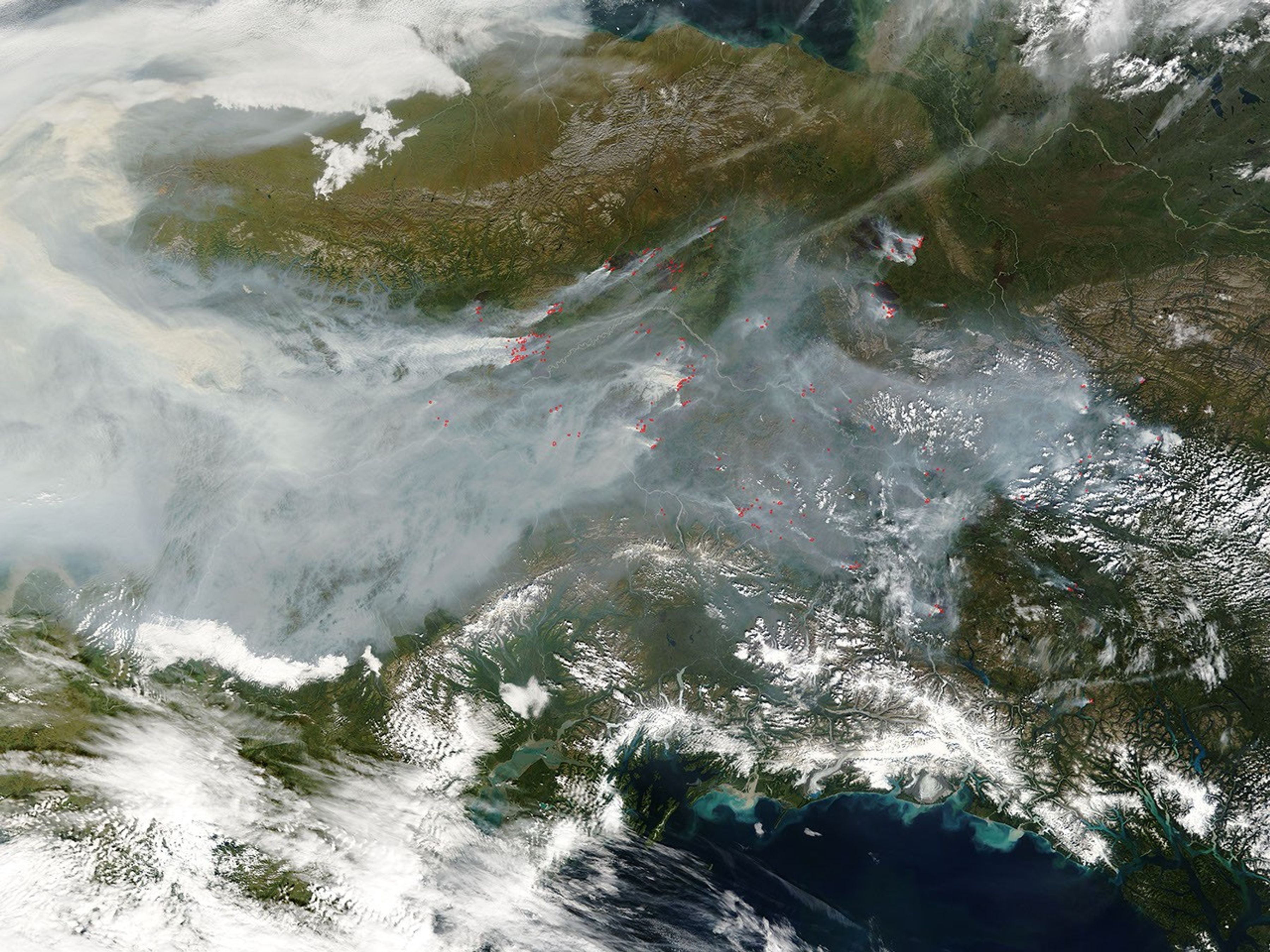
Numerous large wildfires were blazing across central Alaska (western two-thirds of image) and Yukon Territory, Canada (eastern third of image) on August 22, 2004. The image from the Moderate Resolution Imaging Spectroradiometer (MODIS) on NASA’s Terra satellite shows the incredibly thick blanket of smoke flowing like a vast river between the Brooks Range Mountains in the northern part of Alaska and the Alaska Range to the south. Red dots indicate the location of 1-square-kilometer pixels in which MODIS detected actively burning fires. According to reports from the Alaska Interagency Fire Center on August 23, there have been 616 fires this season, which have burned nearly 5.5 million acres.
References & Resources
NASA image courtesy Jacques Descloitres, MODIS Rapid Response Team, NASA-Goddard Space Flight Center