![Request for Information – Potential [Placeholder for Prize]](https://assets.science.nasa.gov/dynamicimage/assets/science/psd/solar/2023/09/s/solarsystem_0.jpg?w=1024)


A series of 23 fires known as the Santa Clara Complex burn in the Diablo Mountain range northeast of San Jose, California. Seen as red squares in this Moderate Resolution Imaging Spectroradiometer (MODIS) image captured by NASA’s Aqua satellite on August 27, 2003, the fires were started when a lightning storm rolled through the region on Monday, August 25. On August 29, the California Department of Forestry and Fire Protection reported that 18,457 acres had burned, threatening 40 homes. The fire was 50 percent contained.
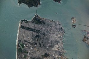
To the west of the fires, the San Francisco Bay is surrounded by cities seen as grey patches. San Jose is the triangular region south of the bay. San Francisco is west of the bay and Oakland is on the east.
References & Resources
Image courtesy Jeff Schmaltz, MODIS Land Rapid Response Team at NASA GSFC