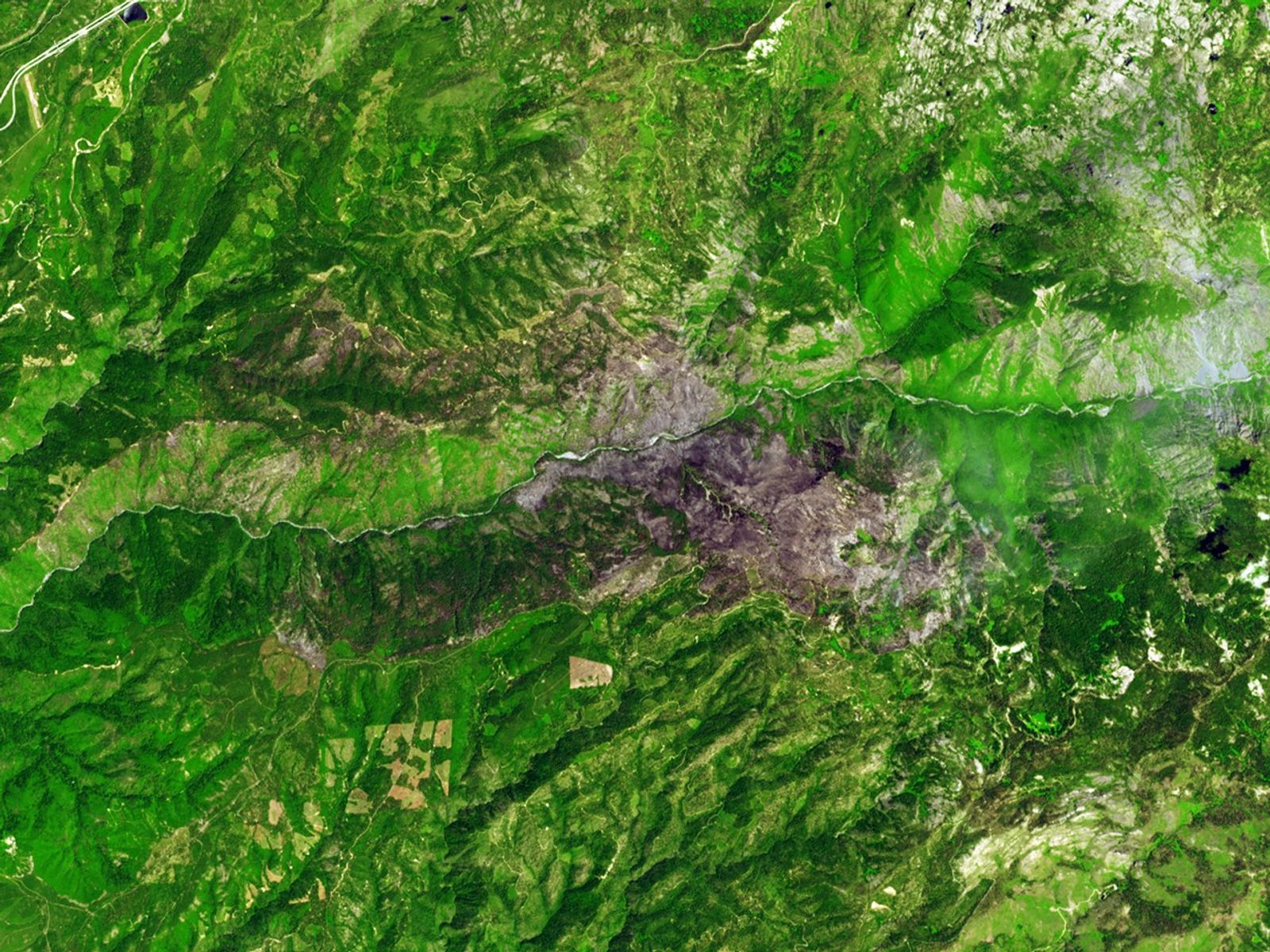


On June 21, 2008, lightning triggered a complex of wildfires in the National Forest northwest of Lake Tahoe. The fires converged and spread north and south of the North Fork of the American River. As of July 15, the fire had grown to more than 18,000 acres and was about 40 percent contained.
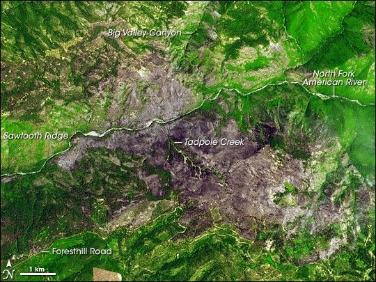
This image from the Advanced Spaceborne Thermal Emission and Reflection Radiometer (ASTER) on NASA’s Terra satellite shows the burned area on July 15, 2008. The false-color image uses infrared and visible light to enhance the appearance of the burned area, which is purple-gray. Unburned vegetation is bright green.
South of the river, the burn appears to have been more complete and more intense, with little green mixed with the purple. Foresthill Road appears to have created a firebreak. North of the river, a large section of hillside between Sawtooth Ridge and Big Valley Canyon appears to have been scorched from the mountaintop all the way to the riverbank. From there, the scorched area traces around the backside of the ridge, to the northwest.
References & Resources
NASA image created by Jesse Allen, using data provided courtesy of NASA/GSFC/METI/ERSDAC/JAROS, and the U.S./Japan ASTER Science Team. Caption by Rebecca Lindsey.