


- Large images
- natural color (116 kb)
- false color (132 kb)
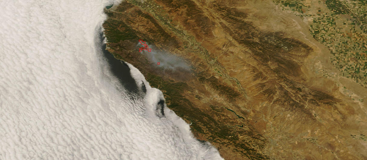
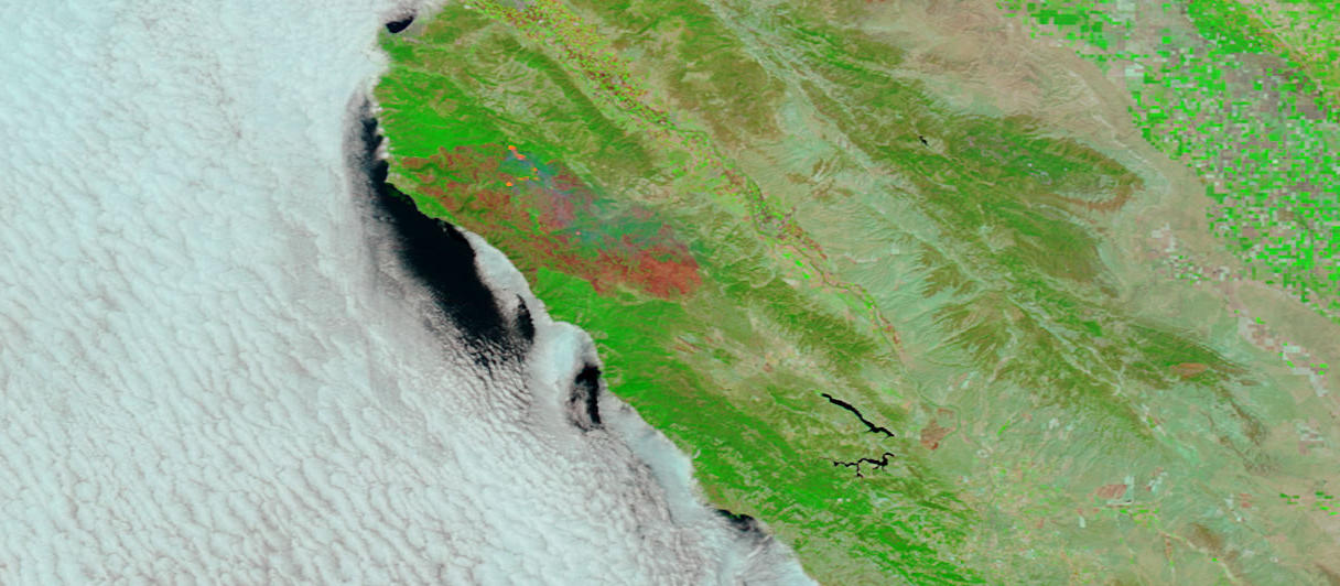
Voluntary evacuations and road closures were in effect for the Basin Complex Fire near Big Sur, California, on July 25, 2008. According to the day’s morning report from the National Interagency Fire Center, the fire (a combination of the Basin Fire and the Indians Fire) grew by 7,307 acres in the previous 24 hours. It was estimated to be 149,924 acres and 79 percent contained. This pair of images from the Moderate Resolution Imaging Spectroradiometer (MODIS) on NASA’s Terra satellite shows the area in photo-like natural-color (top) and infrared-enhanced false-color (bottom) to highlight the burned ground (reddish brown). The bright pink spots in the false-color image indicate areas with very hot temperatures. In this type of image (made with visible, shortwave, and near-infrared light), the “glow” is often a sign of open flame.
The high-resolution image provided above is at MODIS’ maximum spatial resolution (level of detail) of 250 meters per pixel. The MODIS Rapid Response Team provides twice-daily images of the region in additional resolutions.
References & Resources
NASA image courtesy the MODIS Rapid Response Team. Caption by Rebecca Lindsey.


