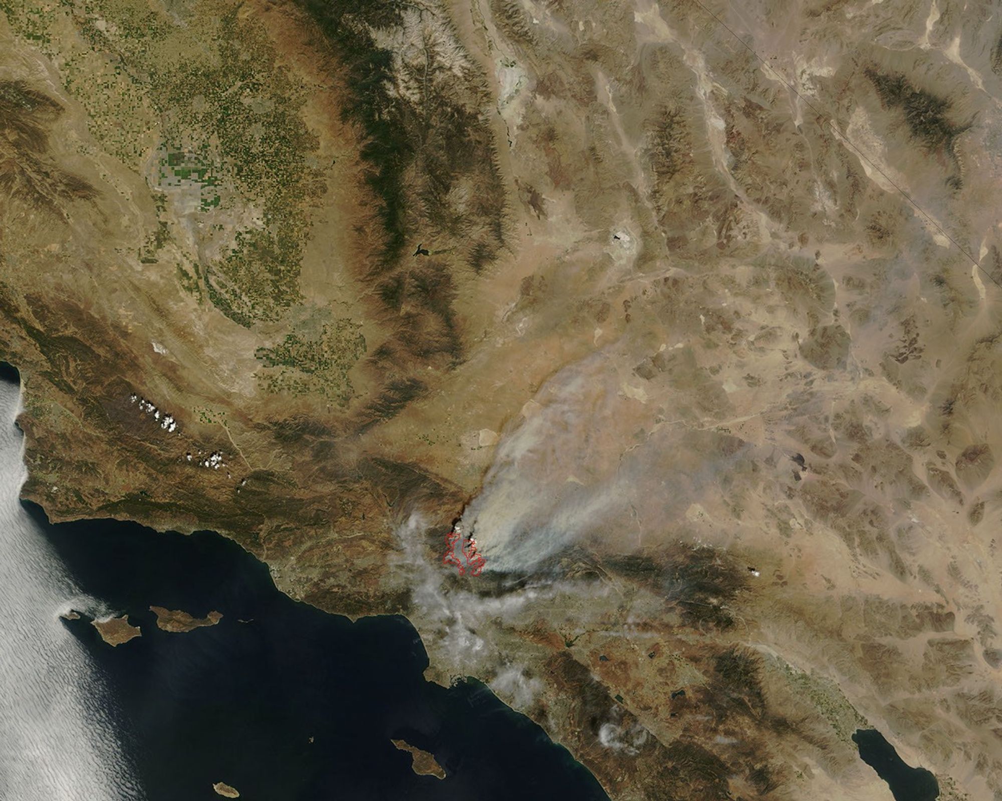


On the night of August 30-31, 2009, the Station Fire north of the city of Los Angeles spread in three directions and doubled in size, according to the Los Angeles Times. Two fire fighters had been killed and at least at least 18 homes in Tujunga Canyon had burned as of the morning of August 31. According to the Incident Information System, the Station Fire covered 85,760 acres as of the morning of August 31, 2009.
The Moderate Resolution Imaging Spectroradiometer (MODIS) on NASA’s Terra satellite captured this true-color image around 11:45 a.m. local time (18:45 UTC) on August 30, 2009. Red outlines indicate hotspots of anomalously high surface temperatures associated with wildfires. In this image, the hotspots remain west of Mt. Wilson. The site of critical communication centers, Mt. Wilson had not burned but was threatened by the fire as of August 31, according to the Los Angeles Times. Smoke from the fire blows toward the northeast in this image. Clouds, perhaps mixed with some smoke, linger over Los Angeles.
References & Resources
- Staff. (2009, August 31). L.A.County fire doubles in size; more homes destroyed; Mt. Wilson threatened. Los Angeles Times. Accessed August 31, 2009.
NASA image by Jeff Schmaltz, MODIS Rapid Response Team, Goddard Space Flight Center. The Rapid Response Team provides daily images of this area. Caption by Michon Scott.