July 29, 2003
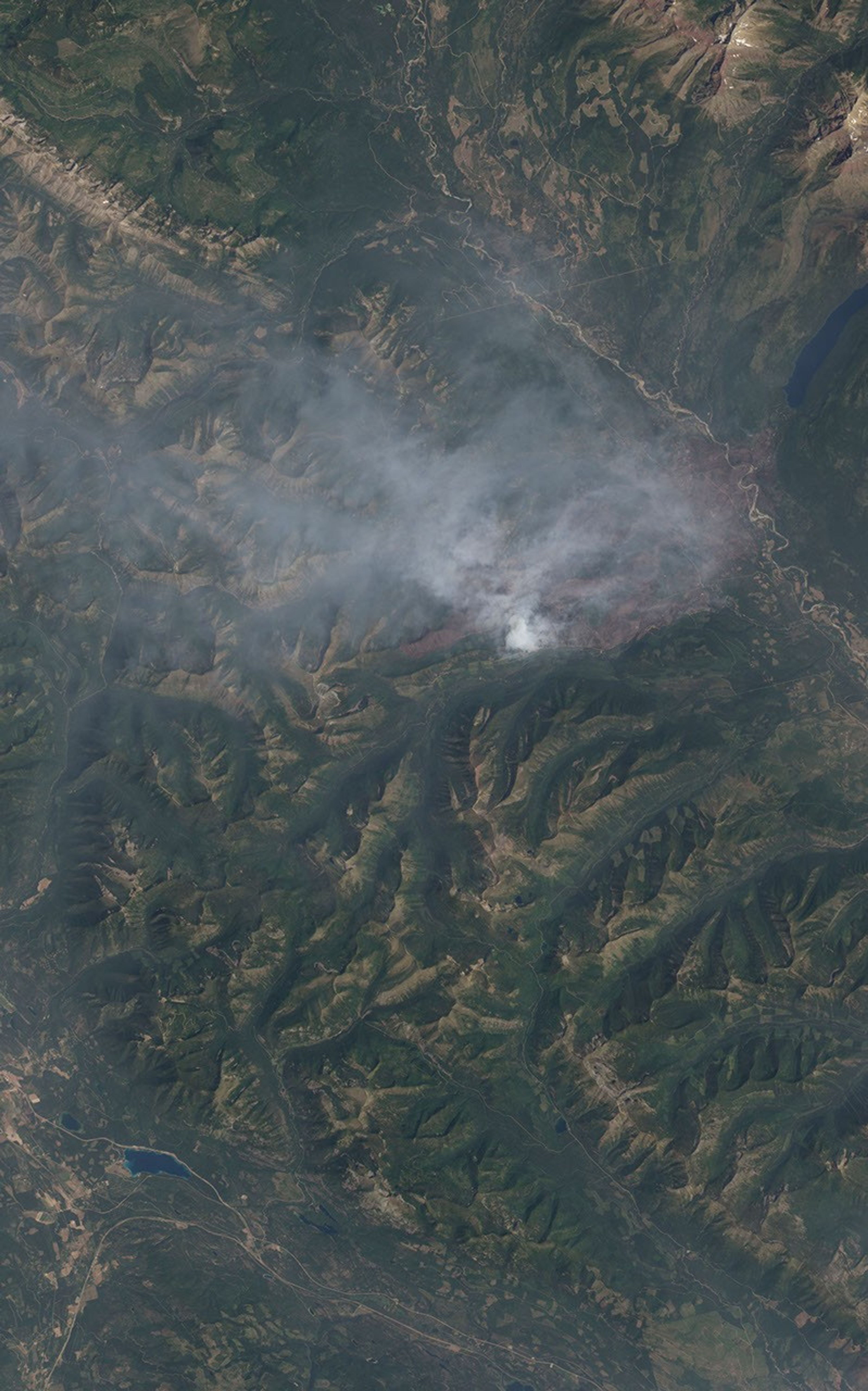
Through a shroud of smoke, the scorched, brown landscape left by the Wedge Canyon Fire in northwest Montana is visible in this image from the Advanced Land Imager sensor on the Earth Observing 1 satellite. The brown scar stretches over the tan ribbon of the Flathead River, which runs diagonally from top center to right center edge. At the time this image was acquired on July 29, 2003, the southwest perimeter of the fire appears most active, with a thick cloud of smoke rising from the fire. The Wedge Canyon Fire is one of three large fires burning in the mountainous terrain of northwestern Montana near Glacier National Park.
References & Resources
Image courtesy Lawrence Ong, EO-1 Mission Science Office and the EO-1 Team at GSFC/NASA and EDC/USGS