![Request for Information – Potential [Placeholder for Prize]](https://assets.science.nasa.gov/dynamicimage/assets/science/missions/a-step/FFR_Earth_Background_20251120%20.png?w=1024)


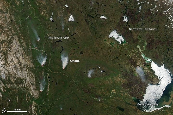
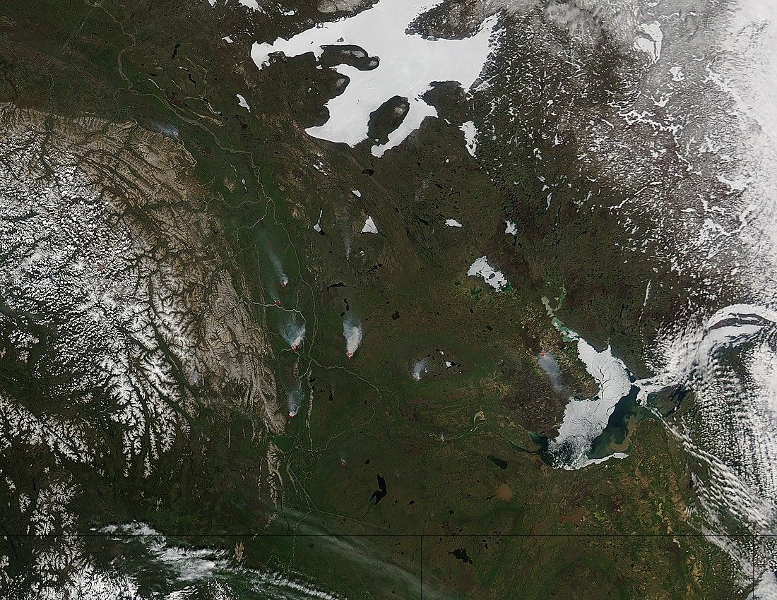
On May 28, 2015, the Moderate Resolution Imaging Spectroradiometer (MODIS) on NASA’s Aqua satellite acquired this image of smoke from fires in Canada’s Northwest Territories. Red outlines indicate hot spots where MODIS detected unusually warm surface temperatures associated with fire.
Due to a dry spring, forecasts suggested that the territory would see above-average fire danger in May and June. The May 29 wildfire situation report, issued by the Northwest Territories Department of Environment and Natural Resources, noted that there have been 46 total fires so far in 2015 affecting 406 square kilometers (157 square miles). Two of the three most recent fires prior to the report were caused by people: one from an abandoned campfire and another from grass burning. The third was caused by lightning. According to news reports, the summer season in the Northwest Territories was expected to see a return to more normal fire conditions.
Meanwhile, fires burning in Alberta, Canada, (south of this image) displaced thousands of residents and led some energy companies to suspend oil operations. CBC News reported that as of May 28, the Wabasca wildfire was under control, but dry conditions in that province remained a concern. Lighting was responsible for almost half of the 44 fires burning on May 28 across the province.
References & Resources
- CBC News (2015, May 28) Wabasca wildfire under control, Alberta fire outlook remains grim. Accessed May 29, 2015
- CBC News (2015, May 1) N.W.T. fire season forecast to start early, burn hot in May and June. Accessed May 29, 2015
- The Guardian (via Reuters) (2015, May 26) Alberta wildfires prompt oil firms to suspend production and evacuate staff. Accessed May 29, 2015
- NWT Environment and Natural Resources (2015, May 28) NWT Current Wildfire Situation Report. Accessed May 29, 2015
NASA image by Jeff Schmaltz, LANCE/EOSDIS Rapid Response. Caption by Kathryn Hansen.