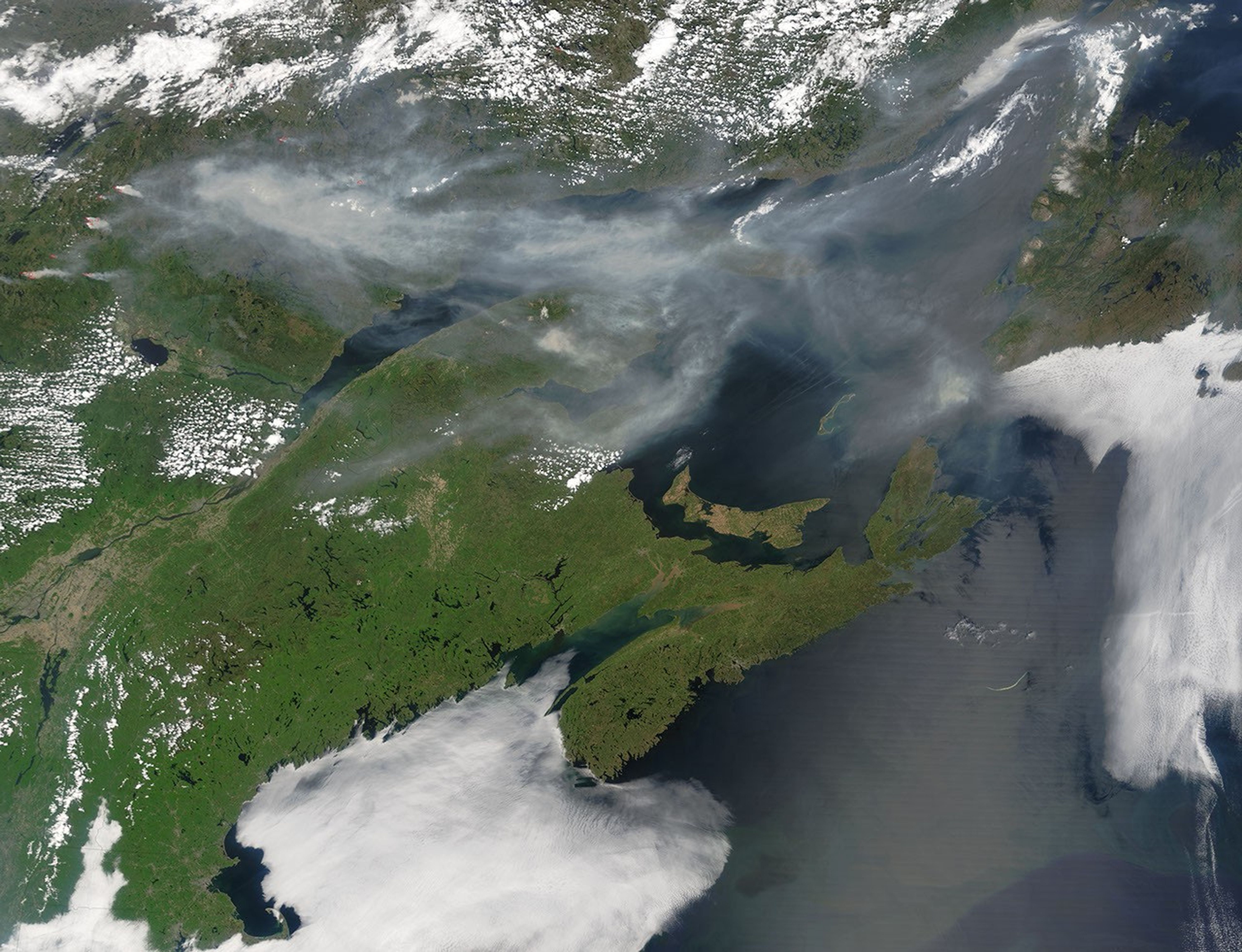
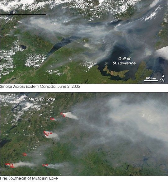
Smoke continued to pour from fires in the Quebec province of Canada on June 2, 2005. Scores of fires have been burning in the area since the end of May. According to reports from the Canadian Interagency Forest Fire Center, at least 20 of the 83 fires burning as of June 2 were out of control. Nearly all the fires were started by lightning.
In this image (top) from the Moderate Resolution Imaging Spectroradiometer (MODIS) on NASAâs Terra satellite from June 2, thick smoke streams eastward across Quebec and out over the Gulf of St. Lawrence toward the island of Newfoundland (far right edge). The lower image shows a close-up view of the fires (areas where MODIS detected active fire are outlined in red) to the southeast of Mistassini Lake. Other large fires are burning farther to the west, outside of the scene shown here. Those fires were likely adding to the smoke pictured in this image.
References & Resources
Image courtesy Jeff Schmaltz, MODIS Rapid Response Team, NASA-GSFC