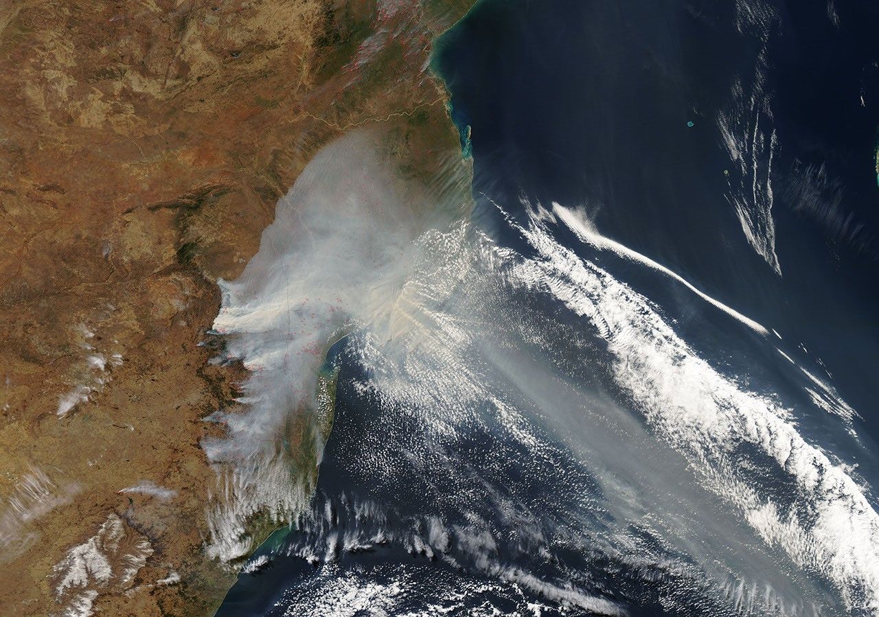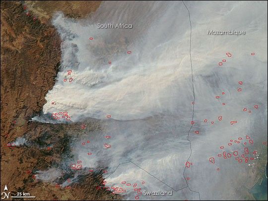
Intense fires raged in South Africa on July 28, 2007, when the Moderate Resolution Imaging Spectroradiometer (MODIS) flying on NASA’s Aqua satellite captured this image. Actively burning fire fronts are outlined in red, though it is likely that MODIS could not detect flames beneath the thick wall of smoke that rose from the fires, so only a portion of the fires are marked here. The smoke completely obscures the ground for hundreds of kilometers across northeastern South Africa, southern Mozambique, and the Indian Ocean (visible in the large image). The most intense fires were burning in the forest and grasslands of the Drakensberg Mountains in South Africa’s Mapumalanga Province. Additional fires were also burning in the Kwazulu Natal Province and Swaziland to the south and in Mozambique to the east. According to the South African Broadcasting Corporation News, six firefighters died in the Mapumalanga fires.
The large image provided above is at MODIS’ maximum resolution of 250 meters per pixel. The image is available in additional resolutions from the MODIS Rapid Response System.
References & Resources
Image courtesy Jeff Schmaltz, MODIS Land Rapid Response Team at NASA GSFC