


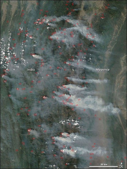
In the hilly terrain of northeastern India and northwestern Myanmar, people practice slash-and-burn cultivation in the region’s tropical forests. The activity has created a mosaic of cleared fields and open-canopy forests in various stages of regrowth. This image of the area was captured by the Moderate Resolution Imaging Spectroradiometer (MODIS) on NASA’s Aqua satellite on March 10, 2006, during the burning season, which takes places mostly in February and March. Areas outlined in red show where the MODIS sensor detected actively burning fires. Thick smoke hangs over the scene, as well.
This image in only part of a much wider-scale image that shows agricultural fires of various kinds burning across a large swath of Southeast Asia. The high-resolution image provided above has a spatial resolution of 250 meters per pixel. The MODIS Rapid Response System provides this image at additional resolutions.
References & Resources
NASA image by Jeff Schmaltz, MODIS Rapid Response Team, Goddard Space Flight Center.


