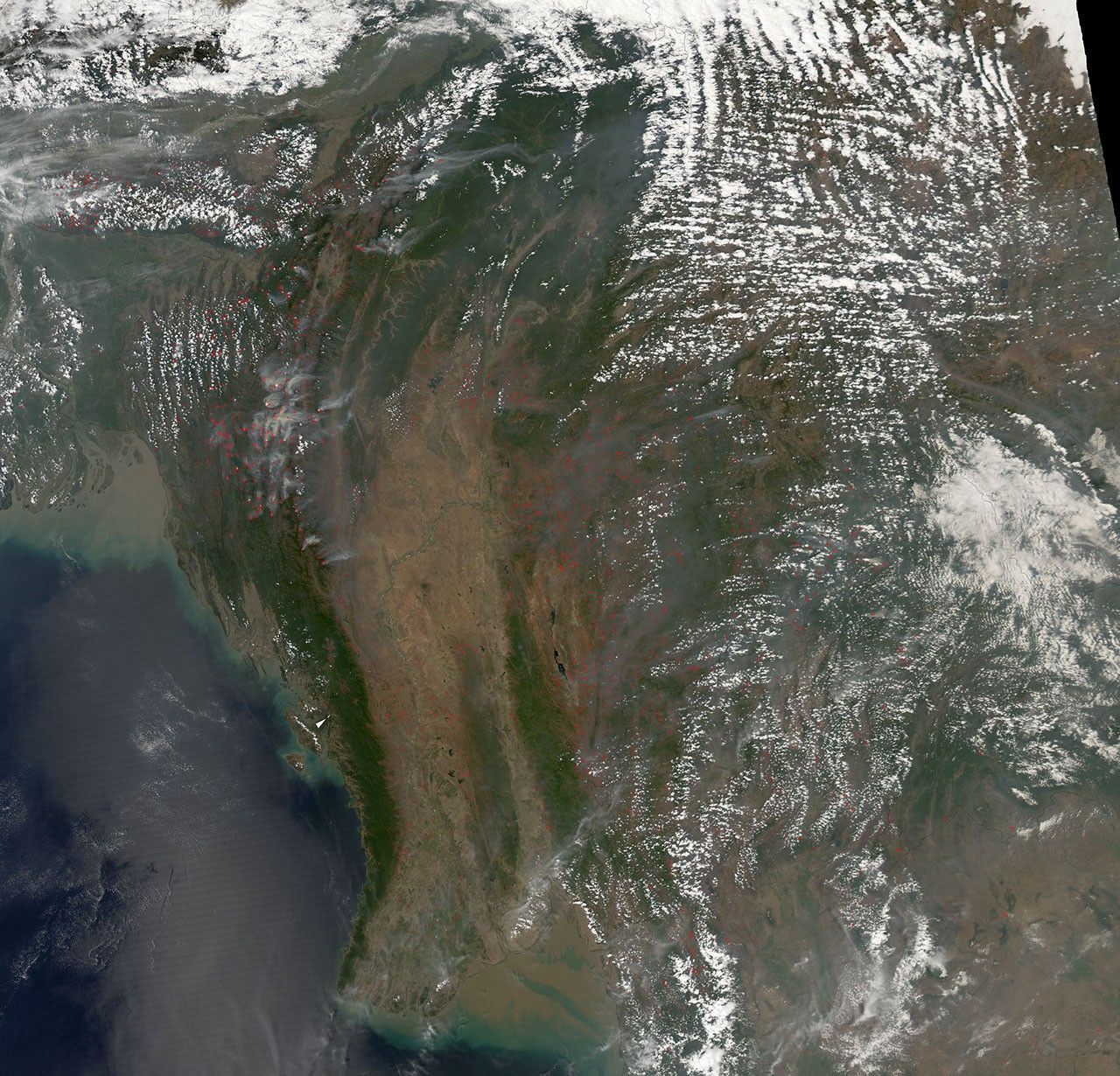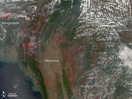
March 14, 2006
Smoke from hundreds of fires mingles with clouds over Southeast Asia on March 14, 2006. Late winter is the peak time for agricultural burning in the area. This image of the area captured by the Moderate Resolution Imaging Spectroradiometer (MODIS) on NASA’s Aqua satellite shows fires (locations marked in red) across northeastern India, Myanmar, Thailand, China, and Laos. Although these fires are not necessarily immediately hazardous, such widespread burning can have a strong influence on air quality and human health, natural resources, and climate.
References & Resources
NASA image created by Jesse Allen, Earth Observatory, using data provided courtesy of the MODIS Rapid Response team.