


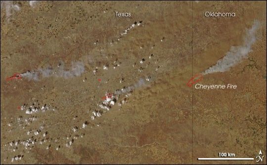
In the northern panhandle of Texas, late winter and early spring of 2006 have brought numerous wildfires. On April 6, high winds drove the spread of several large wildfires across the region, including the Cheyenne Fire at the border of Texas and Oklahoma. This image shows the area on the afternoon of April 6 (2:40 p.m. U.S. Central Time), when NASA’s Aqua satellite passed overhead. The image is from the Moderate Resolution Imaging Spectroradiometer (MODIS), and places where the sensor detected actively burning fire are outlined in red. Smoke (grayish-white) and dust (tan) are blowing sharply eastward in the image, indicating the strength and direction of the wind.
The high-resolution image provided above has a spatial resolution of 250 meters per pixel. The MODIS Rapid Response System provides this image at additional resolutions.
References & Resources
NASA image courtesy the MODIS Rapid Response Team, Goddard Space Flight Center


