March 6, 2017
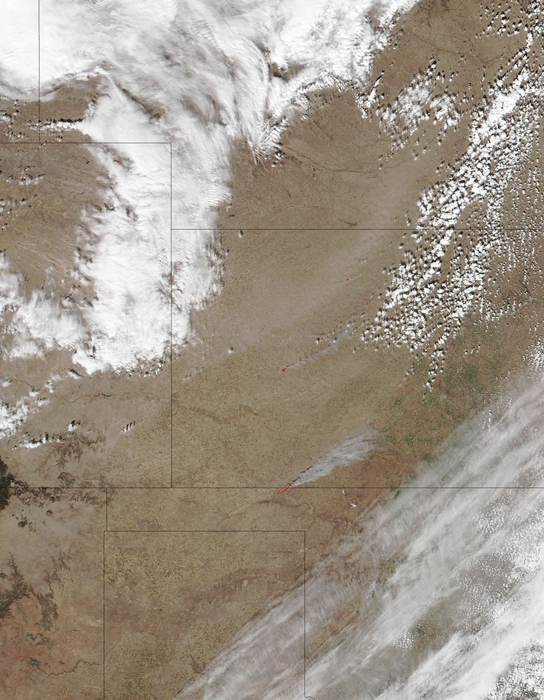
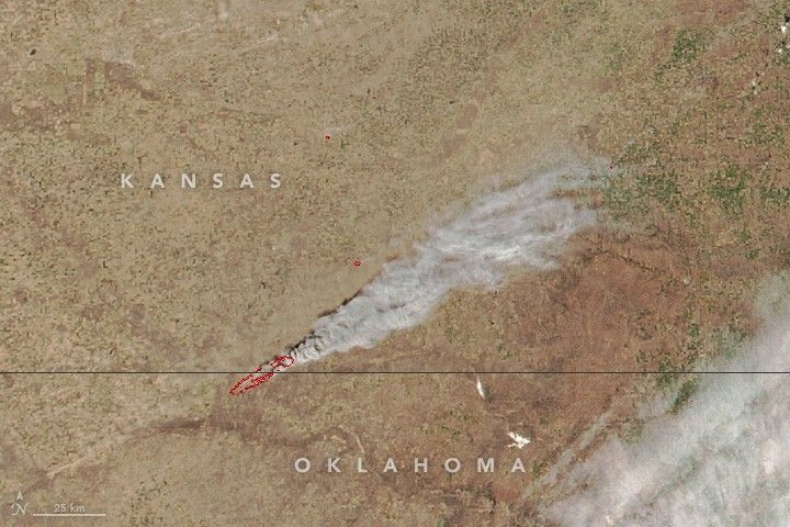
Strong winds have fueled fast-moving fires in the Great Plains.
The Visible Infrared Imaging Radiometer Suite (VIIRS) on the Suomi NPP satellite captured this natural-color image of fires raging along the border of Kansas and Oklahoma at 1:24 p.m. local time (19:24 Universal Time) on March 6, 2017.
The red outlines are areas where the satellite detected heat signatures indicative of active burning. The fires have forced thousands of people to evacuate their homes and damaged more than two dozen structures, according to news reports.
References & Resources
- The Wichita Eagle (2017, March 7) Update 12:30 p.m.: Fires burning across Kansas unprecedented, official says. Accessed March 7, 2017.
- Wildfire Today (2017, March 7) Fires in Kansas, Oklahoma, and Texas burn hundreds of thousands of acres. Accessed March 7, 2017.
NASA image by Jeff Schmaltz, LANCE/EOSDIS Rapid Response . Caption by Adam Voiland.