

















Suggested Searches

1 min read

Fires in the Southwest

Instruments:
Topics:
2005-07-11 00:00:00
July 11, 2005

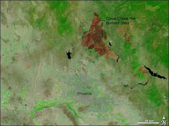
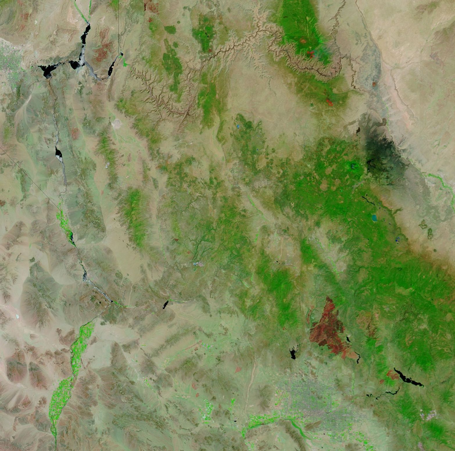
In the mountains north of Phoenix, Arizona, the Cave Creek Fire has been contained at 248,310 acres at a cost of $18.3 million. In this infrared-enhanced image from the Moderate Resolution Imaging Spectroradiometer (MODIS) on NASA’s Terra satellite from July 11, 2005, the deep red burn scar sprawls across the green vegetation of the Tonto National Forest. The burned area appears to cover almost as much area as the city of Phoenix, near the bottom center of the image.

References & Resources

NASA image courtesy the MODIS Rapid Response Team, GSFC
You may also be interested in:

Stay up-to-date with the latest content from NASA as we explore the universe and discover more about our home planet.

Cottonwood Fire Chars Utah
5 min read

The blaze burned more than 150 square miles and swept through parts of a ski resort.

Article
Fires Tear Through Nebraska Grasslands
3 min read

Dry, warm, and windy conditions across the U.S. Great Plains led to extreme fire activity in March 2026.

Article
Smoke Streams Across Eastern Washington
3 min read

Wildland fires in early August 2026 pushed air quality to unhealthy levels, destroyed hundreds of structures, and triggered mandatory evacuations…

Article