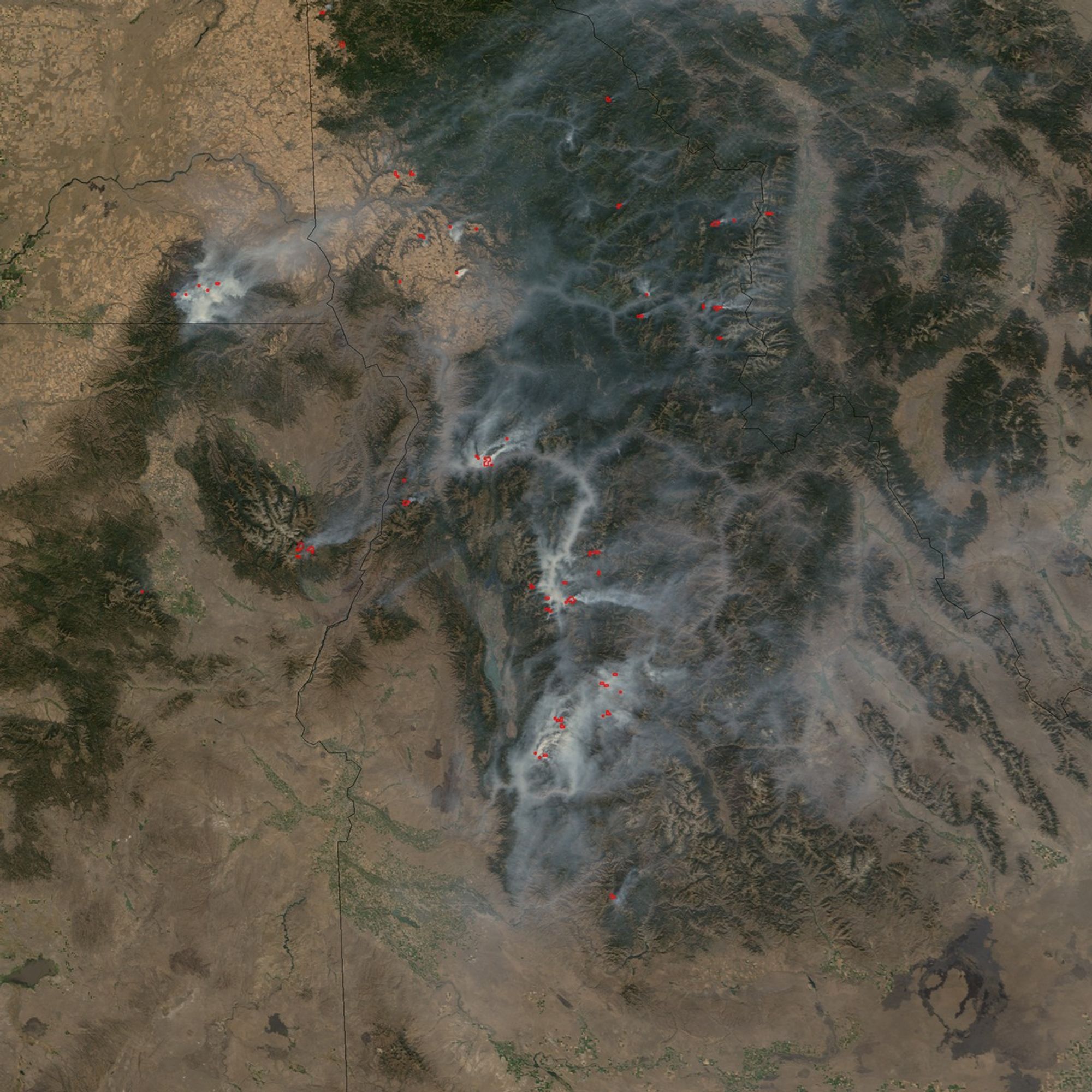

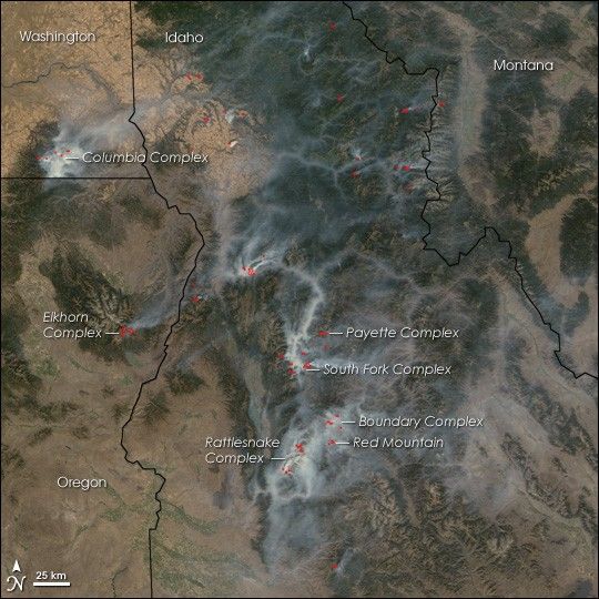
Thick, white smoke seeps through the valleys of the Rocky Mountains ranges that run through Idaho, Washington, and Oregon in this photo-like image taken on September 12, 2006. At the time, firefighters were monitoring 29 wild fires in the three states, said the National Interagency Fire Center. Many of the fires were started by lightning, as suggested by the clusters of fires (red dots) seen in this image. The image was taken in the early afternoon by the Moderate Resolution Imaging Spectroradiometer (MODIS) on NASA’s Terra satellite. Most of the fires are burning in the deep-green, pine-covered mountains. Sage, scrub, and grass-covered desert is tan, while agricultural land creates a pattern of tiny, bright green and gold dots.
Between January 1 and September 12, 2006, a total of 8,653,883 acres of land had burned in the United States, exceeding the totals for the same period of any other year since 2000. Many of the fires that burned in remote areas were simply monitored as part of a long-term land-management strategy, but those that threatened structures were actively combated. Some of the large fires shown here include the Columbia Complex, which had burned 103,100 acres and was 80 percent contained on September 12; the Elkhorn Complex, which had burned 870 acres and was 15 percent contained; the Payette Complex, which had burned 10,729 acres; the South Fork Complex, 41,600 acres and 20 percent contained; the Boundary Complex, 22,785 acres and 5 percent contained; the Red Mountain Fire, 32,825 acres and 30 percent contained; and the Rattlesnake Complex, 37,421 acres and 30 percent contained.
Several other large fires burned in the western United States on September 12. The Derby Fire in western Montana (just beyond the right edge of the image) had threatened homes and forced hundred of evacuations in early September. By September 12, it had burned 207,644 acres and was 70 percent contained, said the National Interagency Fire Center. The Day Fire was burning in Los Padres National Forest about 40 miles north of Los Angeles, California. Its thick smoke temporarily closed Interstate 5 on September 12.
References & Resources
NASA image created by Jesse Allen, Earth Observatory, using data provided courtesy of the MODIS Rapid Response team.