![Request for Information – Potential [Placeholder for Prize]](https://assets.science.nasa.gov/dynamicimage/assets/science/missions/a-step/FFR_Earth_Background_20251120%20.png?w=1024)


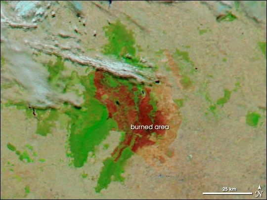
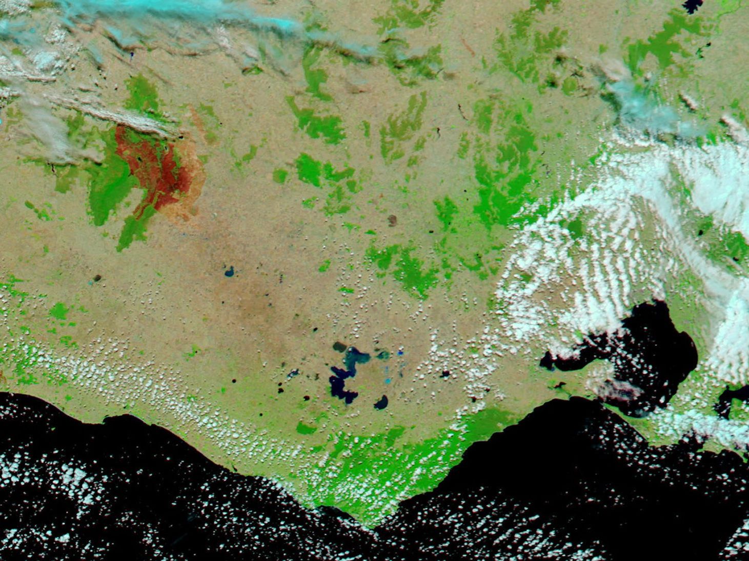
On January 30, 2006, the smoke died down and the clouds cleared over Grampians National Park in western Victoria, Australia. The Moderate Resolution Imaging Spectroradiometer (MODIS) on NASA’s Aqua satellite captured this image revealing the large area burned by a wildfire in previous weeks. Using a combination of visible light and shortwave and near-infrared energy detected by the sensor, this image shows the burned area in bright red and unburned vegetation in bright green. Areas where vegetation is naturally sparse are light tan, sometimes tinged with green or pink. According to reports from the state government’s Department of Sustainability and the Environment, the fire had scorched about 130,000 hectares (1,300 square kilometers, or about 321,237 acres) as of January 30.
This image shows the area at MODIS’ maximum spatial resolution of 250 meters per pixel. The large image shows a wider area of the state. The MODIS Rapid Response Team provides daily images of this area in a variety of formats.
References & Resources
NASA image courtesy the MODIS Rapid Response Team, Goddard Space Flight Center