Monsoon rains are a regular occurrence in parts of Pakistan, but the monsoon rains that arrived in the summer of 2010 were anything but normal. La Niña conditions increased atmospheric moisture, and an unusual pattern in the jet stream trapped rainy weather over the country. According to the Pakistan Meteorological Department, nationwide rain totals were 70 percent above normal in July, and 102 percent above normal in August.
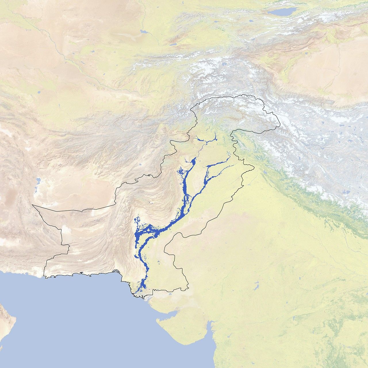
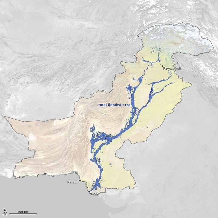
Due to the unusual weather, flood waters overran many parts of Pakistan. Flood waters covered at least 37,280 square kilometers (14,390 square miles) of the country at some time or another between July 28 and September 16, 2010. (Not all areas were inundated at the same time or for the whole time.) This map—made from data assembled by the United Nations Operational Satellite Applications Program—shows the sum of all flooded areas in blue. The country border used in this image indicates areas administered by Pakistan.
A new Earth Observatory feature—Heavy Rains and Dry Lands Don’t Mix: Reflections on the 2010 Pakistan Flood—chronicles the disastrous flow of water in 2010. Here is an excerpt.
Rivers rose rapidly, and the Indus and its tributaries in the northern part of the country soon pushed over their banks. As the surge of water moved south, it swelled the Indus in Pakistan’s central and southern provinces. Then the problems started compounding. In Sindh, a dam failure sent the river streaming down an alternative channel west of the valley. The resulting floodwater lake—which merged with existing Manchhar Lake—spread over hundreds of square kilometers.
Even after the monsoon rains subsided, waters retreated much more slowly than they had advanced. Months after the rains stopped, crops, homes, businesses, and entire towns were still submerged. In some places, there were few means of water dispersal beyond waiting for it to evaporate.
The U.S. Agency for International Development estimates that the Pakistan floods affected more than 18 million people, caused 1,985 deaths, and damaged or destroyed 1.7 million houses. It was perhaps the worst flood in Pakistan’s modern history.
References & Resources
Map by Jesse Allen and Robert Simmon, using data from UNOSAT. Caption by Michon Scott.