April 10, 2014
Flooding in Mississippi
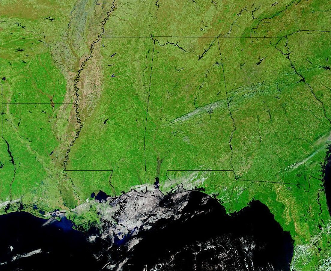
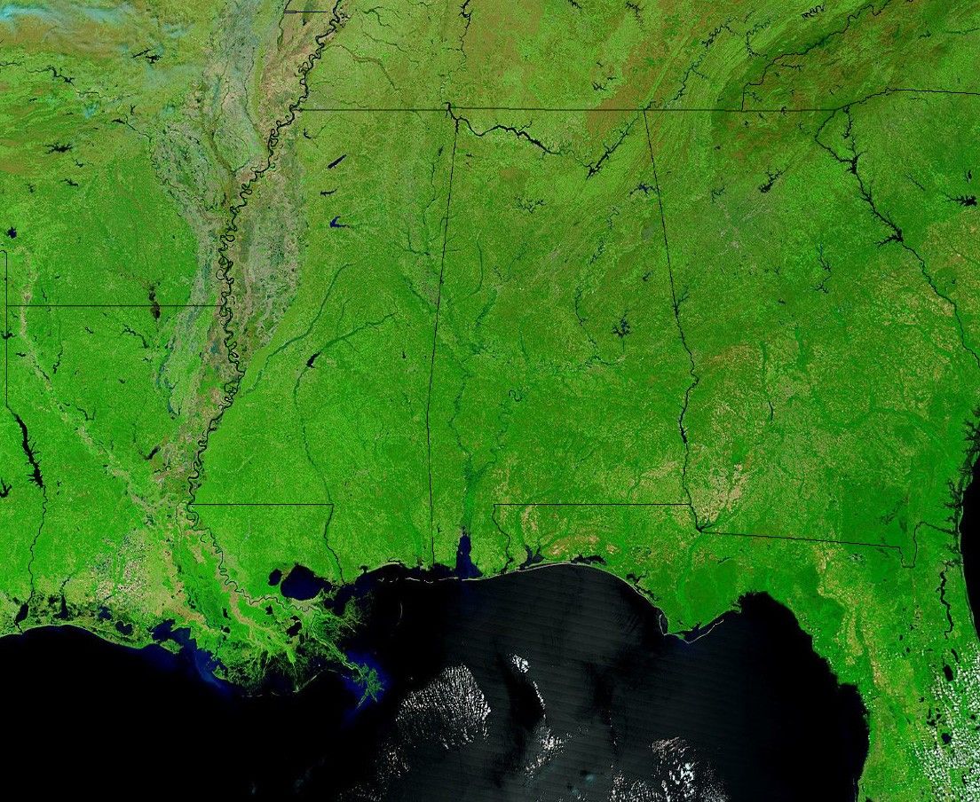
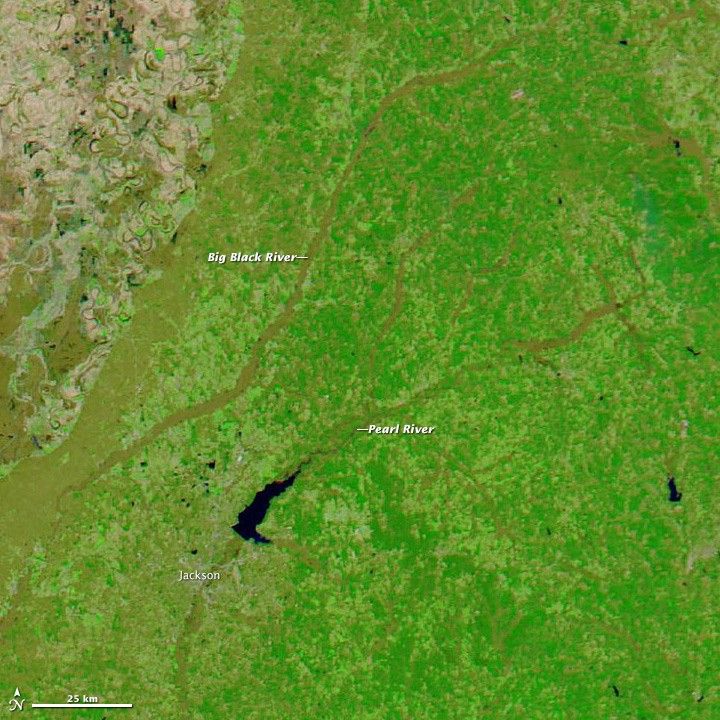
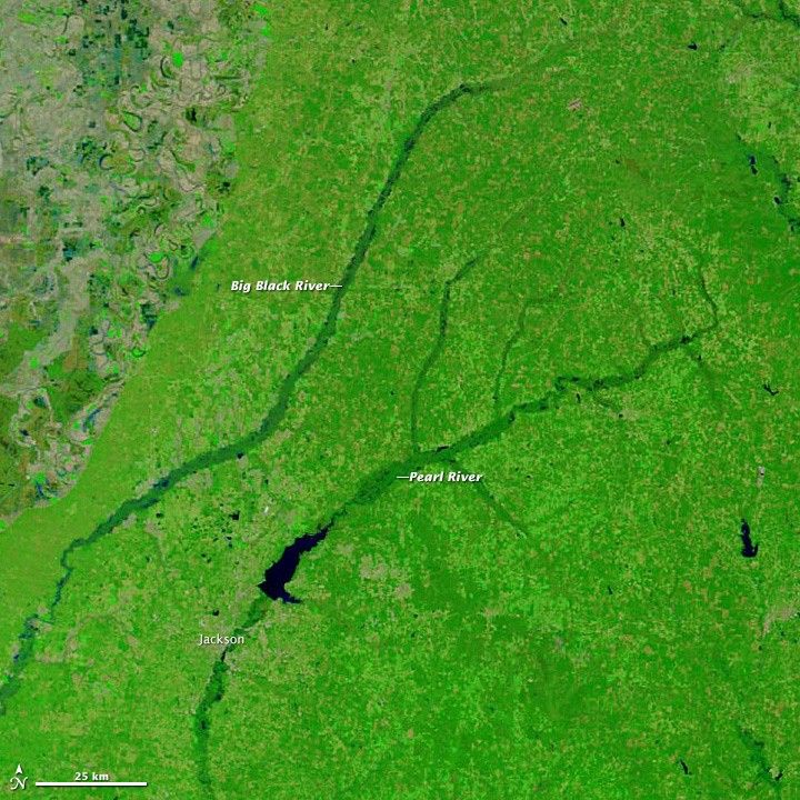
When a storm system passed through Mississippi in April 2014, it dropped between 2 to 8 inches (5 to 20 centimeters) of rain over some parts of the state. The heavy rainfall pushed numerous rivers to flood stage. The Moderate Resolution Imaging Spectroradiometer (MODIS) on NASA’s Terra satellite acquired this false-color image of the swollen Pearl and Big Black rivers on April 10, 2014. The lower image, also from Terra MODIS, shows the area on March 20, 2014, before the storms passed through. The images were made with short-wave and near-infrared light. Water is black; land with living vegetation is green. The brown areas are deciduous forests with few photosynthesizing leaves, bare fields, or grassy areas. Turn on the comparison tool to see the differences between the two images.
References & Resources
- Clarion Ledger (2014, April 9) Warning to public: Stay out of contaminated floodwaters. Accessed April 11, 2014.
- National Weather Service, Jackson Office (2014, April 11) Experimental Flood Extent Areas for the Pearl River Near Jackson. Accessed April 11, 2014.
- National Weather Service, Jackson Office (2014, April 11) April 6 & 7, 2014. Severe Weather Event. Accessed April 11, 2014.
- WAPT News (2014, April 8) Flooding prompts governor to declare state of emergency. Accessed April 11, 2014.
NASA image courtesy, LANCE/EOSDIS MODIS Rapid Response Team at NASA GSFC. Caption by Adam Voiland.