


June and July 2007 brought drenching rain and devastating floods to England. One of the hardest hit regions was Gloucestershire, in southwest England. The floods started in late June and continued throughout July.
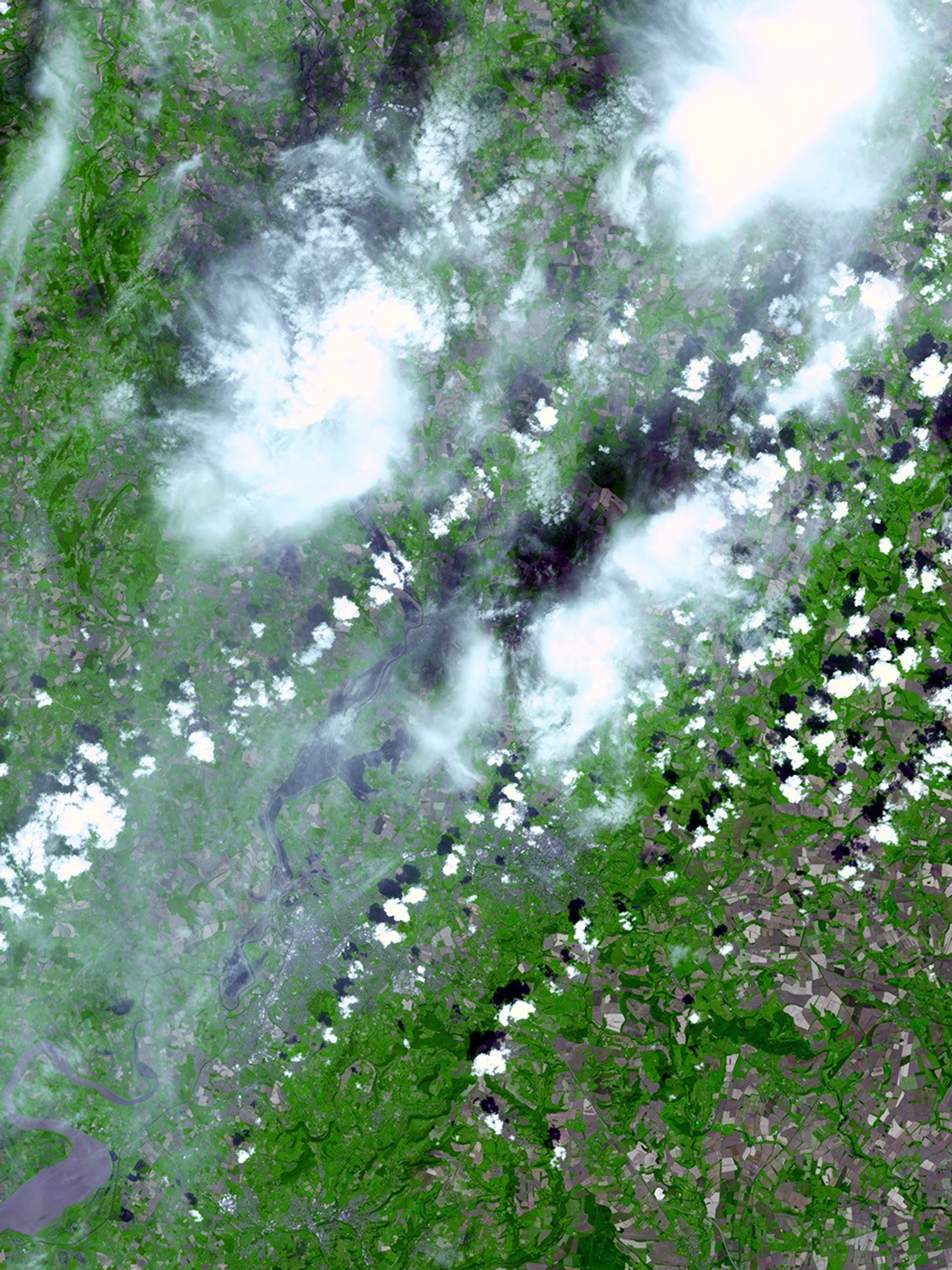
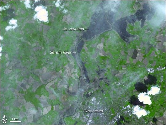
Though water levels had receded, floods were still evident along the Severn River when the Advanced Spaceborne Thermal Emission and Reflection Radiometer (ASTER) captured this image on August 1, 2007. The image shows the northern tip of Gloucester, its bright surfaces a mirror-like silver-white, and the Severn River flowing past the western edge of the city. The river’s banks are neatly defined by lines of gray, plant-free earth, which are probably dikes or flood defenses.
Beyond the river, north of the city, floodwater covers the land like a dark shadow. Geometric gray shapes throughout the scene are likely dormant farm fields; the exposed soil is tan and gray in this image. Additional flooding is visible farther upstream in the large image.
Despite the floods shown here, Gloucester and other cities in Gloucestershire were back in business by August 2, reported BBC news, when the water supply (which had been cut off when the water treatment facility flooded on July 22) was restored to all homes.
You can download a 15-meter-resolution KMZ file of the flooding of the Severn River suitable for use with Google Earth.
References & Resources
NASA image by Jesse Allen, using data provided courtesy of the NASA/GSFC/MITI/ERSDAC/JAROS, and U.S./Japan ASTER Science Team.