


















- September 26, 2006 (3.18 MB)
- September 12, 2006 (3.03 MB)
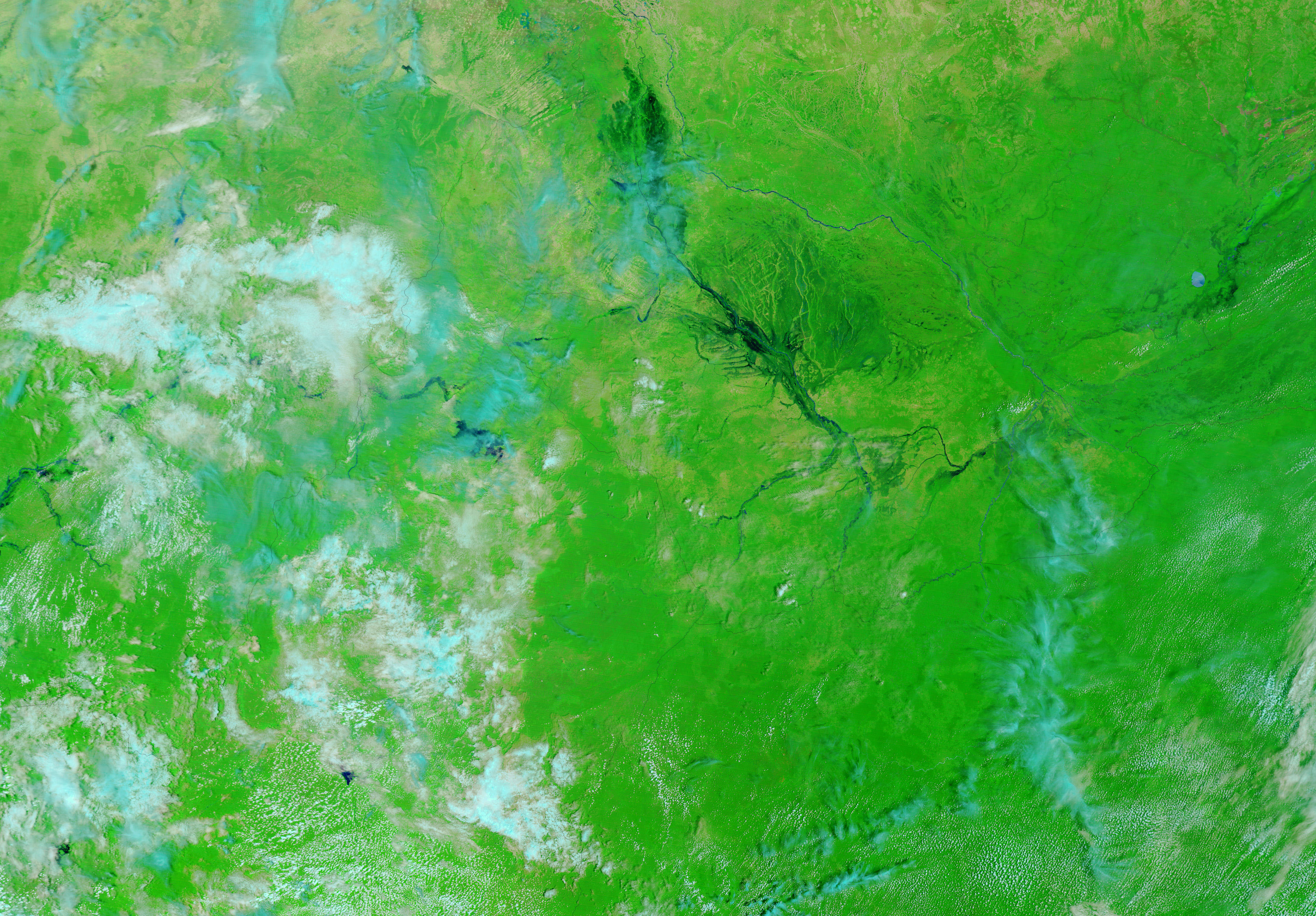
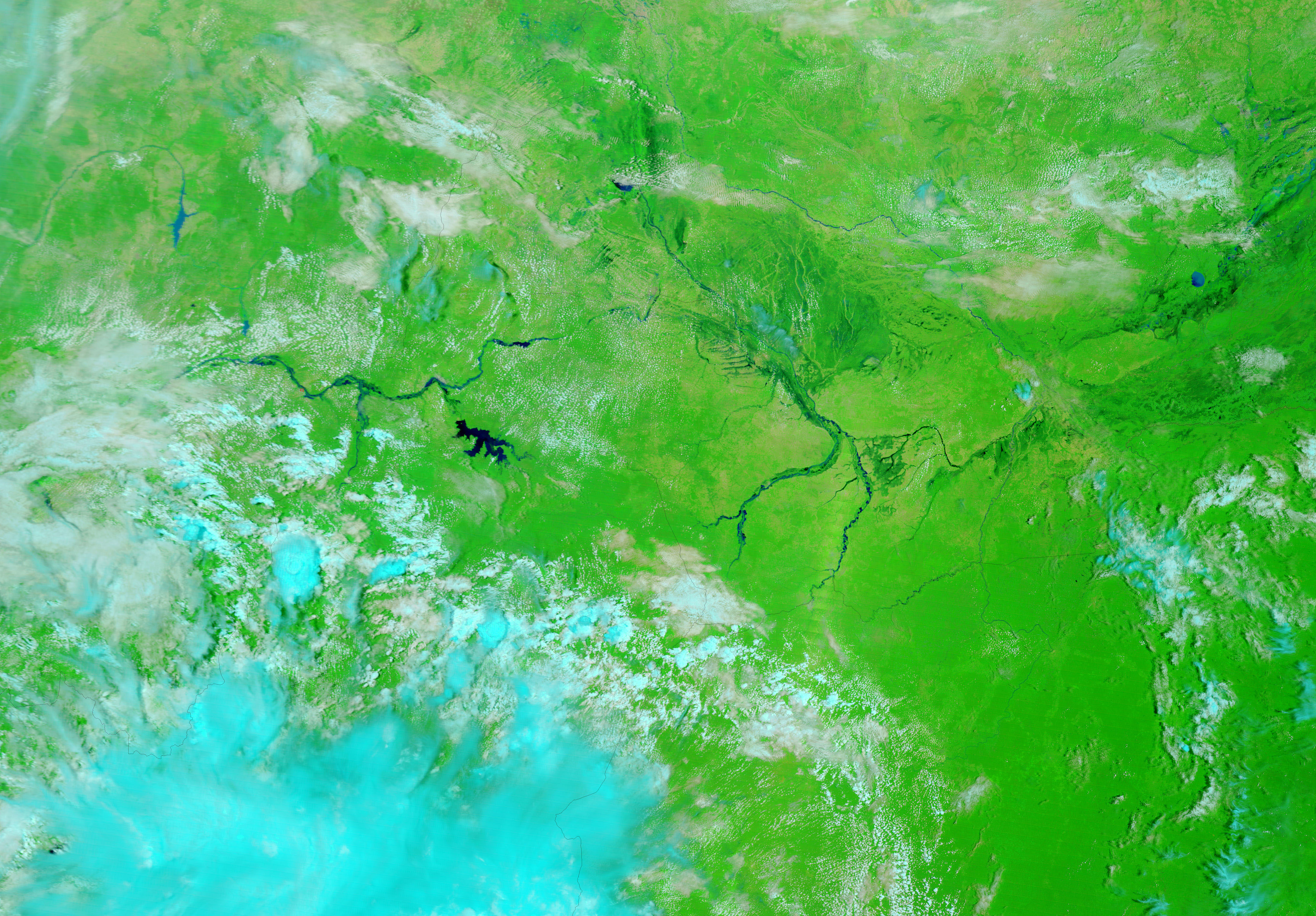
A tangle of rivers weaves across the uneven landscape of southwestern Chad, creating the wetlands that surround the Logone River. The backbone of the intersecting rivers in these images, the Logone flows northeast through Chad, forming part of the border with Cameroon, before joining the Chari River and emptying into Lake Chad. On September 26, 2006, when the Moderate Resolution Imaging Spectroradiometer (MODIS) on NASA’s Terra satellite captured the top image, the wetlands around the Logone were dark with water. Western Chad, like many other countries in Africa’s Sahel region, experienced widespread flooding because of unusually heavy rains in August and September. According to the Dartmouth Flood Observatory, floods in Chad and Nigeria displaced tens of thousands of people and caused extensive agricultural and infrastructure losses. In the top image, floods, not evident two weeks earlier, form dark pools along the Logone River.
These images are displayed in false color to highlight the presence of water. Here, water is black or dark blue, clouds are pale blue and white, plant-covered land is green, and lightly vegetated land is tan. Natural-color and false-color images of Chad are available from the MODIS Rapid Response Team twice daily.
References & Resources
NASA images courtesy the MODIS Rapid Response Team at NASA GSFC.