


![Request for Information – Potential [Placeholder for Prize]](https://assets.science.nasa.gov/dynamicimage/assets/science/missions/a-step/FFR_Earth_Background_20251120%20.png?w=1024)


- January 29, 2007 (1.5 MB)
- January 10, 2007 (1.1 MB)
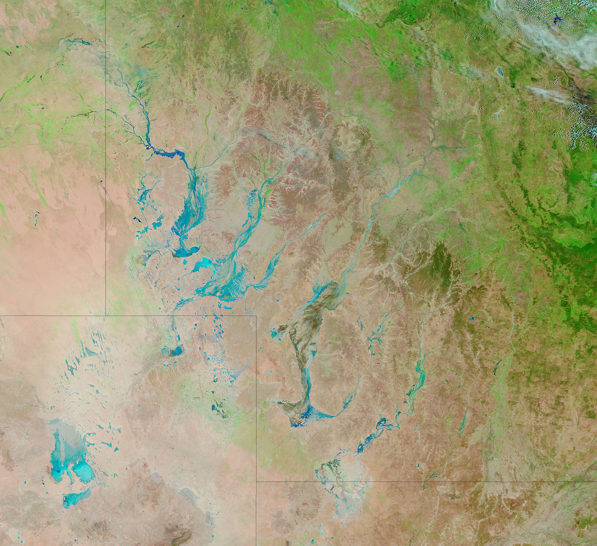
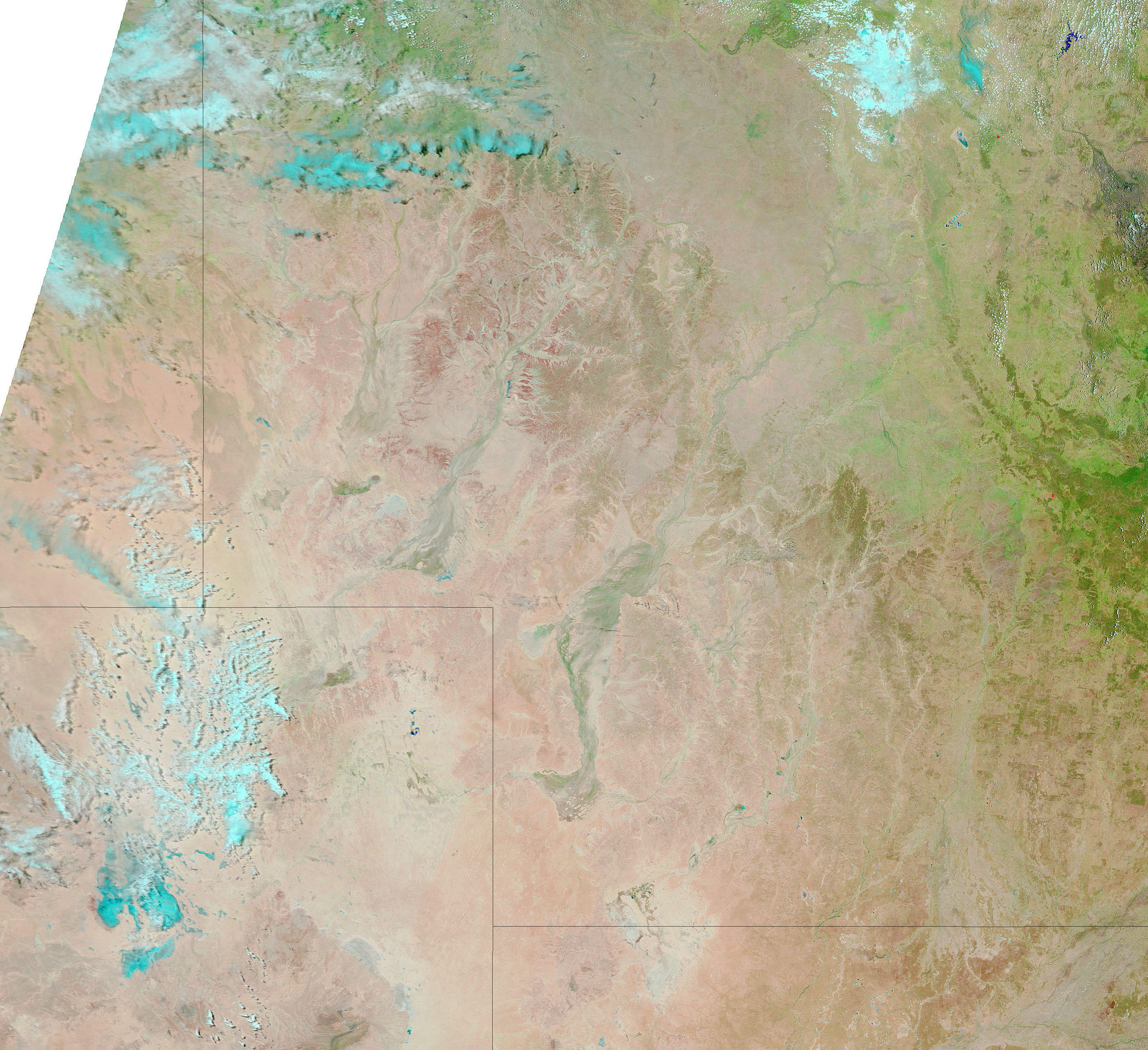
A series of rainstorms left southwestern Queensland running with water. Water channels in central Australia are normally dry, but during summer rains, they can brim with water. According to the Australian Broadcasting Corporation News, the region shown here received record rainfall from January 21 through January 28, 2007, with as much as 250 millimeters falling in some locations. The rain filled the dry channels, causing floods that cut off communities like Bedourie and Birdsville. When the Moderate Resolution Imaging Spectroradiometer (MODIS) flew over on NASA’s Terra satellite on January 29 to capture the top image, southwestern Queensland was awash with flood water. The lower image, captured on January 10, shows the region under normal conditions.
Both images were made with a combination of visible and infrared light. In this combination, water is typically dark blue or black. In this case, the water is mixed with sand or mud, creating a lighter shade of blue. The desert is pale pink, and plant-covered land is bright green. Clouds are pale blue and white. Daily images of Australia are available from the MODIS Rapid Response System.
References & Resources
NASA images courtesy the MODIS Rapid Response Team at NASA GSFC.


