


![Request for Information – Potential [Placeholder for Prize]](https://assets.science.nasa.gov/dynamicimage/assets/science/missions/a-step/FFR_Earth_Background_20251120%20.png?w=1024)


- May 27, 2005 (3.47 MB)
- May 12, 2005 (2.72 MB)
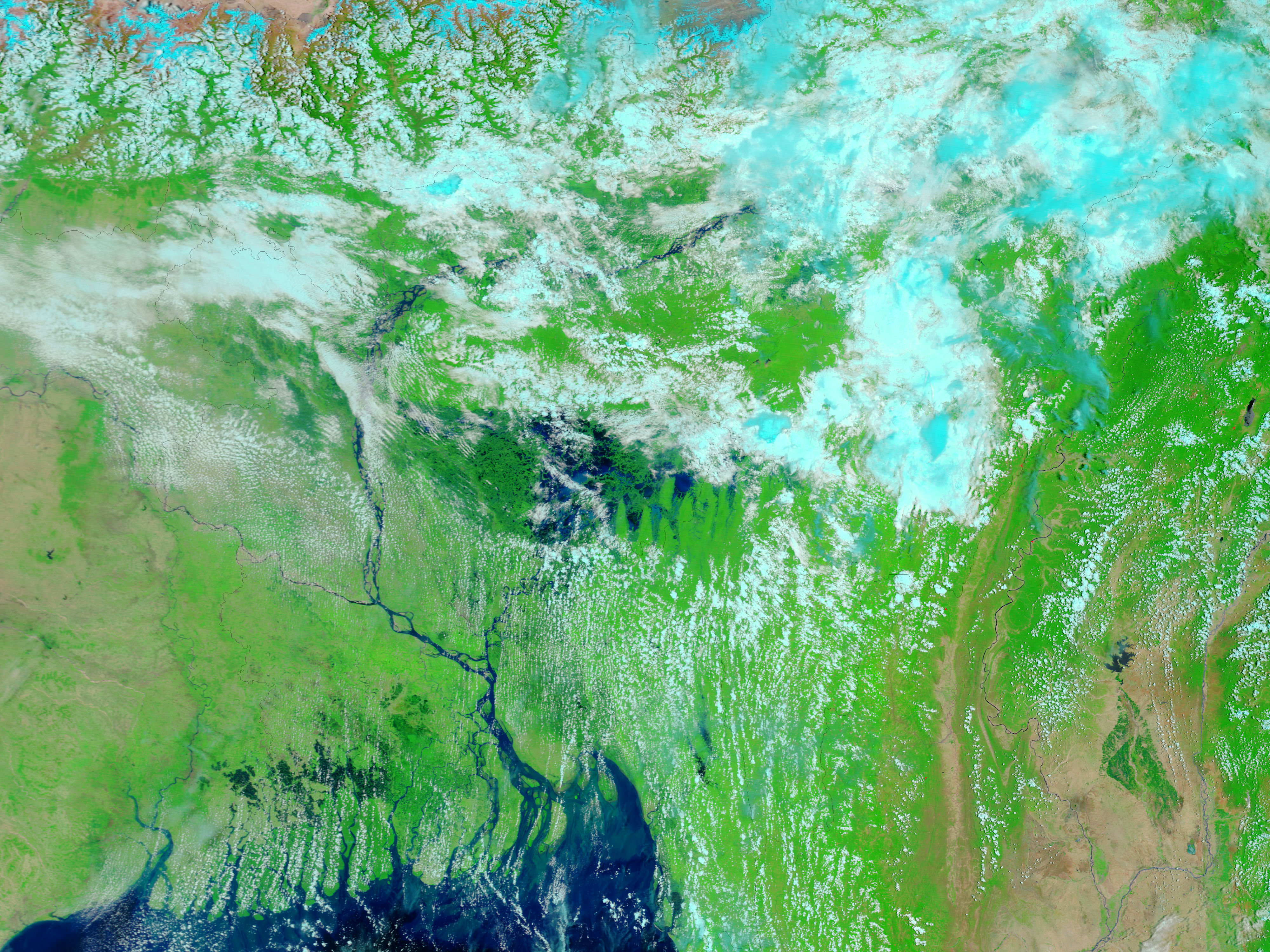
Flash floods poured over the Khasi Hills after heavy unseasonal rains fell in Bangladesh starting on May 24, 2005. Located along Bangladeshâs northeast border with India, the hill region is particularly prone to flooding during the summer monsoon, but these rains and floods came early. On May 27, 2005, when the Moderate Resolution Imaging Spectroradiometer (MODIS) on NASAâs Terra satellite captured the top image, most of the northeast corner of Bangladesh was covered with dark blue flood water. To the east, rivers in India are also swollen. According to news reports, 100,000 people have been affected by the floods, and 10 have died.
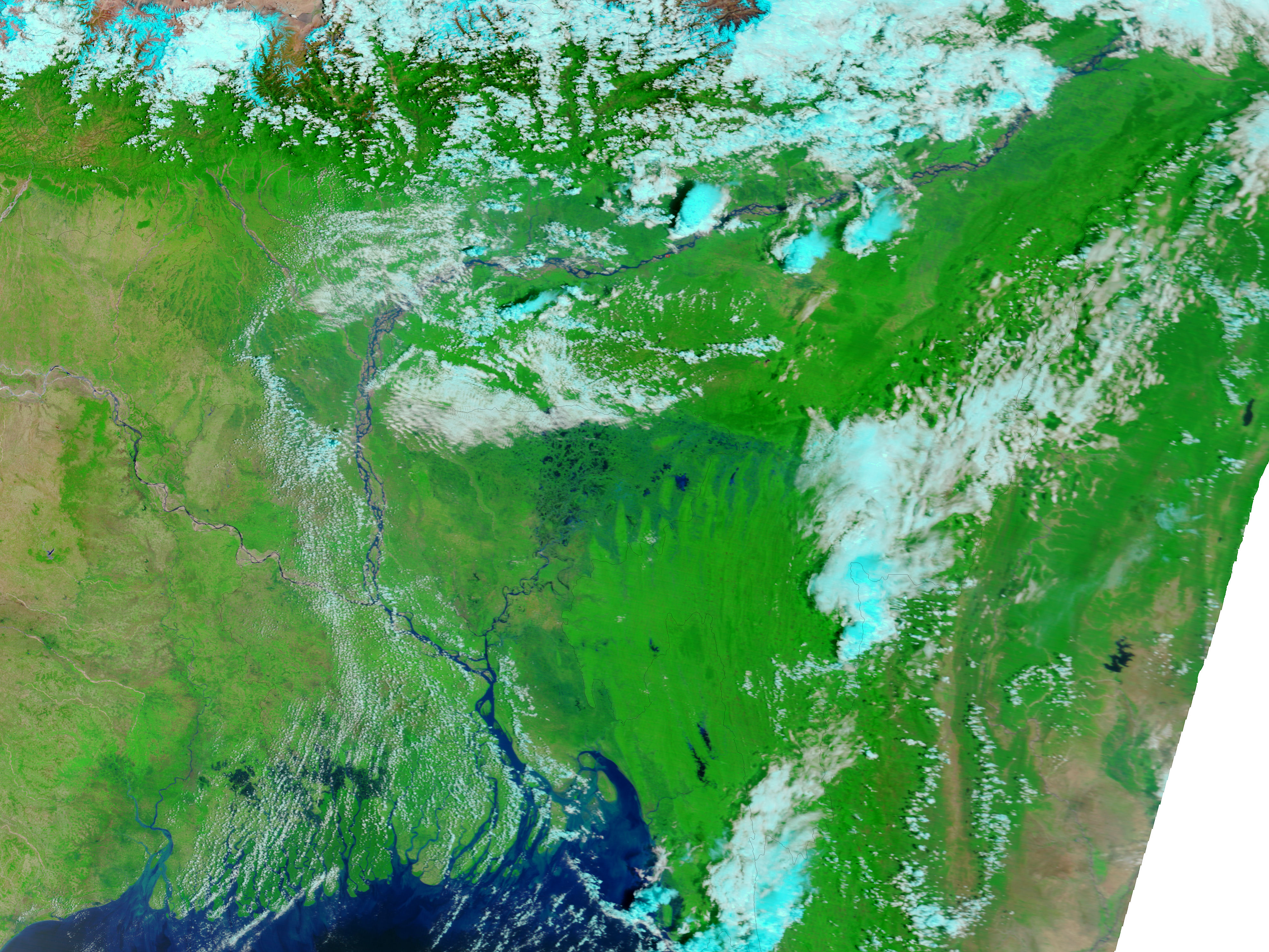
The lower MODIS image, taken on May 12, 2005, by the Terra satellite, shows the region under normal dry season conditions. Both images are shown in false color so that water is dark blue or black, clouds are light blue and white, and vegetation is bright green.
The large images provided above have a resolution of 250 meters per pixel. The MODIS Rapid Response Team provides daily images of this region in a variety of resolutions.
References & Resources
NASA images courtesy the MODIS Rapid Response Team at NASA GSFC.


